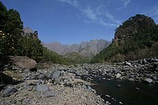
Category:Río Taburiente
| Camera location | | View all coordinates using: OpenStreetMap |
|---|
watercourse in Spain | |||||
| Upload media | |||||
| Instance of | |||||
|---|---|---|---|---|---|
| Located in protected area | |||||
| Location | Caldera de Taburiente, Santa Cruz de Tenerife Province, Canary Islands, Spain | ||||
| Length |
| ||||
 | |||||
Media in category "Río Taburiente"
The following 12 files are in this category, out of 12 total.
-
I08 674 Playa de Taburiente.jpg 4,494 × 2,996; 6 MB
-
I08 675 Playa de Taburiente.jpg 4,357 × 2,905; 5.59 MB
-
I08 676 Playa de Taburiente.jpg 4,434 × 2,956; 6.18 MB
-
I08 678 Río Taburiente.jpg 2,996 × 4,494; 5.56 MB
-
I08 805 Río Taburiente.jpg 4,494 × 2,996; 6.54 MB
-
Rio de Taburiente 2016-12 02.jpg 3,264 × 1,840; 2.69 MB
-
RK1112 9295 Caldera.jpg 1,800 × 1,200; 1.08 MB
-
Río Taburiente en la Caldera, isla de La Palma, España, año 2015.gif 640 × 480; 7.94 MB
-
Río Taburiente en verano, isla de La Palma, España, 2015.gif 640 × 480; 17.63 MB
-
Río Taburiente, isla de la Palma, España, 2015.gif 640 × 480; 9.72 MB
-
Río Taburiente, La Caldera, isla de la Palma, España, 2015.gif 640 × 480; 9.48 MB
-
S04 301 Playa de Taburiente.jpg 3,984 × 2,656; 3.95 MB


