Category:Römisch-katholische Pfarrkirche St. Leodegar Schupfart
| Object location | | View all coordinates using: OpenStreetMap |
|---|
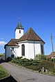
church building in Schupfart in the canton of Aargau, Switzerland  | |||||
| Upload media | |||||
| Instance of | |||||
|---|---|---|---|---|---|
| Part of | |||||
| Named after | |||||
| Patron saint | |||||
| Location | Schupfart, Rheinfelden District, Aargau, Switzerland | ||||
| Street address |
| ||||
| Architectural style | |||||
| Heritage designation | |||||
| Inception |
| ||||
 | |||||
Media in category "Römisch-katholische Pfarrkirche St. Leodegar Schupfart"
The following 3 files are in this category, out of 3 total.
-
 2018-Schupfart-Pfarrhaus-Kirche.jpg 1,920 × 1,280; 2.03 MB
-
 Schupfart Kirche 2014-04-16 11.jpg 2,592 × 3,888; 4.17 MB
-
 Schupfart Kirche.JPG 2,048 × 1,536; 1.16 MB

