Category:Rüttischrofen
Deutsch: Der Rüttischrofen ist eine Erhebung und Klippe (Schrofen) in der Gemeinde Weiler in Vorarlberg, Österreich. 300 Meter südöstlich befindet sich die Ruine Alt-Montfort auf einem weiteren Hügel. Die Gemeinde Fraxern etwa 900 Meter östlich davon.
English: The Ruettischrofen is an elevation and cliff in the municipality of Weiler in Vorarlberg, Austria. The Alt-Montfort ruins (castle) are located 300 meters to the southeast on another hill. The municipality of Fraxern about 900 meters east of it.
Français : Le Ruettischrofen est une élévation et falaise de la commune de Weiler dans le Vorarlberg, en Autriche. Les ruines d'Alt-Montfort (château) sont situées à 300 mètres au sud-est sur une autre colline. La municipalité de Fraxern à environ 900 mètres à l'est de celle-ci.
is an elevation and cliff in the municipality of Weiler in Vorarlberg, Austria  | |||||
| Upload media | |||||
| Instance of |
| ||||
|---|---|---|---|---|---|
| Location | Weiler, Feldkirch District, Vorarlberg, Austria | ||||
| Elevation above sea level |
| ||||
 | |||||
Media in category "Rüttischrofen"
The following 5 files are in this category, out of 5 total.
-
 Fraxern vom Rüttischrofen.jpg 4,320 × 3,240; 4.71 MB
-
 Fraxern-view to alpine Rhinevalley-right Rüttischrofen-left hill Alt-Montfort-01ASD.jpg 4,582 × 2,339; 1.42 MB
-
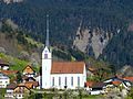 Pfarrkirche Fraxern von Westen.jpg 4,320 × 3,240; 4.68 MB
-
 Weiler-Ruin Alt-Monfort view to Ruetti-Ruettikopf-Burgfeld-01ASD.jpg 4,592 × 3,056; 6.75 MB
-
 Weiler-Ruin Alt-Monfort view to Ruetti-Ruettikopf-Burgfeld-02ASD.jpg 4,592 × 3,056; 6.5 MB


