Category:RAF Wymeswold
| Object location | | View all coordinates using: OpenStreetMap |
|---|
former military airfield in Wymeswold, Leicestershire, England, UK  | |||||
| Upload media | |||||
| Instance of |
| ||||
|---|---|---|---|---|---|
| Location | Leicestershire, East Midlands, England | ||||
| Operator | |||||
| Inception |
| ||||
| Dissolved, abolished or demolished date |
| ||||
 | |||||
Subcategories
This category has the following 2 subcategories, out of 2 total.
Media in category "RAF Wymeswold"
The following 8 files are in this category, out of 8 total.
-
 Northeast edge of Wymeswold Airfield - geograph.org.uk - 905697.jpg 640 × 504; 106 KB
-
 Northern edge of Wymeswold Airfield - geograph.org.uk - 905706.jpg 640 × 534; 104 KB
-
 RAF Wymeswold - geograph.org.uk - 2732984.jpg 1,280 × 827; 303 KB
-
 RAF Wymeswold - geograph.org.uk - 2733998.jpg 1,280 × 827; 194 KB
-
 RAF Wymeswold, control tower and water tank - geograph.org.uk - 2734000.jpg 1,280 × 959; 254 KB
-
 Wymeswold Airfield - geograph.org.uk - 15683.jpg 640 × 387; 95 KB
-
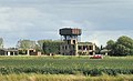
 Wymeswold airfield water tower - geograph.org.uk - 2732980.jpg 1,280 × 949; 328 KB
-
 Wymeswold disused airfield - geograph.org.uk - 32597.jpg 640 × 480; 61 KB


