Category:Radar images of Earth
Subcategories
This category has the following 13 subcategories, out of 13 total.
Media in category "Radar images of Earth"
The following 59 files are in this category, out of 59 total.
-
"Quill" satellite radar image of flooded Eel River outflow current.JPG 1,000 × 719; 123 KB
-
2007 Tabasco flood seen by TerraSAR-X.jpg 1,998 × 1,124; 4.85 MB
-
Alfred Ernest Ice Shelf.jpg 640 × 663; 348 KB
-
Angkor Satellit mit Karte.jpg 1,024 × 609; 148 KB
-
Angkor satellite with map.jpg 1,024 × 609; 234 KB
-
Aorounga crater.png 500 × 398; 191 KB
-
B15t 350.jpg 1,179 × 906; 337 KB
-
BeardmoreGlacier NASA Radar.jpg 528 × 500; 159 KB
-
Burningman aug31.jpg 3,044 × 2,836; 9.2 MB
-
Canada mosaic lcc 1000m 2.jpg 5,700 × 4,800; 4.38 MB
-
Canada mosaic lcc 1000m.tif 5,700 × 4,800; 26.13 MB
-
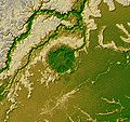
Chicxulub radar topography.jpg 715 × 799; 119 KB
-
Chicxulub.jpg 3,010 × 3,416; 2.43 MB
-
CZE PragueCenter.jpg 3,800 × 2,686; 6.01 MB
-
Death Valley SAR.jpg 287 × 598; 57 KB
-
Ecuador (14214099788).jpg 4,155 × 1,948; 2.53 MB
-
F-35 SAR.jpg 399 × 399; 94 KB
-
Floyd flood map.jpg 350 × 269; 35 KB
-
FRicestreams.jpg 2,808 × 1,985; 2.42 MB
-
Gwc-from-space.jpg 500 × 1,501; 338 KB
-
Haiti fault satellite image.jpg 6,662 × 5,139; 6.04 MB
-
Haughton impact crater radar image.jpg 696 × 600; 104 KB
-
Inuvik-ROT CROP-stdcalcomposite MRES-FULL.jpg 3,223 × 2,917; 4.93 MB
-
Iturralde Crater PIA03359 cropped.jpg 1,196 × 1,131; 543 KB
-
Izmit interferogram.jpg 569 × 585; 83 KB
-
Kufra-space-radar.jpg 464 × 719; 94 KB
-
L C band topo interferograms.jpg 638 × 522; 90 KB
-
Los Angeles JPLLandsat.jpg 4,475 × 1,896; 1.82 MB
-
Lost Hills Subsidence interferogram.jpg 504 × 662; 88 KB
-
Napo River in Ecuador and Peru.jpg 2,806 × 1,314; 8.16 MB
-
NASA Kilauea InSAR.jpg 1,511 × 863; 401 KB
-
Pakistan Khairabad digital elevation model by TanDEM-X (DLR).jpg 2,268 × 2,526; 2.28 MB
-
Palm Springs JPLLandsat.jpg 1,152 × 870; 172 KB
-
Palpa geoglyph.jpg 2,161 × 961; 2.55 MB
-
PIA01844 modest rotated.jpg 418 × 797; 121 KB
-
Radar Views Earth, Venus, Mars (4089157853).jpg 2,516 × 2,016; 4.51 MB
-
Roter Kamm, PIA00503 md.jpg 2,896 × 2,032; 3.87 MB
-
SafsafOasis SAR comparison.jpg 540 × 588; 154 KB
-
San Diego-Tijuana JPLLandsat.jpg 1,150 × 724; 174 KB
-
SAR Kilauea topo interferogram.jpg 577 × 577; 152 KB
-
SAR Kilauea.jpg 1,000 × 1,000; 333 KB
-
Sarwaterp.jpg 548 × 748; 374 KB
-
Sc-muar.gif 342 × 480; 188 KB
-
SIR-B Sudbury Impact Crater.jpg 432 × 249; 87 KB
-
Space radar image of Washington, D.C. DVIDS744627.jpg 1,536 × 1,376; 951 KB
-
Staufen interferogram detailed by TerraSAR-X.jpg 400 × 400; 171 KB
-
Swaths imaged Dec 1964 by U. S. "Quill" satellite radar.jpg 1,050 × 634; 187 KB
-
Tandem-X ScanSAR Greenland.jpg 2,222 × 1,073; 1.56 MB
-
TEIDE.JPG 3,600 × 2,180; 1.89 MB
-
TerraSAR-X image of Gabon, 60 kilometres south east of the capital Libreville.jpg 1,107 × 669; 1.53 MB
-
TNF-NASAmap-Labels.png 720 × 436; 431 KB
-
Tonga rdr 2019280 lrg.jpg 13,226 × 8,578; 23.37 MB
-
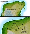
Yucatan chix crater-ar.jpg 715 × 799; 183 KB
-
Yucatan chix crater.jpg 715 × 799; 305 KB
-
Радарограмма дна р. Амур.jpg 1,262 × 682; 701 KB


