Category:Radley
village and civil parish in Vale of White Horse district, Oxfordshire, England  | |||||
| Upload media | |||||
| Instance of | |||||
|---|---|---|---|---|---|
| Location | Vale of White Horse, Oxfordshire, South East England, England | ||||
| Located in or next to body of water | |||||
| Population |
| ||||
| Said to be the same as | Radley (Wikimedia duplicated page, civil parish) | ||||
| official website | |||||
 | |||||
English: Radley is a village and civil parish about northwest of the centre of Abingdon, Oxfordshire. The parish includes the hamlet of Lower Radley on the River Thames. In 1974 it was transferred from Berkshire.
Subcategories
This category has the following 5 subcategories, out of 5 total.
Media in category "Radley"
The following 200 files are in this category, out of 324 total.
(previous page) (next page)-
 A clear view of the railway - geograph.org.uk - 936934.jpg 640 × 480; 87 KB
-
 A frosty Sugworth Lane - geograph.org.uk - 3298177.jpg 1,024 × 683; 215 KB
-
 A heron by the Thames - geograph.org.uk - 6156956.jpg 2,700 × 2,025; 419 KB
-
 A narrowboat on the Thames - geograph.org.uk - 2039916.jpg 1,500 × 1,000; 337 KB
-
 A party boat on the Thames - geograph.org.uk - 1932950.jpg 1,500 × 1,000; 197 KB
-
 A weir from the River Thames - geograph.org.uk - 3933568.jpg 1,500 × 999; 244 KB
-
 A34 bridge carrying Sugworth Lane - geograph.org.uk - 2534696.jpg 3,648 × 2,736; 1.04 MB
-
 A34 northbound - geograph.org.uk - 3342104.jpg 640 × 480; 42 KB
-
 A34 northbound - geograph.org.uk - 3342107.jpg 640 × 480; 48 KB
-
 A34 northbound - geograph.org.uk - 3342112.jpg 640 × 461; 58 KB
-
 A34 northbound - geograph.org.uk - 5637632.jpg 640 × 428; 76 KB
-
 A34 northbound - geograph.org.uk - 5637644.jpg 640 × 428; 85 KB
-
 A34 Northbound Layby - geograph.org.uk - 6001491.jpg 4,160 × 3,120; 2.84 MB
-
 A34 passes under Sugworth Lane - geograph.org.uk - 3103507.jpg 640 × 480; 48 KB
-

-

-
 A4183 joins the A34 at Lodge Hill Interchange - geograph.org.uk - 2534123.jpg 3,648 × 2,456; 859 KB
-
 Abingdon bus - geograph.org.uk - 5218427.jpg 3,884 × 2,427; 2.09 MB
-

-

-
 Aerial view of Lower Radley - geograph.org.uk - 3469451.jpg 4,288 × 2,848; 4.48 MB
-
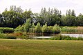
 Angler at Radley Lakes - geograph.org.uk - 2331966.jpg 3,888 × 2,592; 1.36 MB
-
 Arable field in Lower Radley - geograph.org.uk - 1299725.jpg 640 × 427; 74 KB
-
 Arable field in Lower Radley - geograph.org.uk - 1299728.jpg 640 × 427; 62 KB
-
 Avenue of trees near Radley College - geograph.org.uk - 1232466.jpg 640 × 427; 129 KB
-
 Barn at Warren Farm - geograph.org.uk - 4532114.jpg 1,024 × 781; 335 KB
-
 Barrow Hills BMX and skateboard park - geograph.org.uk - 1232447.jpg 640 × 427; 79 KB
-
 Below Nuneham Viaduct - geograph.org.uk - 2057592.jpg 1,500 × 986; 202 KB
-
 Benchmark at Park End Barn - geograph.org.uk - 3329747.jpg 683 × 1,024; 247 KB
-
 Benchmark on buttress of Radley College Hall - geograph.org.uk - 3329682.jpg 683 × 1,024; 244 KB
-
 Benchmark on garage of The Coach House - geograph.org.uk - 3299273.jpg 683 × 1,024; 205 KB
-
 Benchmark on Radley College Lodge - geograph.org.uk - 3329594.jpg 683 × 1,024; 232 KB
-

-
 Benchmark on Turnpike Cottage, Oxford Road - geograph.org.uk - 3299076.jpg 683 × 1,024; 263 KB
-
 Between the Fences - geograph.org.uk - 2341794.jpg 3,744 × 2,372; 1.02 MB
-
 Blossoms Glade, Woodland Park - geograph.org.uk - 4362273.jpg 640 × 480; 103 KB
-
 Blue-tailed damselfly (Ischnura elegans) teneral female violacea.jpg 4,428 × 3,168; 3.15 MB
-
 Boathouse on the River Thames near Lower Radley - geograph.org.uk - 6658836.jpg 1,600 × 1,065; 997 KB
-
 Bowyer Arms - geograph.org.uk - 5216448.jpg 5,184 × 3,456; 5.77 MB
-
 Bridge carrying A4183 over A34 - geograph.org.uk - 6371438.jpg 1,024 × 768; 123 KB
-
 Bridge carrying minor road over A34 - geograph.org.uk - 6371436.jpg 1,024 × 768; 82 KB
-
 Buildings at Park End Barns, Kennington Road - geograph.org.uk - 3329761.jpg 1,024 × 683; 131 KB
-
 Bus img 5860 (15713699293).jpg 2,788 × 2,091; 1.58 MB
-
 Bus img 5862 (16333620065).jpg 3,072 × 2,304; 2.23 MB
-
 Circular crop mark at Barrow Hills - geograph.org.uk - 6498957.jpg 4,160 × 3,120; 646 KB
-
 Clockhouse Barn - geograph.org.uk - 3204115.jpg 2,560 × 1,920; 1.54 MB
-
 Culvert for stream under Kennington Road - geograph.org.uk - 3322894.jpg 683 × 1,024; 297 KB
-
 Daytrippers - geograph.org.uk - 3176246.jpg 640 × 480; 134 KB
-
 East Lodge, Bayworth Manor - geograph.org.uk - 6562715.jpg 1,024 × 576; 203 KB
-
 Electricity sub station Kennington Road - geograph.org.uk - 4362274.jpg 640 × 480; 126 KB
-
 Evening Light near Radley College - geograph.org.uk - 2694529.jpg 3,592 × 2,424; 2.1 MB
-
 Farmland by the railway - geograph.org.uk - 3929352.jpg 640 × 430; 50 KB
-
 Farmland in the Thames Valley - geograph.org.uk - 3937216.jpg 640 × 430; 65 KB
-
 Farmland Near Bayworth Manor - geograph.org.uk - 3208544.jpg 1,024 × 746; 343 KB
-
 Farmland near Radley - geograph.org.uk - 3929293.jpg 640 × 322; 28 KB
-
 Farmland near Radley - geograph.org.uk - 3929313.jpg 640 × 430; 45 KB
-
 Farmland north of Radley - geograph.org.uk - 3929306.jpg 640 × 353; 40 KB
-
 Farmland north of Sugworth Lane - geograph.org.uk - 4362288.jpg 640 × 480; 77 KB
-
 Farmland south of Radley - geograph.org.uk - 3937223.jpg 640 × 430; 50 KB
-
 Farmland, Park Farm - geograph.org.uk - 3929318.jpg 640 × 430; 35 KB
-
 Field by the wood - geograph.org.uk - 6294225.jpg 2,700 × 2,025; 724 KB
-
 Field of rape at Peachcroft Farm - geograph.org.uk - 4122388.jpg 1,500 × 999; 272 KB
-

-
 Flooded gravel pit - geograph.org.uk - 3929276.jpg 640 × 356; 39 KB
-
 Flooded gravel pit - geograph.org.uk - 3929279.jpg 640 × 309; 37 KB
-
 Flooded gravel pit near Abingdon - geograph.org.uk - 2306653.jpg 1,280 × 960; 647 KB
-
 Flooded gravel pit near the Thames - geograph.org.uk - 2306655.jpg 1,280 × 960; 600 KB
-
 Footbridge along the Thames Path - geograph.org.uk - 4531828.jpg 1,024 × 599; 274 KB
-

-
 Footbridge on the Thames Path - geograph.org.uk - 2034245.jpg 1,500 × 1,000; 445 KB
-
 Footbridge on the Thames Path - geograph.org.uk - 2057567.jpg 1,500 × 978; 388 KB
-
 Footbridge on the Thames Path - geograph.org.uk - 2057585.jpg 1,500 × 992; 393 KB
-
 Footbridge on the Thames Path - geograph.org.uk - 2057591.jpg 1,500 × 1,000; 452 KB
-
 Footbridge on the Thames Path - geograph.org.uk - 3936691.jpg 1,500 × 999; 363 KB
-
 Footbridge over a ditch - geograph.org.uk - 6294224.jpg 2,025 × 2,700; 1,001 KB
-
 Footbridge over a ditch - geograph.org.uk - 6294230.jpg 2,700 × 1,986; 778 KB
-
 Footbridge over a ditch - geograph.org.uk - 6294231.jpg 2,025 × 2,700; 1.17 MB
-
 Footbridge over a stream - geograph.org.uk - 6730118.jpg 4,800 × 3,575; 2.01 MB
-
 Footpath from Radley Park to Oxford Road, Lodge Hill - geograph.org.uk - 6561152.jpg 3,658 × 2,743; 5.81 MB
-
 Footpath marker to Kennington - geograph.org.uk - 6294233.jpg 1,977 × 2,700; 521 KB
-
 Footpath marker to Kennington - geograph.org.uk - 6294234.jpg 2,700 × 2,025; 1.07 MB
-
 Footpath through the rape field - geograph.org.uk - 2060641.jpg 1,500 × 1,000; 372 KB
-
 Footpath through the trees - geograph.org.uk - 2060648.jpg 1,500 × 1,000; 333 KB
-
 Footpath to Kennington - geograph.org.uk - 6294238.jpg 2,025 × 2,700; 900 KB
-
 Footpath to Radley - geograph.org.uk - 6294226.jpg 2,025 × 2,700; 1.46 MB
-
 Footpath to Radley - geograph.org.uk - 6294227.jpg 2,025 × 2,700; 1.24 MB
-
 Footpath to Radley - geograph.org.uk - 6294229.jpg 2,025 × 2,700; 1,006 KB
-
 Footpath to Radley - geograph.org.uk - 6294237.jpg 2,700 × 2,025; 855 KB
-
 Footpath to Radley - geograph.org.uk - 6730128.jpg 4,800 × 3,600; 2.53 MB
-
 Footpath to Sugworth Farm - geograph.org.uk - 6294232.jpg 2,700 × 2,025; 685 KB
-
 Footpath to the river - geograph.org.uk - 2060650.jpg 1,500 × 1,000; 245 KB
-
 Former gravel pit at Abingdon - geograph.org.uk - 2306648.jpg 1,280 × 960; 655 KB
-
 Furrows at Peachcroft Farm - geograph.org.uk - 3400986.jpg 1,500 × 1,000; 257 KB
-
 Gate by Radley College Boathouse - geograph.org.uk - 2034216.jpg 1,500 × 1,000; 268 KB
-
 Gate on the footpath - geograph.org.uk - 6730131.jpg 4,800 × 3,600; 2.01 MB
-
 Golf Course, Radley Park - geograph.org.uk - 2694606.jpg 3,576 × 2,232; 1.05 MB
-
 Goose Acre Farm - geograph.org.uk - 3929288.jpg 640 × 331; 37 KB
-
 Great Bear - geograph.org.uk - 2333309.jpg 3,888 × 2,592; 1.32 MB
-
 Green Slime and Yukk, Radley Pits - geograph.org.uk - 2330964.jpg 3,696 × 2,464; 1.49 MB
-
 Hay meadow beside the Thames - geograph.org.uk - 2612055.jpg 1,024 × 680; 308 KB
-
 Heading south along the Thames Path - geograph.org.uk - 4531663.jpg 1,024 × 704; 287 KB
-
 Home Farm Barn - geograph.org.uk - 2456899.jpg 3,888 × 2,592; 1.48 MB
-
 House named The Old Boat House - geograph.org.uk - 2531306.jpg 640 × 427; 148 KB
-
 Housing, Radley - geograph.org.uk - 3929300.jpg 640 × 405; 55 KB
-
 Just popping down the shops^ - geograph.org.uk - 3176256.jpg 640 × 480; 148 KB
-
 Sandford Lane - geograph.org.uk - 1085531.jpg 640 × 480; 116 KB
-
 Kissing gate along the Thames Path - geograph.org.uk - 4531717.jpg 1,024 × 832; 400 KB
-
 Lake and Canoe - geograph.org.uk - 2333289.jpg 3,288 × 2,364; 928 KB
-
 Layby on the northbound A34 - geograph.org.uk - 3295067.jpg 640 × 480; 405 KB
-
 Lazy river - geograph.org.uk - 3176613.jpg 640 × 480; 124 KB
-
 Line of trees - geograph.org.uk - 3937213.jpg 640 × 430; 68 KB
-
 Line of trees near Radley - geograph.org.uk - 2034212.jpg 1,500 × 1,000; 282 KB
-
 Lodge Hill Garage, Oxford Road - geograph.org.uk - 3299029.jpg 1,024 × 683; 156 KB
-

-
 Looking down the River Thames near Kennington - geograph.org.uk - 1932946.jpg 1,500 × 1,000; 216 KB
-
 Looking east over the River Thames - geograph.org.uk - 3936634.jpg 1,500 × 999; 239 KB
-
-
 Looking south along the River Thames - geograph.org.uk - 4531644.jpg 1,024 × 768; 276 KB
-
 Looking south along the River Thames - geograph.org.uk - 4531757.jpg 1,024 × 736; 277 KB
-
 Looking up the Thames - geograph.org.uk - 1932954.jpg 1,500 × 1,000; 250 KB
-
 Lower Farm buildings - geograph.org.uk - 5218469.jpg 5,202 × 3,017; 2.47 MB
-
 Lower Radley - geograph.org.uk - 3469446.jpg 4,288 × 2,848; 3.75 MB
-
 Lower Radley houses - geograph.org.uk - 5218456.jpg 5,202 × 3,465; 3.14 MB
-
 Lower Radley Park - geograph.org.uk - 5218436.jpg 5,184 × 3,456; 5.77 MB
-
 Mature rape at Radley - geograph.org.uk - 2060645.jpg 1,500 × 1,000; 331 KB
-
 Meadow next to the River Thames - geograph.org.uk - 4532387.jpg 1,024 × 753; 275 KB
-
 Morris Behind the Boat House - geograph.org.uk - 2344674.jpg 1,822 × 1,364; 365 KB
-
 New house "The Limes" - geograph.org.uk - 4362275.jpg 640 × 480; 117 KB
-
 Nice day for a walk - geograph.org.uk - 3176258.jpg 640 × 480; 126 KB
-
 North along the Thames Path and the River Thames - geograph.org.uk - 4531702.jpg 1,024 × 687; 267 KB
-
 North Close Copse - geograph.org.uk - 3929324.jpg 640 × 347; 39 KB
-
 North Close Copse - geograph.org.uk - 3929348.jpg 640 × 383; 37 KB
-
 Northbound A34 near Sunningwell - geograph.org.uk - 3295058.jpg 640 × 480; 423 KB
-
 Northbound A34, Sugworth Lane Bridge - geograph.org.uk - 3295061.jpg 640 × 480; 402 KB
-
 Nuneham House viewed from the River Thames - geograph.org.uk - 4531746.jpg 1,024 × 906; 380 KB
-
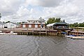
 Nuneham Park boat house - geograph.org.uk - 4531780.jpg 1,024 × 781; 407 KB
-
 Nuneham Park Boat House - geograph.org.uk - 5828221.jpg 4,601 × 3,469; 3.57 MB
-
 Nuneham Railway Bridge - geograph.org.uk - 4532096.jpg 1,024 × 747; 256 KB
-
 Nuneham Viaduct - geograph.org.uk - 2058885.jpg 1,500 × 1,000; 289 KB
-
 Oak Avenue, Woodlands Park - geograph.org.uk - 1349085.jpg 600 × 393; 100 KB
-
 Old Gravel Pit at Radley - geograph.org.uk - 2437086.jpg 3,888 × 2,592; 1.05 MB
-
 Outside Radley Station - geograph.org.uk - 3204020.jpg 1,024 × 685; 180 KB
-
 Oxford Green Belt Way - geograph.org.uk - 3300586.jpg 640 × 480; 88 KB
-
 Oxford Green Belt Way - geograph.org.uk - 3300601.jpg 640 × 480; 105 KB
-
 Oxford Green Belt Way-Thames Path - geograph.org.uk - 3300456.jpg 640 × 480; 160 KB
-
 Oxford Green Belt Way-Thames Path - geograph.org.uk - 3300475.jpg 640 × 480; 147 KB
-
 Passing Bayworth Manor - geograph.org.uk - 2241768.jpg 640 × 480; 81 KB
-
 Path off the Thames Path - geograph.org.uk - 5218502.jpg 4,635 × 3,027; 4.96 MB
-
 Path through the wood - geograph.org.uk - 3936680.jpg 1,500 × 999; 284 KB
-
 Path to Radley - geograph.org.uk - 871745.jpg 640 × 480; 110 KB
-
 Picnic benches - geograph.org.uk - 2612672.jpg 1,024 × 680; 250 KB
-
 Pond near the Thames - geograph.org.uk - 2057544.jpg 1,500 × 1,000; 263 KB
-
 Poppies in the rape - geograph.org.uk - 2060640.jpg 1,500 × 1,073; 174 KB
-
 Power lines over the Thames - geograph.org.uk - 3936613.jpg 1,500 × 999; 324 KB
-
 Private Pines. Radley Park - geograph.org.uk - 2694615.jpg 1,024 × 683; 131 KB
-
 Pumping Station in Lower Radley - geograph.org.uk - 1299744.jpg 640 × 427; 86 KB
-
 Pylon - geograph.org.uk - 3937224.jpg 640 × 430; 57 KB
-
 Pylon south of Radley - geograph.org.uk - 3937217.jpg 640 × 430; 53 KB
-
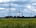 Pylons crossing the Oxfordshire countryside - geograph.org.uk - 4531673.jpg 1,024 × 785; 205 KB
-
 Bluebells in Radley Large Wood - geograph.org.uk - 1270342.jpg 640 × 427; 148 KB
-
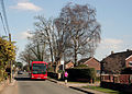 Bus and Jogger, Radley - geograph.org.uk - 2330891.jpg 3,532 × 2,532; 1.2 MB
-
 Thames Conservancy Launch 'Windrush' - geograph.org.uk - 1538991.jpg 640 × 501; 66 KB
-
 Radley Church of England Primary School - geograph.org.uk - 1229452.jpg 640 × 427; 123 KB
-
 Radley College - geograph.org.uk - 3469391.jpg 4,288 × 2,848; 3.55 MB
-
 Radley College Boat House along the River Thames - geograph.org.uk - 4531724.jpg 1,024 × 743; 212 KB
-
 Radley College Boat Houses - geograph.org.uk - 2497031.jpg 640 × 427; 121 KB
-
 Radley College Boathouse - geograph.org.uk - 2034220.jpg 1,500 × 969; 159 KB
-
 Radley College Hall - geograph.org.uk - 3329690.jpg 1,024 × 683; 219 KB
-
 Radley College War Memorial Arches - geograph.org.uk - 3300596.jpg 640 × 480; 80 KB
-
 Radley School Lodge - geograph.org.uk - 3329639.jpg 1,024 × 683; 175 KB
-
 Radley Station - geograph.org.uk - 3300583.jpg 640 × 480; 94 KB
-
 Radley station sign, bus shelter and sign post - geograph.org.uk - 5218423.jpg 4,375 × 3,081; 3.11 MB
-
 Railway bridge over the Thames - geograph.org.uk - 2057580.jpg 1,500 × 1,000; 294 KB
-
 Railway bridge, Sandford Lane - geograph.org.uk - 3323320.jpg 683 × 1,024; 239 KB
-
 Railway lines near Radley - geograph.org.uk - 110377.jpg 640 × 480; 253 KB
-
 Reeds and Seeds, Radley Lakes - geograph.org.uk - 2436463.jpg 3,608 × 2,508; 1.25 MB
-
 River bank and an island - geograph.org.uk - 3176252.jpg 640 × 480; 167 KB
-
 River Thames - geograph.org.uk - 1085558.jpg 640 × 480; 57 KB
-
 River Thames - geograph.org.uk - 3270065.jpg 1,024 × 768; 215 KB
-
 River Thames - geograph.org.uk - 3270068.jpg 640 × 480; 82 KB
-
 River Thames near Abingdon-on-Thames - geograph.org.uk - 4532401.jpg 1,024 × 768; 273 KB
-
 River Thames near Lower Farm - geograph.org.uk - 2497044.jpg 640 × 427; 161 KB
-
 River Thames near Radley - geograph.org.uk - 2612038.jpg 1,024 × 680; 203 KB
-
 River Thames north of Radley - geograph.org.uk - 4531668.jpg 1,024 × 768; 173 KB
-
 Road junction at Lower Radley - geograph.org.uk - 5218446.jpg 4,829 × 2,957; 3.81 MB
-
 Road junction south of Kennington - geograph.org.uk - 2643247.jpg 640 × 480; 57 KB
-
 Road to Lower Radley - geograph.org.uk - 1299734.jpg 640 × 427; 91 KB
-
 Rough meadows east of Abingdon - geograph.org.uk - 4691301.jpg 2,592 × 1,944; 1.46 MB
-
 Rough meadows near Abingdon - geograph.org.uk - 4691282.jpg 2,592 × 1,944; 1.73 MB
-
 Sand ^ Mud - geograph.org.uk - 3204110.jpg 1,600 × 1,200; 543 KB
-
 Scrubby woodland - geograph.org.uk - 3937226.jpg 640 × 430; 56 KB
-

-
 Sign, Radley Railway Station - geograph.org.uk - 2874202.jpg 640 × 462; 70 KB
-
 Sitting in the Sun - geograph.org.uk - 3632549.jpg 1,695 × 1,437; 755 KB
-
 St James Rd, Radley - geograph.org.uk - 3204083.jpg 1,600 × 1,155; 399 KB
-
 Stile and gate on the footpath - geograph.org.uk - 6294236.jpg 2,700 × 2,025; 1.17 MB
-
 Stile at Barrow Hills - geograph.org.uk - 1232445.jpg 640 × 427; 96 KB
-
 Stile into Radley Large Wood - geograph.org.uk - 1270344.jpg 640 × 427; 128 KB
-
 Sugworth Crescent - geograph.org.uk - 3632529.jpg 1,024 × 643; 169 KB
-
 Sugworth Lane - geograph.org.uk - 4362286.jpg 640 × 480; 65 KB


_teneral_female_violacea.jpg)


.jpg)
.jpg)


