Category:Rail trails in England
Wikimedia category | |||||
| Upload media | |||||
| Instance of | |||||
|---|---|---|---|---|---|
| Category combines topics | |||||
 | |||||
Subcategories
This category has the following 49 subcategories, out of 49 total.
A
- Alban Way (38 F)
- Auckland Way (12 F)
- Ayot Greenway (5 F)
B
- Bedford to Sandy Cycle Way (3 F)
- Brampton Railway (24 F)
- Bubwith Rail Trail (27 F)
- Bure Valley Path (51 F)
C
- Castleman Trailway (35 F)
- Centurion Way (18 F)
- Cuckoo Trail (23 F)
D
E
- Ebury Way (131 F)
F
H
- Harborne Walkway (7 F)
K
M
- Marriott's Way (234 F)
- Merelake Way (19 F)
N
P
S
- Salt Line (19 F)
- South Staffordshire Railway Walk (21 F)
T
- Teversal Trail (18 F)
U
- Upper Don Trail (6 F)
W
- Weavers' Way (203 F)
- Worth Way, West Sussex (20 F)
Y
Media in category "Rail trails in England"
The following 31 files are in this category, out of 31 total.
-
 Abandoned sleepers - geograph.org.uk - 312436.jpg 640 × 480; 118 KB
-
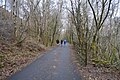
 Along the former railway (4) - geograph.org.uk - 6212122.jpg 4,320 × 3,240; 4.36 MB
-
 Coast path in former railway cutting - geograph.org.uk - 5912222.jpg 1,024 × 683; 254 KB
-
 Course of former branch railway to Addiscombe - geograph.org.uk - 6126717.jpg 1,024 × 768; 435 KB
-

-
 Cycle path on disused railway - geograph.org.uk - 6358364.jpg 800 × 600; 129 KB
-

-
 Footpath along old railway embankment - geograph.org.uk - 6370624.jpg 2,000 × 1,335; 3.81 MB
-
 Former railway, now a caravan site - geograph.org.uk - 6224150.jpg 1,024 × 768; 322 KB
-
 Former South Devon and Tavistock Railway - geograph.org.uk - 5809319.jpg 1,024 × 681; 296 KB
-
 Former South Devon and Tavistock Railway - geograph.org.uk - 5809460.jpg 1,024 × 681; 318 KB
-
 Former Tavistock to Plymouth railway - geograph.org.uk - 5804274.jpg 640 × 426; 115 KB
-
 Former Tavistock to Plymouth railway - geograph.org.uk - 5804276.jpg 640 × 426; 117 KB
-
 Former Tavistock to Plymouth railway - geograph.org.uk - 5804317.jpg 640 × 426; 122 KB
-
 Hyndburn Greenway in Baxenden - geograph.org.uk - 5896860.jpg 5,184 × 3,456; 4.14 MB
-
 KC Stadium from old Withernsea railway bridle path - geograph.org.uk - 5289766.jpg 5,376 × 3,024; 2.14 MB
-
 Line of disused railway - geograph.org.uk - 4940387.jpg 1,600 × 1,200; 1.32 MB
-

-

-
 Path on a dismantled railway line - geograph.org.uk - 5788880.jpg 1,024 × 768; 360 KB
-
 Path on former railway trackbed north of Instow - geograph.org.uk - 5913106.jpg 1,024 × 683; 208 KB
-
 Tarka Trail - geograph.org.uk - 5798777.jpg 4,227 × 2,742; 2.19 MB
-
 Tarka Trail - geograph.org.uk - 5799379.jpg 4,288 × 2,848; 2.84 MB
-
 Tarka Trail approaching Yarde - geograph.org.uk - 5790479.jpg 4,288 × 2,848; 2.43 MB
-
 Tarka Trail near Yarde - geograph.org.uk - 5799358.jpg 4,288 × 2,848; 2.78 MB
-
 The Wirral Way towards West Kirby - geograph.org.uk - 6166588.jpg 800 × 590; 154 KB
-
 The Wirral Way towards West Kirby - geograph.org.uk - 6166595.jpg 800 × 600; 114 KB
-
 The Wirral Way towards West Kirby - geograph.org.uk - 6166597.jpg 800 × 600; 181 KB
-
 Trackbed of former railway line - now used as a footpath - geograph.org.uk - 5796631.jpg 4,000 × 3,000; 4.22 MB
-

-
 Walkers on the Flitch Way Near Felsted - geograph.org.uk - 6198200.jpg 678 × 1,024; 326 KB

_-_geograph.org.uk_-_6212122.jpg)


