Category:Rail transport in Buckinghamshire
Ceremonial counties of England: Bedfordshire · Berkshire · Buckinghamshire · Cambridgeshire · Cheshire · Cornwall · Cumbria · Derbyshire · Devon · Dorset · Durham · East Riding of Yorkshire · East Sussex · Essex · Gloucestershire · Greater London · Greater Manchester · Hampshire · Herefordshire · Hertfordshire · Kent · Lancashire · Leicestershire · Lincolnshire · Merseyside · North Yorkshire · Northamptonshire · Northumberland · Nottinghamshire · Oxfordshire · Rutland · Shropshire · Somerset · South Yorkshire · Staffordshire · Suffolk · Surrey · Tyne and Wear · Warwickshire · West Midlands · West Sussex · West Yorkshire · Wiltshire · Worcestershire
City-counties: Bristol · City of London
Former historic counties:
Other former counties:
City-counties: Bristol · City of London
Former historic counties:
Other former counties:
Wikimedia category | |||||
| Upload media | |||||
| Instance of | |||||
|---|---|---|---|---|---|
| Category combines topics | |||||
| Buckinghamshire | |||||
ceremonial county in England, UK (use Q21694636 for administrative unitary authority)  Вид города Марлоу     | |||||
| Instance of |
| ||||
| Location |
| ||||
| Capital | |||||
| Population |
| ||||
| Area |
| ||||
| Different from | |||||
| Said to be the same as | Buckinghamshire (historic county of England, ceremonial county of England, 1844) | ||||
| official website | |||||
 | |||||
Subcategories
This category has the following 12 subcategories, out of 12 total.
Media in category "Rail transport in Buckinghamshire"
The following 30 files are in this category, out of 30 total.
-
 Approaching Wycombe station - geograph.org.uk - 1235842.jpg 640 × 458; 92 KB
-

-
 Railway beneath Potkiln Lane Bridge - geograph.org.uk - 852032.jpg 640 × 480; 127 KB
-
 Railway embankment, Haydon Hill - geograph.org.uk - 96970.jpg 640 × 480; 121 KB
-
 Railway Embankment, Haydon Hill - geograph.org.uk - 96971.jpg 480 × 640; 109 KB
-
 Railway line near Calvert - geograph.org.uk - 502268.jpg 640 × 480; 97 KB
-
 Railway line near Calvert 2 - geograph.org.uk - 502343.jpg 640 × 480; 170 KB
-
 Railway line near Doddershall House - geograph.org.uk - 930184.jpg 480 × 640; 90 KB
-
 Railway line near Railway Cottage - geograph.org.uk - 1248340.jpg 480 × 640; 81 KB
-
 Railway lines near Calvert - geograph.org.uk - 502421.jpg 640 × 480; 115 KB
-
 Railway near Haddenham - geograph.org.uk - 33753.jpg 482 × 640; 123 KB
-
 Red Light at Sears Crossing - geograph.org.uk - 1302.jpg 640 × 480; 48 KB
-

-

-

-

-
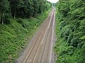
 West Coast Main Line - view downline - geograph.org.uk - 895207.jpg 640 × 413; 185 KB
-
 Wotton miniature railway - geograph.org.uk - 1562794.jpg 640 × 480; 98 KB
-

-
 Buffers, railway line near Calvert - geograph.org.uk - 502296.jpg 640 × 480; 180 KB
-

-

-

-
 Metropolitan Line railway at Amersham - geograph.org.uk - 421269.jpg 640 × 480; 138 KB
-
 Railway line - geograph.org.uk - 437602.jpg 640 × 480; 79 KB
-
 Railway line near Calvert - geograph.org.uk - 496873.jpg 480 × 640; 127 KB
-
 Railway line near Woodlands Farm - geograph.org.uk - 379620.jpg 640 × 480; 90 KB
-
 Railway line near Woodlands Farm - geograph.org.uk - 484730.jpg 640 × 480; 96 KB
-
 Railway north of Charndon - geograph.org.uk - 134988.jpg 640 × 480; 91 KB
-


_-_geograph.org.uk_-_751677.jpg)
_-_geograph.org.uk_-_751694.jpg)


