Category:Rail transport maps of East Sussex
Media in category "Rail transport maps of East Sussex"
The following 11 files are in this category, out of 11 total.
-
 Hastings line.png 2,421 × 2,014; 3.41 MB
-
 West Coastway line.png 2,771 × 1,134; 2.24 MB
-
 Brighton Railway development.gif 600 × 427; 38 KB
-
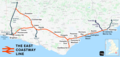 East Coastway line.png 3,192 × 1,512; 2.54 MB
-
 Hellingly railway route.png 800 × 600; 24 KB
-
 Hellingly station layout.png 800 × 800; 39 KB
-
 Max extent of brighton railways.png 603 × 431; 25 KB
-
 Oxted line.png 1,552 × 1,707; 2.6 MB
-
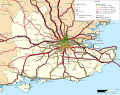 Rail transport infrastructure map - UK - South East England.svg 1,247 × 983; 8.83 MB
-
 Rye and Camber Map.png 1,088 × 598; 98 KB
-
 Seaford branch line.png 1,971 × 1,477; 1.17 MB


