Category:Rail transport maps of Gironde
Media in category "Rail transport maps of Gironde"
The following 13 files are in this category, out of 13 total.
-
 Plan Eisenbahnnetz Bordeaux.png 624 × 600; 58 KB
-
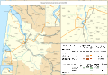
 Railway map of France - 33 - 1860 - fr - small.svg 1,273 × 879; 6.69 MB
-
 Railway map of France - 33 - 1885 - fr - small.svg 1,273 × 879; 6.87 MB
-
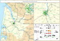
 Railway map of France - 33 - 1900 - fr - small.svg 1,273 × 879; 7.11 MB
-
 Railway map of France - 33 - 1913 - fr - small.svg 1,273 × 879; 7.44 MB
-
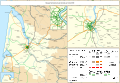
 Railway map of France - 33 - 1929 - fr - small.svg 1,273 × 879; 7.51 MB
-
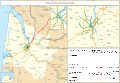
 Railway map of France - 33 - 1939 - fr - small.svg 1,273 × 879; 7.41 MB
-
 Railway map of France - 33 - 1960 - fr - small.svg 1,273 × 879; 7.35 MB
-
 Railway map of France - 33 - 1980 - fr - small.svg 1,273 × 879; 7.34 MB
-
 Railway map of France - 33 - 2000 - fr - small.svg 1,273 × 879; 7.34 MB
-
 Railway map of France - 33 - 2020 - fr - small.svg 1,273 × 879; 7.21 MB
-
 Railway map of France - 33 - animated - fr.gif 2,672 × 1,845; 8.97 MB
-
 Railway map of France - Bordeaux - animated - fr.gif 2,067 × 1,501; 20.21 MB


