Category:Rail transport maps of Iran
Subcategories
This category has the following 9 subcategories, out of 9 total.
I
- Isfahan Metro maps (5 F)
K
- Karaj Metro maps (11 F)
- Kermanshah Metro maps (1 F)
M
- Mashhad Metro maps (5 F)
P
S
- Shiraz Metro maps (9 F)
T
- Tabriz Metro maps (8 F)
- Tehran Metro maps (36 F)
Media in category "Rail transport maps of Iran"
The following 15 files are in this category, out of 15 total.
-

-
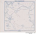 Iran - Railroads - DPLA - 07cd994f0149fb563cdcded2a7b0926a.jpg 3,651 × 3,538; 1.26 MB
-
 Iran High Speed Rail Network Approved Plan.png 895 × 823; 22 KB
-
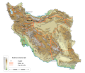
 Iran railway en.png 1,142 × 1,042; 290 KB
-
 Kazakhstan-turkmenistan-iran railway link map 2014.svg 500 × 928; 620 KB
-
 Kermanshah Metro Geographic map.png 1,233 × 1,109; 21 KB
-
 Lines english.jpg 1,349 × 833; 367 KB
-
 Map Iran railways en.svg 2,318 × 2,000; 7.15 MB
-
 Map Iran railways es.svg 2,318 × 2,000; 7.52 MB
-
 Map Iran railways fa.svg 2,318 × 2,000; 7.15 MB
-
 Map of the Yerewan Jolfa railway.jpg 1,406 × 816; 344 KB
-
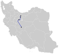 Tehran-Qom-Isfahan HSR.png 895 × 823; 25 KB
-
 Transiran railway en.png 1,142 × 1,042; 179 KB
-
 Transiran vasut hu1.png 1,142 × 1,042; 181 KB
-
 X846.graphic rail now.jpg.pagespeed.ic.eSV H7Pugn.jpg 846 × 754; 220 KB
.jpg)


