Category:Rail transport maps of Leicestershire
Media in category "Rail transport maps of Leicestershire"
The following 13 files are in this category, out of 13 total.
-
 B'ham-Peterborough Line Map.png 1,324 × 527; 954 KB
-
 Birmingham–Peterborough line.png 2,647 × 1,485; 3.17 MB
-
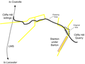 CliffeHillMineralRailwayMap.png 615 × 467; 25 KB
-
 Leicester–Burton upon Trent line.png 1,535 × 1,225; 1.47 MB
-
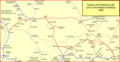
 Loughborough Gap.png 750 × 661; 725 KB
-
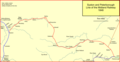
 Mcrmap.jpg 400 × 886; 31 KB
-
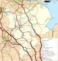 Rail transport infrastructure map - UK - East Midlands.svg 983 × 1,020; 6.31 MB
-
 Swannington 1850.png 1,298 × 1,076; 82 KB
-
 Syston - Peterborough 1846.png 1,587 × 826; 85 KB
-
 Syston to Peterborough 1848.png 1,587 × 826; 93 KB
-
 Syston to Peterborough1893.png 1,587 × 826; 153 KB
-
 Syston to Peterbrough 1879.png 1,587 × 826; 145 KB
-
 Zouch railway.png 1,063 × 1,190; 112 KB


