Category:Rail transport maps of Ohio
States of the United States: Alaska · Arizona · California · Colorado · Connecticut · Delaware · Florida · Georgia · Idaho · Illinois · Indiana · Iowa · Kentucky · Maine · Maryland · Massachusetts · Michigan · Minnesota · Mississippi · Missouri · Nevada · New Hampshire · New Jersey · New Mexico · New York · North Dakota · Ohio · Oregon · Pennsylvania · Rhode Island · Texas · Utah · Vermont · Virginia · Washington · Wisconsin – Washington, D.C.
Subcategories
This category has the following 2 subcategories, out of 2 total.
M
- Maps of Conrail (10 F)
T
Media in category "Rail transport maps of Ohio"
The following 56 files are in this category, out of 56 total.
-
-

-
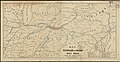
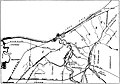
 1898 PUTNAM COUNTY RAILROAD MAP.jpg 379 × 297; 53 KB
-
 1901 Poor's Cleveland, Lorain and Wheeling Railway.jpg 3,340 × 2,164; 1.58 MB
-
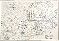
 1920 Midwest interurban map.png 7,250 × 5,931; 14.44 MB
-
 Cincinnati, Dayton and Toledo Traction map.jpg 512 × 544; 61 KB
-
 Cleveland Columbus and Cincinnati Railroad map.jpg 2,630 × 3,473; 2.16 MB
-
 Cleveland railroads 1907.jpg 2,399 × 1,678; 749 KB
-

-

-
 Cuyahoga Valley Scenic Railroad Road Map Big.jpg 888 × 800; 265 KB
-
 Cuyahoga Valley Scenic Railroad Road Map.jpg 712 × 780; 215 KB
-
 Electric railway journal (1911) (14571857689).jpg 2,854 × 2,026; 919 KB
-
 GCRTA 1913-2015.gif 988 × 461; 4.01 MB
-

-

-
 Hocking Valley Scenic Railway Road Map.jpg 612 × 395; 129 KB
-
 LSE711922.Jpg 1,248 × 608; 119 KB
-
 Map of Cleveland-Southwestern and Columbus Railway c 1907.png 1,290 × 1,072; 1.37 MB
-
 Map of the Cleveland, Painesville, & Ashtabula Railway System (51805823487).jpg 2,292 × 927; 696 KB
-
 Map Showing the Line of the Conneaut and Erie Traction Company c 1907.png 1,316 × 802; 718 KB
-

-

-

-

-
 Ohio Electric Railway map (14575084010).jpg 2,444 × 1,272; 583 KB
-
 Ohio electric railways, February 1904 (14760158195).jpg 2,528 × 2,748; 822 KB
-
 Pennsylvania Lines West of Pittsburgh, Flood of March 1913 (51806780928).jpg 5,548 × 3,499; 14.46 MB
-
 Pennsylvania Railroad Erie & Ashtabula Division (51412372909).jpg 2,448 × 3,276; 7.48 MB
-
 Rail lines in Ohio. LOC 76691536.jpg 6,872 × 8,529; 4.25 MB
-
 Rail lines in Ohio. LOC 76691536.tif 6,872 × 8,529; 167.69 MB
-
 Rail road map of Ohio 1873. LOC 98688540.jpg 6,288 × 4,976; 5.56 MB
-
 Rail road map of Ohio 1873. LOC 98688540.tif 6,288 × 4,976; 89.52 MB
-
 Railroad & township map of Ohio. LOC 98688538.tif 8,430 × 9,545; 230.21 MB
-
 Railroad Map Of Ohio 1873.jpg 6,000 × 4,748; 20.8 MB
-
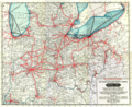
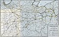
 Railroad Map of Ohio in 1880.jpg 2,812 × 2,142; 1.09 MB
-

-

-

-

-

-
-

-

-

-
 The Commercial and financial chronicle (1908) (14775132831).jpg 4,256 × 2,598; 1.75 MB
-
 The Commercial and financial chronicle (1909) (14576933310).jpg 4,192 × 2,558; 2.18 MB
-
 The Commercial and financial chronicle (1909) (14783217873).jpg 4,368 × 2,616; 1.91 MB
-
 The Commercial and financial chronicle (1910) (14577761600).jpg 4,230 × 2,608; 2.03 MB
-
 The Commercial and financial chronicle (1911) (14595469479).jpg 4,304 × 2,632; 2.51 MB
-
 The Commercial and financial chronicle (1911) (14595628547).jpg 4,432 × 2,688; 2 MB
-
 The Street railway journal (1906) (14574540870).jpg 3,092 × 2,258; 1.2 MB
-
 The Street railway journal (1906) (14758067931).jpg 2,652 × 2,952; 751 KB
-
 The street railway review (1891) (14758081111).jpg 2,908 × 2,043; 668 KB
-

-
 Txu-oclc-6445490-electric railway-akron-1913.jpg 1,302 × 1,800; 679 KB


_(14571857689).jpg)


.jpg)
.jpg)
.jpg)
.jpg)


_(14775132831).jpg)
_(14576933310).jpg)
_(14783217873).jpg)
_(14577761600).jpg)
_(14595469479).jpg)
_(14595628547).jpg)
_(14574540870).jpg)
_(14758067931).jpg)
_(14758081111).jpg)
.jpg)

._Its_past_history_and_present_resources%27_(11102159305).jpg)
.jpg)