Category:Rail transport maps of Pyrénées-Atlantiques
Media in category "Rail transport maps of Pyrénées-Atlantiques"
The following 7 files are in this category, out of 7 total.
-
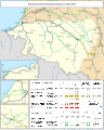
 Railway map of France - 64 - 1880 - fr - small.svg 776 × 968; 5.56 MB
-
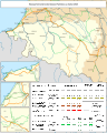
 Railway map of France - 64 - 1900 - fr - small.svg 776 × 968; 5.61 MB
-
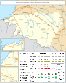
 Railway map of France - 64 - 1913 - fr - small.svg 776 × 968; 5.7 MB
-
 Railway map of France - 64 - 1928 - fr - small.svg 776 × 968; 5.78 MB
-
 Railway map of France - 64 - 1950 - fr - small.svg 776 × 968; 5.71 MB
-
 Railway map of France - 64 - 1980 - fr - small.svg 776 × 968; 5.71 MB
-
 Railway map of France - 64 - 2020 - fr - small.svg 776 × 968; 5.51 MB


