Category:Rail transport maps of Western Australia
States of Australia: New South Wales · Queensland · South Australia · Western Australia
Internal territories of Australia:
External territories of Australia:
Internal territories of Australia:
External territories of Australia:
Media in category "Rail transport maps of Western Australia"
The following 24 files are in this category, out of 24 total.
-
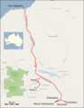
 Baldivis Tramway marked on OpenStreetMap.jpg 447 × 829; 92 KB
-
 Clackline to Piawaning railway map 1917.jpg 2,441 × 2,796; 3.03 MB
-
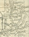
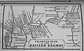 Eastern Railway 1897 detail.JPG 1,963 × 1,196; 976 KB
-
 Eisenbahnunfall von Turners Siding.png 762 × 983; 927 KB
-
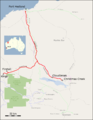 Fortescue Railway.png 1,608 × 2,081; 429 KB
-
 Iron ore Pilbara 2.svg 1,385 × 1,033; 1.34 MB
-
 Iron ore Pilbara.jpg 2,048 × 1,500; 268 KB
-
 Map of One Rail Australia facilities and serviced lines.png 3,327 × 2,144; 869 KB
-
 Mount Newman Railway.png 1,608 × 2,081; 454 KB
-
 Perth rail map.png 680 × 631; 78 KB
-
 Perth Railway map.svg 2,694 × 570; 74 KB
-
 Roy Hill Railway.png 1,608 × 2,081; 415 KB
-
 Transperth railway map.svg 516 × 810; 653 KB
-
 TransperthRailwayMap.svg 650 × 1,050; 142 KB
-
 WA part railway network map 1935.jpg 2,865 × 3,693; 2.39 MB
-
 WAGR 1935 network Bowelling.JPG 2,368 × 1,290; 2.14 MB
-
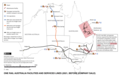
 Western Australia Pilbara railway operators.png 1,081 × 892; 75 KB
-
 Western Australia Pilbara railway track gauges.png 1,119 × 936; 76 KB
-
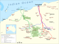
 Western Australia rail network.gif 705 × 1,168; 523 KB
-
 Western Australia railway operators.png 2,482 × 3,443; 317 KB
-
 Western Australia railway track gauges.png 2,498 × 3,533; 321 KB
-
 Western Australia South West railway operators.png 1,052 × 822; 72 KB
-
 Western Australia South West railway track gauges.png 1,092 × 831; 74 KB
-
 Zigzag1.svg 744 × 1,052; 43 KB


