Category:Railway bridges in Hertfordshire
Ceremonial counties of England: Bedfordshire · Berkshire · Buckinghamshire · Cambridgeshire · Cheshire · Cornwall · Cumbria · Derbyshire · Devon · Dorset · Durham · East Riding of Yorkshire · East Sussex · Essex · Gloucestershire · Greater London · Greater Manchester · Hampshire · Herefordshire · Hertfordshire · Kent · Lancashire · Leicestershire · Lincolnshire · Merseyside · Norfolk · North Yorkshire · Northamptonshire · Northumberland · Nottinghamshire · Oxfordshire · Rutland · Shropshire · Somerset · South Yorkshire · Staffordshire · Suffolk · Surrey · Tyne and Wear · Warwickshire · West Midlands · West Sussex · West Yorkshire · Wiltshire · Worcestershire
City-counties: Bristol · City of London
Former historic counties:
Other former counties:
City-counties: Bristol · City of London
Former historic counties:
Other former counties:
Wikimedia category | |||||
| Upload media | |||||
| Instance of | |||||
|---|---|---|---|---|---|
| |||||
Subcategories
This category has the following 3 subcategories, out of 3 total.
A
R
Media in category "Railway bridges in Hertfordshire"
The following 67 files are in this category, out of 67 total.
-
 A railway bridge over Priory Lane - geograph.org.uk - 1317067.jpg 640 × 480; 76 KB
-
 Berry Lane - geograph.org.uk - 951474.jpg 640 × 480; 102 KB
-
 Boxmoor Skew Bridge detail.jpg 4,000 × 3,000; 3.83 MB
-
 Boxmoor Skew Bridge.jpg 4,000 × 3,000; 4.06 MB
-

-
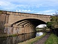
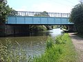 Bridge 170A, Grand Union Canal - geograph.org.uk - 1397461.jpg 640 × 480; 96 KB
-
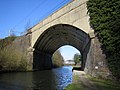
 Bridge 170A, Grand Union Canal - geograph.org.uk - 1397469.jpg 640 × 480; 89 KB
-
 Bridge over Park Street and Frogmore (1965).JPG 1,818 × 1,818; 987 KB
-
 Bridge remains, Park Street and Frogmore (1965).JPG 1,818 × 1,780; 976 KB
-
 Bridging the gap, Hitchin Flyover begins to shape up, June 2012 - panoramio.jpg 3,158 × 1,932; 1.55 MB
-
 Bullsmill Railway Bridge - geograph.org.uk - 134529.jpg 640 × 480; 119 KB
-
 Cuffley world War 2 Anti-tank Blocks - geograph.org.uk - 92099.jpg 640 × 480; 91 KB
-
 Darnicle Hill anti-tank blocks.jpg 2,992 × 2,992; 2.81 MB
-

-
 Ebury Way, Croxley - geograph.org.uk - 86530.jpg 640 × 425; 132 KB
-
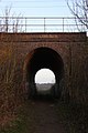 Footpath under the railway - geograph.org.uk - 636492.jpg 427 × 640; 65 KB
-
 GOC Hemel Hempstead 088 Railway Bridge, Grand Union Canal (48330010277).jpg 4,608 × 3,456; 5.42 MB
-
 GOC Hitchin 064 Bridge ECM1 99 (9579947475).jpg 4,288 × 3,216; 4.28 MB
-

-

-

-

-

-
-

-
 Hertingfordbury bridge (1964).JPG 1,818 × 1,731; 1.23 MB
-
 Hitchin MMB 02 Hitchin Flyover.jpg 4,347 × 2,284; 2.68 MB
-
 How Wood, Park Street Lane railway bridge - geograph.org.uk - 595685.jpg 640 × 480; 106 KB
-
 Hunton Bridge, Bridge Road bridge - geograph.org.uk - 1415996.jpg 640 × 480; 93 KB
-

-
 Kecksy's Bridge - geograph.org.uk - 241941.jpg 640 × 427; 162 KB
-
 Kings Langley railway bridge - geograph.org.uk - 2160185.jpg 640 × 427; 237 KB
-
 Kings Langley, Harthall Lane - geograph.org.uk - 128266.jpg 640 × 480; 132 KB
-

-

-
 New railway bridge at Cadwell - geograph.org.uk - 889805.jpg 640 × 480; 232 KB
-

-
 Over Cadwell Lane bridge, Hitchin. - panoramio.jpg 3,888 × 2,592; 4.44 MB
-

-
 Pleasant Lane, Bricket Wood - geograph.org.uk - 1550292.jpg 640 × 428; 95 KB
-
 Potters Bar 04.JPG 4,000 × 3,000; 4.23 MB
-
 Radlett Brook, Railway bridge - geograph.org.uk - 1266471.jpg 640 × 480; 112 KB
-

-
 Railtrack (sic) bridge sign at Cadwell - geograph.org.uk - 889834.jpg 640 × 480; 200 KB
-
 Railway Bridge - geograph.org.uk - 325387.jpg 640 × 480; 145 KB
-
 Railway Bridge at Old Mill Broxbourne - geograph.org.uk - 108990.jpg 640 × 480; 207 KB
-
 Railway bridge near Radlett - geograph.org.uk - 93991.jpg 640 × 480; 102 KB
-
 Railway bridge over Bullsmill Lane - geograph.org.uk - 1221044.jpg 640 × 480; 93 KB
-
 Railway bridge over Queensway, Hemel Hempstead (1964).JPG 1,818 × 1,624; 934 KB
-
 Railway bridge over Station Road - geograph.org.uk - 1395571.jpg 640 × 480; 98 KB
-

-
 Railway bridges over Station Road - geograph.org.uk - 1323966.jpg 640 × 465; 71 KB
-
 Railway overbridge nr Knebworth (1965).JPG 1,818 × 1,741; 1.21 MB
-
 Spring Road - geograph.org.uk - 31283.jpg 640 × 480; 159 KB
-

-
 Stapleford Railway Bridge - geograph.org.uk - 147135.jpg 640 × 480; 109 KB
-
 The new Hitchin railway flyover begins to take shape. - panoramio.jpg 2,048 × 1,365; 661 KB
-
 The replacement rail bridge at Cadwell - geograph.org.uk - 889853.jpg 640 × 480; 170 KB
-

-
 Walsworth railway bridge. - geograph.org.uk - 30504.jpg 640 × 480; 133 KB
-
 Watford, Ascot Road railway bridge - geograph.org.uk - 735534.jpg 640 × 480; 102 KB
-
 Watford, Lammas Road railway bridge - geograph.org.uk - 943811.jpg 640 × 480; 87 KB
-
 Winkwell, Pouchen End Lane railway bridge - geograph.org.uk - 614724.jpg 640 × 480; 102 KB
-
 Work in progress^ - geograph.org.uk - 228995.jpg 640 × 480; 143 KB
-
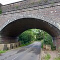
 Brick arches over side road. off B 653 - geograph.org.uk - 45229.jpg 640 × 480; 24 KB
-
 Railway bridge near Slip End - geograph.org.uk - 403139.jpg 640 × 588; 93 KB
-
 Railway bridge over the A.505 - geograph.org.uk - 389740.jpg 640 × 430; 60 KB


.JPG)
.JPG)


.jpg)
.jpg)


.JPG)


_bridge_sign_at_Cadwell_-_geograph.org.uk_-_889834.jpg)


.JPG)


.JPG)


