Category:Railway lines in North Yorkshire
Subcategories
This category has the following 18 subcategories, out of 18 total.
A
D
E
H
L
N
S
T
W
Y
Media in category "Railway lines in North Yorkshire"
The following 25 files are in this category, out of 25 total.
-
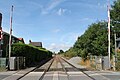
 Approaching Cow Lane level crossing - geograph.org.uk - 3793930.jpg 1,280 × 1,111; 299 KB
-
 Avoiding lines - geograph.org.uk - 1583481.jpg 640 × 479; 93 KB
-
-
 Diesel Unit heading toward York - geograph.org.uk - 4066889.jpg 4,608 × 3,456; 3.08 MB
-
 Fairburn Ings and Leeds to York railway line - geograph.org.uk - 5664766.jpg 4,608 × 3,456; 4 MB
-
 Goole York Hillhouse RJD 83.jpg 1,815 × 1,110; 330 KB
-
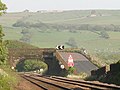
 Level crossing, Scruton - geograph.org.uk - 2133468.jpg 640 × 482; 80 KB
-

-
 Looking west from Dam Lane level crossing - geograph.org.uk - 5132349.jpg 4,608 × 3,456; 3.51 MB
-
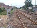
 North of Burn Lane - geograph.org.uk - 753860.jpg 640 × 489; 136 KB
-
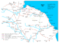 North yorkshire moors railway map.gif 1,198 × 888; 73 KB
-
 Railway near Bell Busk - geograph.org.uk - 170647.jpg 640 × 480; 69 KB
-
 Railway through Cliffe - geograph.org.uk - 4594533.jpg 1,024 × 683; 197 KB
-
 The Midland line at Niffany - geograph.org.uk - 1391242.jpg 640 × 480; 174 KB
-
 The railway to York and Station Farm - geograph.org.uk - 2748744.jpg 1,024 × 768; 181 KB
-
 Train line through Cliffe - geograph.org.uk - 4594543.jpg 1,024 × 683; 185 KB
-
 View east from railway footbridge in Leyburn - geograph.org.uk - 5857985.jpg 1,024 × 768; 311 KB
-

-

-

-

-

-
-
 York and North Midland Railway - geograph.org.uk - 4614759.jpg 640 × 426; 55 KB
-
 York to Leeds line - geograph.org.uk - 2791844.jpg 640 × 480; 96 KB


