Category:Raithby by Spilsby
village in Lincolnshire, UK  | |||||
| Upload media | |||||
| Instance of | |||||
|---|---|---|---|---|---|
| Location | Raithby, East Lindsey, Lincolnshire, East Midlands, England | ||||
 | |||||
Subcategories
This category has the following 4 subcategories, out of 4 total.
C
- Chapel at Raithby Hall (51 F)
H
- Raithby Hall (2 F)
R
- The Red Lion Inn, Raithby (4 F)
T
- Holy Trinity, Raithby by Spilsby (27 F)
Media in category "Raithby by Spilsby"
The following 47 files are in this category, out of 47 total.
-
 B1195 towards Spilsby - geograph.org.uk - 3491351.jpg 640 × 480; 97 KB
-

-
-
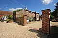
 Coach House, Raithby - geograph.org.uk - 4086061.jpg 640 × 426; 104 KB
-
 Cottages in Raithby by Spilsby - geograph.org.uk - 5109098.jpg 1,280 × 960; 503 KB
-
 Cut Mark, Raithby, Raithby Road - geograph.org.uk - 5109093.jpg 1,067 × 1,105; 306 KB
-

-
 Dovendale near Louth, Lincolnshire - geograph.org.uk - 183258.jpg 640 × 427; 112 KB
-
 Farm building, Glebe Farm - geograph.org.uk - 3491354.jpg 640 × 480; 102 KB
-
 Farm buildings by Glebe Farm - geograph.org.uk - 4129770.jpg 640 × 427; 87 KB
-
 Farmland near Raithby - geograph.org.uk - 3491350.jpg 640 × 480; 64 KB
-
 Footpath leading to Raithby by Spilsby - geograph.org.uk - 4150174.jpg 1,600 × 1,200; 502 KB
-
 Former village school by Spilsby - geograph.org.uk - 4150182.jpg 1,600 × 1,200; 470 KB
-
 Goose Lane - geograph.org.uk - 3634936.jpg 2,256 × 1,504; 2.77 MB
-
 Houses on Raithby Road, Raithby by Spilsby - geograph.org.uk - 4150196.jpg 1,600 × 1,136; 404 KB
-
 Junction of footpaths south of Wood Hill - geograph.org.uk - 3615322.jpg 1,600 × 1,064; 362 KB
-
 Mavis Enderby, aerial 2016 - geograph.org.uk - 5011633.jpg 640 × 427; 38 KB
-
 Minor Road towards Raithby Cross Roads - geograph.org.uk - 4150167.jpg 1,600 × 1,221; 530 KB
-

-

-

-
 Raithby by Spilsby village school - geograph.org.uk - 4129064.jpg 640 × 427; 62 KB
-
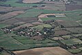 Raithby by Spilsby, aerial 2016 - geograph.org.uk - 5229766.jpg 640 × 427; 57 KB
-
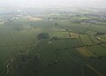
 Raithby by Spilsby, aerial 2016 - geograph.org.uk - 5229769.jpg 640 × 427; 46 KB
-
 Raithby by Spilsby, aerial 2016 - geograph.org.uk - 5229911.jpg 427 × 640; 54 KB
-
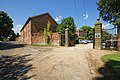
 Raithby Road, Raithby - geograph.org.uk - 4086527.jpg 426 × 640; 120 KB
-
 Raithby Road, Raithby - geograph.org.uk - 4086531.jpg 640 × 426; 80 KB
-
 Raithby Road, Raithby - geograph.org.uk - 4086534.jpg 640 × 426; 85 KB
-
 Raithby Road, Raithby - geograph.org.uk - 4086538.jpg 640 × 426; 84 KB
-
 Raithby Road, Raithby - geograph.org.uk - 4086547.jpg 640 × 426; 97 KB
-
 Raithby Road, Raithby - geograph.org.uk - 4086548.jpg 640 × 426; 94 KB
-
 Raithby Road, Raithby - geograph.org.uk - 4088705.jpg 640 × 426; 71 KB
-
 Raithby Road, Raithby - geograph.org.uk - 4088741.jpg 640 × 426; 89 KB
-
 Raithby Road, Raithby - geograph.org.uk - 4088867.jpg 640 × 640; 171 KB
-
 Raithby Road, Raithby by Spilsby - geograph.org.uk - 2694336.jpg 1,280 × 960; 483 KB
-
 Rape field and hills - geograph.org.uk - 418317.jpg 640 × 480; 114 KB
-
-
 Road into Raithby by Spilsby - geograph.org.uk - 4129063.jpg 640 × 427; 68 KB
-
 Road to Sausthorpe - geograph.org.uk - 4129034.jpg 640 × 427; 83 KB
-
 Sausthorpe Bridge - geograph.org.uk - 2694642.jpg 1,280 × 960; 540 KB
-
 Sausthorpe Bridge over Tennyson's Brook - geograph.org.uk - 4128571.jpg 640 × 427; 101 KB
-
 School Lane, Raithby - geograph.org.uk - 4086542.jpg 640 × 426; 97 KB
-
 School Lane, Raithby by Spilsby - geograph.org.uk - 4150179.jpg 1,600 × 1,200; 461 KB
-
 Sprayer on the footpath, near Spilsby - geograph.org.uk - 473126.jpg 640 × 480; 116 KB
-
 Towards the A16 - geograph.org.uk - 418310.jpg 640 × 480; 87 KB
-
 Tractor on Raithby Hill - geograph.org.uk - 4129739.jpg 640 × 427; 79 KB
-


