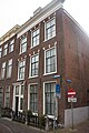
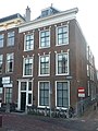
Category:Rapenburg 59, Leiden
| Object location | | View all coordinates using: OpenStreetMap |
|---|
 | |||||
| Upload media | |||||
| Instance of |
| ||||
|---|---|---|---|---|---|
| Location | Leiden, South Holland, Netherlands | ||||
| Heritage designation |
| ||||
 | |||||
|
This is a category about rijksmonument number 25497
|
| Address |
|
Media in category "Rapenburg 59, Leiden"
The following 9 files are in this category, out of 9 total.
-
 En 63 - Leiden - 20137230 - RCE.jpg 1,200 × 886; 214 KB
-
 Exterieur OVERZICHT VOORGEVELS - Leiden - 20365473 - RCE.jpg 1,200 × 1,193; 331 KB
-
 Gevel - Leiden - 20137231 - RCE.jpg 802 × 1,200; 166 KB
-
 Leiden - Rapenburg 59 v2.jpg 3,024 × 4,032; 2.02 MB
-
 Leiden - Rapenburg 59 v3.jpg 3,456 × 5,184; 1.79 MB
-
 Leiden - Rapenburg 59.jpg 2,736 × 3,648; 4.29 MB
-
 Overzicht met grachtenhuizen - Leiden - 20343430 - RCE.jpg 1,200 × 787; 208 KB
-
 Wiki Takes Leiden 2017 - 14.jpg 3,480 × 4,640; 4.01 MB
-
 Wiki Takes Leiden 2017 - 15.jpg 3,480 × 4,640; 3.84 MB


