Category:Rapeseed fields in Derbyshire
Ceremonial counties of England: Bedfordshire · Berkshire · Buckinghamshire · Cambridgeshire · Cheshire · Cornwall · Cumbria · Derbyshire · Devon · Dorset · Durham · East Riding of Yorkshire · East Sussex · Essex · Gloucestershire · Greater London · Greater Manchester · Hampshire · Herefordshire · Hertfordshire · Kent · Leicestershire · Lincolnshire · Norfolk · North Yorkshire · Northamptonshire · Northumberland · Nottinghamshire · Oxfordshire · Rutland · Shropshire · Somerset · South Yorkshire · Staffordshire · Suffolk · Surrey · Warwickshire · West Sussex · West Yorkshire · Wiltshire · Worcestershire
City-counties:
Former historic counties:
Other former counties:
City-counties:
Former historic counties:
Other former counties:
Media in category "Rapeseed fields in Derbyshire"
The following 24 files are in this category, out of 24 total.
-
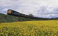 56006 , Oxcroft Colliery Junction.jpg 1,500 × 920; 230 KB
-
 56011 Oxcroft Colliery Branch.jpg 2,048 × 1,344; 478 KB
-
 A woody outcrop - geograph.org.uk - 418879.jpg 640 × 480; 115 KB
-
 Blakenhall farm - geograph.org.uk - 395070.jpg 640 × 481; 101 KB
-

-

-
 Common Farm from Winshill - geograph.org.uk - 396890.jpg 640 × 481; 112 KB
-
 Crop Boundary - geograph.org.uk - 465921.jpg 640 × 360; 65 KB
-
 Field and trees below Palterton (geograph 2380813).jpg 950 × 700; 415 KB
-
 Field of oilseed rape near Egginton - geograph.org.uk - 381062.jpg 640 × 480; 93 KB
-
 Fields of gold - geograph.org.uk - 395120.jpg 640 × 481; 118 KB
-
 Footpath - geograph.org.uk - 466085.jpg 640 × 360; 86 KB
-
 Footpath - geograph.org.uk - 466735.jpg 640 × 360; 94 KB
-
 Footpath through fields of gold - geograph.org.uk - 395057.jpg 481 × 640; 118 KB
-
 Footpath through oilseed rape - geograph.org.uk - 401813.jpg 640 × 480; 97 KB
-
 Footpath through the oilseed rape (geograph 7168561).jpg 1,600 × 1,200; 785 KB
-
 Harvest Time 2.jpg 1,500 × 1,000; 749 KB
-
 Harvest Time.jpg 1,500 × 1,000; 520 KB
-
 On muddy pond - geograph.org.uk - 418890.jpg 640 × 480; 127 KB
-
 Over the Rapeseed to Walton Wood - geograph.org.uk - 418856.jpg 640 × 480; 91 KB
-
 Path and crop - geograph.org.uk - 387674.jpg 640 × 480; 101 KB
-
 Path to Risley Lodge Farm - geograph.org.uk - 878703.jpg 640 × 427; 313 KB
-
 Rapeseed nr stanfree - panoramio.jpg 2,592 × 3,888; 5.67 MB
-
 Eastern Edge of Winshill - geograph.org.uk - 398028.jpg 640 × 481; 80 KB


.jpg)


.jpg)


