Category:Ravenscliffe, Bradford
housing estate in Bradford, West Yorkshire, UK | |||||
| Upload media | |||||
| Instance of | |||||
|---|---|---|---|---|---|
| Location | Bradford, West Yorkshire, Yorkshire and the Humber, England | ||||
 | |||||
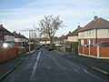
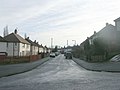
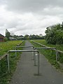
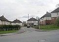
Ravenscliffe is a housing estate within the Eccleshill ward of the City of Bradford.
Subcategories
This category has the following 6 subcategories, out of 6 total.
F
L
- Langdale Road, Bradford (3 F)
N
- Norbury Road, Bradford (4 F)
R
- Ravenscliffe Avenue, Bradford (16 F)
- Ravenscliffe Wood (10 F)
T
- Thackeray Road, Bradford (5 F)
Media in category "Ravenscliffe, Bradford"
The following 44 files are in this category, out of 44 total.
-

-
 Benbow Avenue - Delius Avenue - geograph.org.uk - 2379786.jpg 640 × 480; 93 KB
-
 Bowness Avenue - Damon Avenue - geograph.org.uk - 2193673.jpg 640 × 480; 62 KB
-
 Bowness Avenue - Ravenscliffe Avenue - geograph.org.uk - 2193669.jpg 640 × 526; 99 KB
-
 Bowness Avenue - Ravenscliffe Avenue - geograph.org.uk - 2325481.jpg 640 × 480; 61 KB
-
 Bridleway through Ravenscliffe Wood, Calverley - geograph.org.uk - 2268785.jpg 2,000 × 1,500; 1.37 MB
-
 Building Site - off Winslow Road - geograph.org.uk - 2325569.jpg 640 × 457; 48 KB
-
 Damon Avenue - Ravenscliffe Avenue - geograph.org.uk - 2193792.jpg 640 × 480; 64 KB
-
 Damon Avenue - Ravenscliffe Avenue - geograph.org.uk - 2193794.jpg 640 × 480; 64 KB
-

-
 Delius Avenue - Ravenscliffe Avenue - geograph.org.uk - 2193665.jpg 640 × 480; 86 KB
-
 Delius Avenue - Roundwood Avenue - geograph.org.uk - 2379783.jpg 640 × 480; 64 KB
-

-
 Falkland Road - Thackeray Road - geograph.org.uk - 2193760.jpg 640 × 480; 48 KB
-

-

-
 Field and woodland near Low Rein - geograph.org.uk - 2268766.jpg 2,000 × 1,500; 1.13 MB
-

-
 Footpath - at end of Ravenscliffe Avenue - geograph.org.uk - 2325778.jpg 480 × 640; 104 KB
-
 Footpath - Harden Grove - geograph.org.uk - 2325597.jpg 480 × 640; 83 KB
-
 Footpath - Martindale Close - geograph.org.uk - 2194177.jpg 480 × 640; 83 KB
-
 Footpath - Ranelagh Avenue - geograph.org.uk - 2378666.jpg 640 × 480; 55 KB
-
 Footpath - Roundwood Avenue - geograph.org.uk - 2379776.jpg 480 × 640; 54 KB
-
 Footpath - Roundwood Avenue - geograph.org.uk - 2379780.jpg 480 × 640; 62 KB
-
 Footpath - Wharncliffe Drive - geograph.org.uk - 2194171.jpg 480 × 640; 71 KB
-

-

-
 Hallwood Green - Roundwood Avenue - geograph.org.uk - 2379775.jpg 640 × 484; 45 KB
-
 Harden Grove - Falkland Road - geograph.org.uk - 2325594.jpg 640 × 480; 58 KB
-

-
 Hawley Terrace - Damon Avenue - geograph.org.uk - 2325486.jpg 640 × 464; 46 KB
-
 Lambourne Avenue - Delius Avenue - geograph.org.uk - 2379784.jpg 640 × 480; 79 KB
-
 Martindale Close - Wharncliffe Drive - geograph.org.uk - 2194176.jpg 640 × 480; 53 KB
-
 Melton Terrace - Damon Avenue - geograph.org.uk - 2325491.jpg 640 × 480; 82 KB
-
 Oakdale Close - Oakdale Drive - geograph.org.uk - 2325784.jpg 640 × 480; 58 KB
-

-
 Oakdale Drive - Ravenscliffe Avenue - geograph.org.uk - 2325764.jpg 640 × 480; 57 KB
-

-
 Stepping stones across Fagley Beck - geograph.org.uk - 2268792.jpg 2,000 × 1,500; 1.25 MB
-

-
 Winslow Road - Ravenscliffe Avenue - geograph.org.uk - 2325576.jpg 640 × 470; 58 KB
-

-

-
 Woodhall Quarries, Fagley, Bradford - geograph.org.uk - 651717.jpg 640 × 531; 90 KB


_-_end_of_Ravenscliffe_Avenue_-_geograph.org.uk_-_2325774.jpg)


