Category:Rechthuis (Goudriaan)
| Object location | | View all coordinates using: OpenStreetMap |
|---|
farmhouse in Molenwaard, Netherlands  | |||||
| Upload media | |||||
| Instance of | |||||
|---|---|---|---|---|---|
| Location | Goudriaan, Molenlanden, South Holland, Netherlands | ||||
| Street address |
| ||||
| Located on street |
| ||||
| Heritage designation |
| ||||
 | |||||
No 12
|
This is a category about rijksmonument number 17035
|
No 13
|
This is a category about rijksmonument number 17036
|
No 14
|
This is a category about rijksmonument number 17037
|
| Address |
|
Media in category "Rechthuis (Goudriaan)"
The following 6 files are in this category, out of 6 total.
-
 Aanzicht - Goudriaan - 20083267 - RCE.jpg 1,200 × 810; 209 KB
-
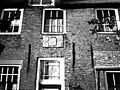 Detail voorgevel kleur - Goudriaan - 20503025 - RCE.jpg 1,200 × 900; 269 KB
-
 Goudriaan - Noordzijde 11 Boerderij.JPG 3,888 × 2,592; 6.73 MB
-
 Goudriaan - Noordzijde 12 - Boerderij - wapensteen.JPG 2,993 × 1,999; 4.54 MB
-
 Voor- en zijgevel kleur - Goudriaan - 20503024 - RCE.jpg 1,200 × 900; 225 KB
-
 Voorgevel en rechter zijgevel - Goudriaan - 20369663 - RCE.jpg 1,200 × 956; 221 KB


