Category:Regions locator maps of Thailand
The six-region system is commonly used for geographical and scientific purposes. This system was formalised in 1977 by the National Geographical Committee.
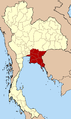
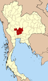
The four-region system is also commonly used: - North, Northeast, Central and South. Several definitions of subdivisions of the Central region exist, like western, eastern, Bangkok metropolis and subcentral.
Media in category "Regions locator maps of Thailand"
The following 20 files are in this category, out of 20 total.
-
 Central Thailand six regions.png 892 × 1,500; 58 KB
-
 Northern Thailand locator map.svg 1,052 × 1,849; 1.52 MB
-
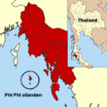 Phi Phi eilanden.png 405 × 405; 29 KB
-
 Thailand Bangkok and vicinity.png 892 × 1,500; 57 KB
-
 Thailand Bangkok and vicinity.svg 1,051 × 1,849; 1 MB
-
 Thailand Center eco.png 892 × 1,500; 58 KB
-
 Thailand Central 2.png 178 × 300; 54 KB
-
 Thailand Central alternative.png 178 × 300; 14 KB
-
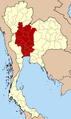
 Thailand Central.png 892 × 1,500; 58 KB
-
 Thailand East eco.png 892 × 1,500; 58 KB
-
 Thailand East.png 892 × 1,500; 58 KB
-
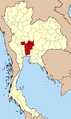
 Thailand Isan.png 892 × 1,500; 58 KB
-
 Thailand North six regions.png 892 × 1,500; 57 KB
-
 Thailand North.png 892 × 1,500; 58 KB
-
 Thailand Pattani region.png 178 × 300; 15 KB
-
 Thailand South.png 892 × 1,500; 57 KB
-
 Thailand Sub-central.png 892 × 1,500; 58 KB
-
 Thailand West alternative.png 892 × 1,500; 58 KB
-
 Thailand West.png 892 × 1,500; 58 KB
-
 Thailand Western Region.png 178 × 300; 14 KB


