Category:Relief maps of subdivisions of Georgia
Media in category "Relief maps of subdivisions of Georgia"
The following 27 files are in this category, out of 27 total.
-
 Eredvi Municipality relief map.svg 511 × 640; 826 KB
-
 Georgia Abkhazia relief location map.svg 647 × 545; 7.64 MB
-
 Georgia Adjara location relief map.svg 512 × 321; 8.81 MB
-
 Georgia Guria relief location map.svg 512 × 290; 6.37 MB
-
 Georgia Imereti relief location map.svg 3,650 × 2,429; 9.6 MB
-
 Georgia Kakheti relief location map.svg 569 × 669; 4.86 MB
-
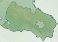
 Georgia Kvemo Kartli relief location map.svg 753 × 444; 8.96 MB
-
 Georgia Mtskheta-Mtianeti relief location map.svg 575 × 747; 9.62 MB
-
 Georgia Racha-Lechkhumi and Kvemo Svaneti relief location map.svg 757 × 407; 2.11 MB
-
 Georgia Samegrelo-Zemo Svaneti relief location map.svg 562 × 564; 8.96 MB
-
 Georgia Tbilisi relief location map.svg 750 × 556; 889 KB
-
 Gori Municipality relief location map.svg 571 × 693; 998 KB
-
 Provisional Administrative-Territorial Unit of South Ossetia relief map.svg 1,087 × 1,013; 3.37 MB
-
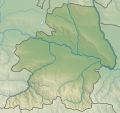
 Relief map of Akhalgori municipality.svg 319 × 512; 1.12 MB
-
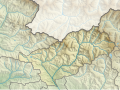
 Relief map of Akhmeta Municipality.svg 1,220 × 1,405; 6.49 MB
-
 Relief map of Dedoplistsqaro Municipality.svg 1,551 × 1,122; 2.66 MB
-
 Relief map of Dusheti Municipality.svg 1,000 × 1,245; 1.65 MB
-
 Relief map of Gali Municipality.svg 719 × 920; 1.17 MB
-
 Relief map of Java district.svg 508 × 379; 909 KB
-
 Relief map of Kareli Municipality.svg 1,000 × 1,239; 4.61 MB
-
 Relief map of Kaspi Municipality.svg 1,783 × 1,679; 2.71 MB
-
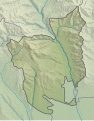 Relief map of Kurta municipality.svg 400 × 512; 1.11 MB
-
 Relief map of Mtskheta Municipality.svg 800 × 558; 2.58 MB
-
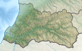
 Relief Map of Samtskhe-Javakheti.svg 906 × 748; 7.39 MB
-
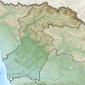
 Relief Map of Shida Kartli.svg 783 × 734; 8.21 MB
-
 Relief map of Signagi Municipality.svg 1,358 × 972; 2.31 MB
-
 Relief map of Tigva municipality.svg 524 × 512; 1.19 MB


