Category:Remote views of Ben Macdui
Media in category "Remote views of Ben Macdui"
The following 47 files are in this category, out of 47 total.
-
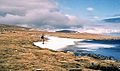
 A frozen Loch Etchachan - geograph.org.uk - 1717586.jpg 800 × 532; 103 KB
-

-
 Approaching Ben Macdui - geograph.org.uk - 281485.jpg 640 × 480; 106 KB
-
 Beinn a ghlo 012.jpg 1,496 × 1,122; 329 KB
-
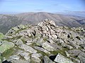
 Beinn a' Chaorainn summit cairn - geograph.org.uk - 207326.jpg 640 × 436; 73 KB
-
 Ben Macdui - Flickr - Graham Grinner Lewis.jpg 3,648 × 2,736; 2.6 MB
-
 Ben Macdui from Cairn Gorm - geograph.org.uk - 38380.jpg 640 × 442; 75 KB
-
 Ben Macdui from Derry Cairngorm.jpg 1,290 × 917; 81 KB
-

-
 Ben-macdui-from-carn-liath.jpg 800 × 566; 83 KB
-
 Braeriach , Munro No 3 - geograph.org.uk - 24084.jpg 640 × 480; 206 KB
-
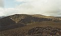
 Cairn Gorm Plateau (geograph 4020899).jpg 640 × 480; 77 KB
-
 Cairn Toul and Ben Macdui.jpg 1,600 × 1,200; 273 KB
-
 Carn a' Mhaim , Munro No 95 - geograph.org.uk - 72944.jpg 640 × 480; 220 KB
-
 Carn a' Mhaim - North Ridge - geograph.org.uk - 567201.jpg 480 × 640; 68 KB
-
 Craig Derry - geograph.org.uk - 207348.jpg 640 × 416; 57 KB
-
 Creag Mhor plateau. - geograph.org.uk - 91076.jpg 640 × 404; 58 KB
-
 Derry Cairngorm , Munro No 20 - geograph.org.uk - 69858.jpg 640 × 480; 204 KB
-

-
 Glen Geusachan - geograph.org.uk - 683688.jpg 640 × 422; 61 KB
-
 Late crop - geograph.org.uk - 236898.jpg 640 × 556; 106 KB
-
 Looking across the Lairig Ghru (geograph 4587204).jpg 4,608 × 3,456; 4.99 MB
-
 Looking SW from Beinn a Chaorainn.jpg 2,022 × 1,410; 269 KB
-
 Looking up Glen Luibeg - geograph.org.uk - 778395.jpg 1,024 × 688; 843 KB
-
-
 On Sgor Mor above Glen Luibeg - geograph.org.uk - 1580081.jpg 640 × 428; 140 KB
-
 On the way to Ben Macdui - geograph.org.uk - 833185.jpg 554 × 327; 78 KB
-
 Path above the Larig Ghru. - geograph.org.uk - 50999.jpg 640 × 480; 64 KB
-
 Path from the Lairig Ghru to Braeriach - geograph.org.uk - 24384.jpg 640 × 480; 221 KB
-
 Path into the Lairig Ghru - geograph.org.uk - 778414.jpg 1,024 × 688; 948 KB
-
 Path to Ben MacDhui - geograph.org.uk - 263766.jpg 640 × 480; 116 KB
-

-
 Sgor an Lochain Uaine , Munro No 5 - geograph.org.uk - 239548.jpg 640 × 480; 140 KB
-
 Sron Riach Path - geograph.org.uk - 230939.jpg 640 × 480; 49 KB
-
 Summit of Beinn a' Chaorainn Bheag - geograph.org.uk - 207319.jpg 640 × 443; 66 KB
-
 The Cairngorms from An Socach - geograph.org.uk - 495476.jpg 800 × 600; 174 KB
-
 The descent to Carrbridge, near Ess - geograph.org.uk - 157384.jpg 640 × 480; 54 KB
-
 The Devil's Point , Munro No 130 - geograph.org.uk - 239563.jpg 640 × 480; 152 KB
-
 The summit ridge of Derry Cairngorm - geograph.org.uk - 777224.jpg 640 × 381; 55 KB
-
 To the south west of Beinn a'Chaorainn - geograph.org.uk - 232045.jpg 640 × 480; 147 KB
-
-
 View north west from the summit of Beinn Bhreac - geograph.org.uk - 760977.jpg 1,000 × 663; 1.19 MB
-
 View southwest from Bynack More - geograph.org.uk - 662652.jpg 640 × 424; 58 KB
-

-
 Western side of Beinn Mheadhoin - geograph.org.uk - 202575.jpg 640 × 480; 70 KB
-
 Western slopes of Beinn Mheadhoin - geograph.org.uk - 886032.jpg 640 × 480; 97 KB
-
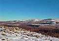
 Winter view - geograph.org.uk - 101533.jpg 640 × 480; 95 KB


.jpg)


,_RP-F-2001-7-1092-40.jpg)


.jpg)


