Category:Remote views of Didcot Power Station
Media in category "Remote views of Didcot Power Station"
The following 82 files are in this category, out of 82 total.
-
 Access road to Didcot Power Station - geograph.org.uk - 2803344.jpg 3,648 × 2,736; 1.28 MB
-
 Across the fields to Didcot - geograph.org.uk - 1056004.jpg 640 × 426; 77 KB
-
 Arable field near Shippon - geograph.org.uk - 1299000.jpg 640 × 425; 66 KB
-
 Bend in Cycle Route 5 - geograph.org.uk - 2738725.jpg 1,024 × 683; 136 KB
-
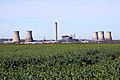
 Cloud Factory - geograph.org.uk - 698208.jpg 640 × 427; 34 KB
-
 Compton Downs - geograph.org.uk - 525933.jpg 640 × 480; 148 KB
-
 Cooling towers seen from Hobbyhorse Lane - geograph.org.uk - 4098000.jpg 1,024 × 768; 146 KB
-
 Culham and cooling - geograph.org.uk - 611008.jpg 640 × 418; 45 KB
-
 Cycleway across the road - geograph.org.uk - 2186217.jpg 1,024 × 683; 99 KB
-
 Didcot marsh - geograph.org.uk - 1736418.jpg 1,024 × 683; 118 KB
-
 Didcot Pkwy Plat3.jpg 1,600 × 1,200; 864 KB
-
-
 Didcot Power station - geograph.org.uk - 1041761.jpg 640 × 426; 34 KB
-
 Didcot Power Station - geograph.org.uk - 1216984.jpg 640 × 427; 39 KB
-
 Didcot Power Station - geograph.org.uk - 1410667.jpg 640 × 480; 77 KB
-
 Didcot Power Station - geograph.org.uk - 1481439.jpg 640 × 480; 79 KB
-
 Didcot Power Station - geograph.org.uk - 18099.jpg 640 × 480; 104 KB
-
 Didcot Power Station - geograph.org.uk - 2213362.jpg 2,560 × 1,920; 951 KB
-
 Didcot Power Station - geograph.org.uk - 420152.jpg 640 × 480; 143 KB
-
 Didcot Power Station - geograph.org.uk - 4424401.jpg 4,320 × 3,240; 4.8 MB
-
 Didcot Power Station - geograph.org.uk - 444129.jpg 640 × 480; 60 KB
-
 Didcot Power Station - geograph.org.uk - 503339.jpg 640 × 480; 126 KB
-
 Didcot Power Station - geograph.org.uk - 503368.jpg 640 × 480; 92 KB
-
 Didcot Power Station - geograph.org.uk - 503369.jpg 640 × 480; 74 KB
-
 Didcot Power Station - geograph.org.uk - 5095812.jpg 640 × 480; 72 KB
-
 Didcot Power Station - geograph.org.uk - 525634.jpg 640 × 480; 80 KB
-
 Didcot Power Station - geograph.org.uk - 631509.jpg 640 × 427; 85 KB
-
 Didcot Power Station - geograph.org.uk - 790233.jpg 640 × 480; 66 KB
-
 Didcot power station behind Cholsey Meadows - geograph.org.uk - 5129591.jpg 1,886 × 1,257; 2.02 MB
-
 Didcot Power Station from Boham's Road - geograph.org.uk - 3248554.jpg 1,500 × 984; 213 KB
-
 Didcot Power Station from Down Hill - geograph.org.uk - 2360586.jpg 1,500 × 1,000; 258 KB
-
 Didcot Power Station from the air - geograph.org.uk - 5102630.jpg 640 × 359; 120 KB
-
 Didcot Power Station from the Icknield Way - geograph.org.uk - 3703972.jpg 1,500 × 976; 190 KB
-

-

-
 Didcot Power Station from Upton - geograph.org.uk - 3248528.jpg 1,500 × 989; 182 KB
-
 Didcot Power Station from Woodway - geograph.org.uk - 3241110.jpg 1,500 × 930; 149 KB
-
 Didcot Power Station in the mist - geograph.org.uk - 752157.jpg 640 × 480; 31 KB
-

-

-
 Didcot Power Station, aerial 2017 - geograph.org.uk - 5437071.jpg 800 × 429; 72 KB
-

-
 Didcot Power.JPG 2,560 × 1,920; 2.35 MB
-
 Didcot South - geograph.org.uk - 4086715.jpg 1,024 × 690; 38 KB
-
 DidcotPower01.JPG 2,048 × 1,536; 1.23 MB
-
 Down they come - geograph.org.uk - 6241345.jpg 1,600 × 1,067; 227 KB
-
 Electricity pylon over the River Thames - geograph.org.uk - 4521774.jpg 999 × 1,500; 239 KB
-

-
 Farmland and railway, Steventon - geograph.org.uk - 290161.jpg 640 × 480; 156 KB
-
 Farmland near Hailey - geograph.org.uk - 627274.jpg 640 × 427; 87 KB
-
 Farmland, South Moreton - geograph.org.uk - 678553.jpg 640 × 480; 123 KB
-
 Farmland, Woodcote - geograph.org.uk - 503367.jpg 640 × 480; 134 KB
-
 Final Moments 2 - geograph.org.uk - 6241352.jpg 1,600 × 1,067; 220 KB
-
 Final Moments 3 - geograph.org.uk - 6241360.jpg 1,600 × 1,067; 232 KB
-
 Final Moments 4 - geograph.org.uk - 6241367.jpg 1,600 × 1,067; 217 KB
-
 GreatHaseley TowerMill topless.JPG 2,950 × 1,770; 2.24 MB
-
 Hedgerow alongside a field - geograph.org.uk - 1240594.jpg 640 × 427; 67 KB
-
-
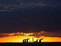
 Last sunrise - geograph.org.uk - 6241337.jpg 1,600 × 1,067; 220 KB
-
 Lines to the Power Station - geograph.org.uk - 2640456.jpg 533 × 800; 66 KB
-
 Looking down the Up Relief at Didcot - geograph.org.uk - 1657977.jpg 640 × 427; 58 KB
-
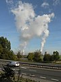
 Making clouds - geograph.org.uk - 1152537.jpg 640 × 426; 25 KB
-
 Man made weather at Didcot - geograph.org.uk - 2295643.jpg 3,025 × 1,993; 705 KB
-
 Milton , Road - geograph.org.uk - 4060807.jpg 4,288 × 2,848; 5.57 MB
-
 Nearly Gone - geograph.org.uk - 4086695.jpg 1,024 × 683; 41 KB
-
 Railway passing loops at Steventon - geograph.org.uk - 1257109.jpg 640 × 427; 79 KB
-
 Remains of the Power Station - geograph.org.uk - 4913532.jpg 1,600 × 1,200; 243 KB
-
 Road junction on Harwell Road - geograph.org.uk - 2204061.jpg 640 × 913; 67 KB
-
 Road to the power station - geograph.org.uk - 2640451.jpg 1,024 × 683; 143 KB
-
 Road to the power Station - geograph.org.uk - 2640457.jpg 1,024 × 683; 142 KB
-
 Station across the meadow - geograph.org.uk - 1056904.jpg 640 × 426; 49 KB
-
 Sun behind the Tower - geograph.org.uk - 4086602.jpg 1,024 × 698; 40 KB
-
 Sunset at the power station - geograph.org.uk - 4086702.jpg 1,024 × 573; 32 KB
-
 The A34, Harwell - geograph.org.uk - 2232392.jpg 640 × 480; 93 KB
-
 The A34, Harwell - geograph.org.uk - 444131.jpg 640 × 480; 91 KB
-
 The Setting Sun - geograph.org.uk - 4086705.jpg 1,024 × 683; 43 KB
-
 Through the Oxfordshire Countryside - geograph.org.uk - 493128.jpg 640 × 422; 77 KB
-
 Truck on the bridge - geograph-2606992-by-Bill-Nicholls.jpg 1,024 × 683; 127 KB
-

-
 Williams F1 at Grove.jpg 480 × 640; 101 KB
-
 Didcot Power Station from Oday Hill - geograph.org.uk - 32856.jpg 640 × 480; 72 KB
-
 Over the flooded fields - geograph.org.uk - 309163.jpg 640 × 480; 67 KB


_-_geograph.org.uk_-_5437107.jpg)


