Category:Remote views of Mount Shasta
Media in category "Remote views of Mount Shasta"
The following 77 files are in this category, out of 77 total.
-

-
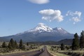
 Mount Shasta.jpg 1,024 × 310; 207 KB
-
 Mount Shasta 2 - Flickr - Joe Parks.jpg 2,948 × 1,960; 4.3 MB
-
 Mount Shasta from Mount Ashland - Flickr - Joe Parks.jpg 2,947 × 1,943; 4.16 MB
-
 Mount Shasta from Mount Shasta City.jpg 4,320 × 3,240; 5.18 MB
-
 Mt shasta from captain jacks stronghold, lava beds.JPG 4,000 × 3,000; 2.47 MB
-
 A field of sagebrush and mount Shasta.jpg 2,048 × 1,178; 116 KB
-
 California - Trinity Mountains - NARA - 23935401.jpg 4,350 × 3,382; 3.15 MB
-
 CastleCrags.jpg 500 × 333; 75 KB
-
 Crystal Matrix Gallery, Mount Shasta (2024)-L1005316.jpg 4,649 × 6,508; 24.59 MB
-

-

-

-

-
 I-5 near Shasta.jpg 450 × 301; 31 KB
-
 Shasta from Lassen.jpg 3,072 × 2,048; 1.03 MB
-
 Little Glass Mountain and Mt Shasta from Little Mount Hoffman-1200px.jpg 1,162 × 444; 67 KB
-
 Medlake aerial USGS.gif 543 × 353; 110 KB
-
 Mount Shasta (2024)-L1005289.jpg 6,865 × 4,290; 32.29 MB
-
 Mount Shasta 2.jpg 3,024 × 4,032; 4.42 MB
-
 Mount Shasta and Shastina north side.jpg 2,168 × 1,053; 436 KB
-
 Mount Shasta at Sunset.JPG 3,264 × 2,448; 1.5 MB
-
 Mount Shasta CA (31053245121).jpg 1,200 × 800; 416 KB
-
 Mount Shasta from Castle Crag State Park, 1900-1930 (CHS-2343).jpg 5,361 × 4,211; 1.78 MB
-
 Mount Shasta from Mount Shasta Vista Point (2010-03-24)*.tiff 4,770 × 3,177; 86.71 MB
-
 Mount Shasta from Mount Shasta Vista Point (2010-03-24).jpg 4,752 × 3,168; 17.35 MB
-
 Mount Shasta from Trinity Alps.jpg 2,933 × 2,200; 3.88 MB
-
 Mount Shasta High School.jpg 3,007 × 1,230; 847 KB
-

-

-
-

-

-

-
 Mount Shasta Pit Stop (2024)-L1005146.jpg 9,229 × 6,129; 44.62 MB
-

-
-
 Mount Shasta, at 14,162 feet the highest peak in the California Cascades LCCN2011633490.tif 5,580 × 6,793; 216.92 MB
-
 Mount Shasta, California LCCN2011630040.tif 6,083 × 4,851; 84.45 MB
-
 Mount Shasta, California LCCN2011631108.tif 6,083 × 4,851; 84.45 MB
-

-

-

-

-
-

-

-
-

-

-
-
-

-
 Mountains from Roxy Ann Peak.jpg 4,320 × 3,240; 4.42 MB
-
 Mt Shasta In the Distance With Snow On It.jpg 2,560 × 1,536; 1.2 MB
-
 Nursery Work- Seed Beds - California - DPLA - 3a5afdbc234b077185cfb49bf69f02ca.jpg 4,788 × 3,912; 2.59 MB
-
 PSM V51 D361 California alps with mount shasta in the distance.png 2,666 × 1,732; 2.25 MB
-
 Results of a biological survey of mount Shasta, California (1899) (14597639939).jpg 3,264 × 2,116; 758 KB
-
 Results of a biological survey of mount Shasta, California (1899) (14597797407).jpg 3,309 × 2,064; 751 KB
-

-
 Shasta Valley from Pilot Rock.JPG 4,320 × 3,240; 5.07 MB
-
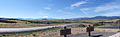 Shasta Valley Panorama.jpg 3,969 × 1,240; 1.82 MB
-
 ShastaCascades.JPG 800 × 657; 372 KB
-

-
 The Ladies' home journal (1948) (14745446096).jpg 2,042 × 2,234; 1,015 KB
-
 Town of Sisson at the foot of Mount Shasta in winter, ca.1900 (CHS-1928).jpg 5,667 × 4,319; 2.11 MB
-
 Train near Algoma, Oregon.jpg 1,200 × 918; 338 KB
-
 Tule Lake Basin.jpg 3,600 × 2,400; 3.4 MB
-
 Tule Lake Lower Marsh.jpg 3,872 × 2,592; 6.89 MB
-
 USA Mt Shasta pano CA alt.jpg 3,971 × 1,500; 1.55 MB
-
 USA Mt Shasta pano CA.jpg 5,540 × 2,066; 4.28 MB
-
 ViewOfMtShastaFromRedding.JPG 3,456 × 2,592; 3.27 MB
-
 MtShastBrewing.jpg 1,004 × 457; 65 KB
-
 Weed High School billboard.jpg 1,024 × 768; 611 KB
-
 Weed Hotel and Mount Shasta postcard.jpg 1,600 × 1,012; 261 KB
-
 Hat Creek Valley.jpg 10,775 × 2,800; 5.47 MB
-
 July 4 fair at Mount Shasta, California.JPG 4,000 × 3,000; 2.67 MB
.jpg)


-L1005316.jpg)


-L1005289.jpg)


.jpg)
.jpg)
.jpg)

-L1005146.jpg)
.jpeg)
.jpeg)


_(14597639939).jpg)
_(14597797407).jpg)


_(14745446096).jpg)
.jpg)


