Category:Rhein-Neckar-Kreis
Urban districts (cities): Baden-Baden · Freiburg · Heidelberg · Heilbronn · Karlsruhe · Mannheim · Pforzheim · Stuttgart · Ulm
district of Baden-Württemberg, Germany   .svg) | |||||
| Upload media | |||||
| Instance of | |||||
|---|---|---|---|---|---|
| Location | Karlsruhe Government Region, Baden-Württemberg, Germany | ||||
| Capital | |||||
| Head of government |
| ||||
| Population |
| ||||
| Elevation above sea level |
| ||||
| official website | |||||
 | |||||
Subcategories
This category has the following 29 subcategories, out of 29 total.
Pages in category "Rhein-Neckar-Kreis"
This category contains only the following page.
Media in category "Rhein-Neckar-Kreis"
The following 15 files are in this category, out of 15 total.
-
 Alte Bruchsaler Straße.jpg 4,032 × 3,024; 5.15 MB
-
 Brückensperrung Rhein-Neckar-Kreis 2011.JPG 3,648 × 2,736; 1.44 MB
-
 Historische Steinbrücke über den Leimbach.jpg 2,041 × 1,221; 945 KB
-
 Kraichbach bei Reilingen.jpg 4,000 × 3,000; 2.82 MB
-
 Landstrasse 532.JPG 3,008 × 2,000; 2.84 MB
-
 Leimbach in Nussloch.jpg 5,080 × 3,378; 9.36 MB
-
 Leimerklinge Amerikanerweg.jpg 4,943 × 3,282; 7.33 MB
-
 Locator map HD in Baden-Württemberg.svg 1,058 × 1,161; 278 KB
-
 Locator map HD in Germany.svg 1,075 × 1,273; 578 KB
-

-
-

-
 SOS Notrufsäule Björn-Steiger-Stiftung.JPG 2,736 × 3,648; 4.23 MB
-
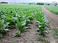 Tabakfeld Sandhausen.jpg 2,048 × 1,536; 1.08 MB
-
 Weg im Herbst - panoramio.jpg 1,936 × 2,592; 2.77 MB


.jpg)
.jpg)
.jpg)


