Category:Ridgeland, South Carolina
town in South Carolina, United States   | |||||
| Upload media | |||||
| Instance of | |||||
|---|---|---|---|---|---|
| Location | Jasper County, South Carolina | ||||
| Population |
| ||||
| Area |
| ||||
| Elevation above sea level |
| ||||
 | |||||
Subcategories
This category has the following 2 subcategories, out of 2 total.
Media in category "Ridgeland, South Carolina"
The following 36 files are in this category, out of 36 total.
-
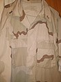
 4843, DEPT OF DEFENSE, USMC.jpg 720 × 960; 102 KB
-
 Church of the Holy Trinity Jasper County.jpg 2,923 × 3,369; 6.17 MB
-
 Clock in Ridgeland, SC, US.jpg 3,303 × 4,000; 10.7 MB
-
 DOD, cadet first lieutenant, usmc.jpg 3,120 × 4,160; 2.52 MB
-
 Feed Store on SC 336; Ridgeland, SC-1.jpg 5,152 × 3,864; 7.52 MB
-
 Feed Store on SC 336; Ridgeland, SC-2.jpg 5,152 × 3,864; 7.48 MB
-
 Forest Motel; Ridgeland, SC.jpg 5,152 × 3,864; 7.55 MB
-
 Honey Hill historical marker SC Hwy 336.JPG 2,560 × 1,920; 2.22 MB
-
 Int95nRoadSC-Exit21-SC336sign (31350864652).jpg 2,400 × 1,600; 1.72 MB
-
 Int95nRoadSC-MM20-LloydFigNewtonSign (31459694826).jpg 2,400 × 1,600; 1.86 MB
-
 Jasper County Farmer's Produce Market.jpg 5,152 × 3,864; 7.59 MB
-
 Jasper County SC Farmer's Market (Better Shot).jpg 3,648 × 2,736; 2.07 MB
-
 N End US 17-278 Overlap; Ridgeland, SC.jpg 5,152 × 3,864; 7.63 MB
-
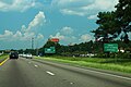
 NB I-95 Billboards in Ridgeland, SC.jpg 5,152 × 3,864; 4.12 MB
-
 NB US 17 before Old US 17 and I-95, SC.jpg 5,152 × 3,864; 7.54 MB
-
 NB US 17 to NB I-95; Ridgeland, SC.jpg 5,152 × 3,864; 7.42 MB
-
 Old House Plantation (cropped).jpg 2,432 × 1,824; 4.05 MB
-
 Old House Plantation.jpg 2,481 × 2,874; 6.39 MB
-
 Old US 17 Begins; Ridgeland, SC.jpg 5,152 × 3,864; 7.53 MB
-
 Palms Motel & Restaurant; Ridgeland, SC.jpg 5,152 × 3,864; 7.68 MB
-
 Ridgeland, SC Street Clock.jpg 5,152 × 3,864; 7.54 MB
-
 SAR.ORG.gif 360 × 216; 8 KB
-
 SB I-95 (SC) Exit 22 @ Old US 17-1.jpg 5,152 × 3,864; 7.68 MB
-
 SB I-95 (SC) Exit 22 @ Old US 17-2.jpg 5,152 × 3,864; 7.74 MB
-
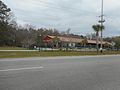
 Sinclairservicesc.jpg 4,032 × 3,024; 2.72 MB
-
 South Carolina I95nb Captain Bill Rd Overpass.jpg 5,184 × 3,456; 4.38 MB
-
 South Carolina I95nb Exit 21 mile.jpg 5,184 × 3,456; 4.38 MB
-
 South Carolina I95nb Exit 22 1 mile.jpg 5,184 × 3,456; 4.51 MB
-
 South Carolina I95nb Exit 22.jpg 5,184 × 3,456; 4.56 MB
-
 South Carolina I95nb State Rd 27-29 Overpass.jpg 5,184 × 3,456; 4.66 MB
-
 Tall Sunoco Sign on Old US 17; NB.jpg 5,152 × 3,864; 7.66 MB
-
 Tall Sunoco Sign on Old US 17; SB.jpg 5,152 × 3,864; 7.71 MB
-

-
 US MARINE CORPS RIBBONS.png 630 × 420; 309 KB
-
 Walkway near Jasper's Porch - panoramio.jpg 2,048 × 1,536; 822 KB
-
 White Hall Plantation Ruins.jpg 982 × 1,140; 1,015 KB


.jpg)
.jpg)

.jpg)


.jpg)


_Exit_22_@_Old_US_17-1.jpg)
_Exit_22_@_Old_US_17-2.jpg)


