Category:Rise, East Riding of Yorkshire
English: Rise is a village and civil parish in the East Riding of Yorkshire, England, in an area known as Holderness. It is situated approximately 7 miles (11 km) east of the town of Beverley and 5 miles (8.0 km) south west of Hornsea it lies to the east of the B1243 road.
village and civil parish in Holderness, the East Riding of Yorkshire, England  | |||||
| Upload media | |||||
| Instance of | |||||
|---|---|---|---|---|---|
| Location | East Riding of Yorkshire, Yorkshire and the Humber, England | ||||
 | |||||
Subcategories
This category has the following 2 subcategories, out of 2 total.
A
- All Saints Church, Rise (6 F)
R
Media in category "Rise, East Riding of Yorkshire"
The following 134 files are in this category, out of 134 total.
-
 1-4 Rise Road, New Rise - geograph.org.uk - 905032.jpg 640 × 428; 98 KB
-

-

-
 A bridleway to Folly Lane - geograph.org.uk - 2565951.jpg 800 × 600; 261 KB
-

-
 All Saints church, Rise - geograph.org.uk - 4870437.jpg 640 × 450; 406 KB
-
 All Saints Church, Rise - geograph.org.uk - 5629390.jpg 1,600 × 1,064; 401 KB
-
 All Saints Church, Rise - geograph.org.uk - 5629391.jpg 1,600 × 1,064; 418 KB
-
 All Saints Church, Rise - geograph.org.uk - 5629393.jpg 1,064 × 1,600; 499 KB
-
 All Saints Church, Rise - geograph.org.uk - 5629394.jpg 1,111 × 1,600; 782 KB
-
 All Saints Church, Rise - geograph.org.uk - 5629398.jpg 1,111 × 1,600; 727 KB
-
 All Saints Church, Rise - geograph.org.uk - 5629400.jpg 1,125 × 1,600; 762 KB
-
 All Saints Church, Rise - geograph.org.uk - 5629403.jpg 1,208 × 1,600; 676 KB
-
 All Saints Church, Rise - geograph.org.uk - 5629408.jpg 1,600 × 1,064; 814 KB
-
 Approaching Wood End Farm - geograph.org.uk - 4968935.jpg 4,564 × 3,398; 5.86 MB
-
 Autumn sown crop - geograph.org.uk - 5603090.jpg 1,024 × 768; 127 KB
-
 B1243 from Sigglesthorne - geograph.org.uk - 20117.jpg 640 × 480; 74 KB
-
 B1243 towards Sigglesthorne - geograph.org.uk - 1463905.jpg 640 × 480; 87 KB
-
 B1243 towards Skirlaugh - geograph.org.uk - 1463923.jpg 640 × 480; 59 KB
-
 B1243 towards Skirlaugh - geograph.org.uk - 1467841.jpg 640 × 480; 82 KB
-
 Blackhall Hill, Rise - geograph.org.uk - 4869259.jpg 480 × 640; 458 KB
-
 Blackthorn Hedge on Cony Hill (geograph 6109625).jpg 1,600 × 1,102; 667 KB
-
 Blue post - geograph.org.uk - 5603089.jpg 1,024 × 768; 312 KB
-
 Bridleway East of Rise - geograph.org.uk - 1467746.jpg 640 × 480; 77 KB
-
 Bridleway near Rise - geograph.org.uk - 1467734.jpg 640 × 480; 74 KB
-
 Bridleway towards Sigglesthorne - geograph.org.uk - 1467601.jpg 640 × 480; 105 KB
-
 Britishmuseumbitriseyorkshire.jpg 3,507 × 1,458; 4.03 MB
-
 Cony Hill, Rise - geograph.org.uk - 561334.jpg 640 × 448; 48 KB
-
 Cony Hill, Rise - geograph.org.uk - 561340.jpg 640 × 478; 101 KB
-
 Cottage on Rise Road - geograph.org.uk - 3973722.jpg 3,264 × 2,448; 1.95 MB
-
 Cottages at New Rise (2019) - geograph.org.uk - 6277394.jpg 1,600 × 1,209; 1.96 MB
-
 Cottages at New Rise - geograph.org.uk - 4869098.jpg 640 × 480; 362 KB
-
 Cottages at Rise - geograph.org.uk - 4869265.jpg 640 × 480; 425 KB
-
 Crop field near Park Farm (geograph 6362563).jpg 800 × 600; 145 KB
-
 Crossroads near Rise - geograph.org.uk - 4869253.jpg 640 × 480; 357 KB
-
 Dawson's Belt - geograph.org.uk - 5472095.jpg 1,024 × 768; 210 KB
-
 East of Rise - geograph.org.uk - 117947.jpg 640 × 480; 150 KB
-
 Eastfield Farm, Rise - geograph.org.uk - 907143.jpg 640 × 472; 122 KB
-
 Entrance to Wood End Farm (geograph 6355148).jpg 1,024 × 768; 158 KB
-
 Farm access on Cony Hill (geograph 5472100).jpg 1,024 × 768; 175 KB
-
 Farm road to Wood End Farm - geograph.org.uk - 3848296.jpg 4,000 × 3,000; 2.68 MB
-
 Farm road to Woodend Farm (geograph 3848302).jpg 4,000 × 3,000; 3.23 MB
-
 Farm Track near Rise - geograph.org.uk - 127001.jpg 640 × 482; 58 KB
-
 Farm track off Rise Lane - geograph.org.uk - 5399002.jpg 1,024 × 768; 146 KB
-
 Farmland at Rise - geograph.org.uk - 117942.jpg 640 × 480; 172 KB
-
 Farmland Bridleway - geograph.org.uk - 127003.jpg 640 × 480; 118 KB
-
 Farmland East of Rise - geograph.org.uk - 1467752.jpg 640 × 480; 70 KB
-
 Farmland near Little Hatfield 1.jpg 640 × 480; 91 KB
-
 Farmland near Long Riston - geograph.org.uk - 37787.jpg 640 × 480; 119 KB
-
 Farmland near Rise - geograph.org.uk - 1467728.jpg 640 × 480; 69 KB
-
 Farmland, Wood End Farm - geograph.org.uk - 1467767.jpg 640 × 480; 89 KB
-
 Farnton Hill - geograph.org.uk - 905041.jpg 498 × 640; 108 KB
-
 Fence and bridleway, Rise - geograph.org.uk - 4869305.jpg 480 × 640; 521 KB
-
 Field edge bridleway toward Rise - geograph.org.uk - 3973644.jpg 3,264 × 2,448; 1.77 MB
-
 Field edge track toward Rise Wood - geograph.org.uk - 3848286.jpg 4,000 × 3,000; 2.48 MB
-
 Field looking towards Park Farm (geograph 6355128).jpg 1,024 × 768; 257 KB
-
 Fields at Park Farm - geograph.org.uk - 6109615.jpg 1,600 × 1,156; 544 KB
-
 Folly Lane towards, Sigglesthorne (geograph 2746303).jpg 800 × 600; 94 KB
-
 Folly Lane towards, Sigglesthorne - geograph.org.uk - 2746307.jpg 800 × 600; 93 KB
-
 Folly Lane, near Rise - geograph.org.uk - 4869311.jpg 640 × 480; 422 KB
-
 Footpath to New Rise - geograph.org.uk - 5399423.jpg 1,024 × 768; 202 KB
-
 Fosse - geograph.org.uk - 907140.jpg 478 × 640; 114 KB
-
 Gallops toward Long Riston - geograph.org.uk - 3973741.jpg 3,264 × 2,448; 1.84 MB
-
 Heading north towards Rise - geograph.org.uk - 2198529.jpg 800 × 600; 218 KB
-
 Hedgerow near Rise (geograph 4869395).jpg 640 × 480; 392 KB
-
 Huddle Cross - geograph.org.uk - 907840.jpg 640 × 466; 100 KB
-
 Lambwath Bridge, near New Ellerby (geograph 4869560).jpg 640 × 480; 412 KB
-
 Lambwath Lane - geograph.org.uk - 1467591.jpg 640 × 480; 74 KB
-
 Lambwath Lane towards New Ellerby (geograph 2230579).jpg 800 × 600; 209 KB
-
 Lambwath Lane, near Rise (geograph 4869404).jpg 640 × 480; 593 KB
-
 Land East of Rise - geograph.org.uk - 117950.jpg 640 × 480; 166 KB
-
 Lane to Rise (geograph 3848314).jpg 4,000 × 3,000; 2.55 MB
-
 Lane to Sigglesthorne - geograph.org.uk - 3351699.jpg 4,000 × 3,000; 2.84 MB
-
 Lane to Whitedale (geograph 3848316).jpg 4,000 × 3,000; 1.87 MB
-
 Looking West down Eastfield Lane - geograph.org.uk - 2099078.jpg 800 × 600; 250 KB
-
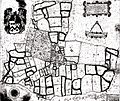 Map of Rise Estate.jpg 868 × 734; 337 KB
-
 Mill Farm, Rise - geograph.org.uk - 907855.jpg 640 × 452; 62 KB
-
 Mill House Farm - geograph.org.uk - 37841.jpg 640 × 480; 82 KB
-
 Mill Lane - geograph.org.uk - 1463931.jpg 640 × 480; 58 KB
-
 Mill Lane, near Rise - geograph.org.uk - 4869083.jpg 640 × 480; 487 KB
-
 Minor Road Towards Rise - geograph.org.uk - 1467787.jpg 640 × 480; 99 KB
-
 Minor Road Towards Sigglesthorne.jpg 640 × 480; 64 KB
-
 Minor Road, Rise - geograph.org.uk - 1467822.jpg 640 × 480; 103 KB
-
 Near Rise Park - geograph.org.uk - 66679.jpg 640 × 480; 103 KB
-
 New Rise and field of peas - geograph.org.uk - 5399415.jpg 1,024 × 768; 171 KB
-
 North Farm, Rise - geograph.org.uk - 907134.jpg 640 × 475; 75 KB
-
 Oak Cottage Plantation replanted (geograph 6355140).jpg 1,024 × 768; 130 KB
-
 Oak Cottages, Rise - geograph.org.uk - 561326.jpg 444 × 640; 70 KB
-
 Oak Cottages, Rise - geograph.org.uk - 561328.jpg 640 × 455; 90 KB
-
 Over field to Dawson's Belt - geograph.org.uk - 3848292.jpg 4,000 × 3,000; 3.4 MB
-
 Park Farm (geograph 6362562).jpg 640 × 480; 103 KB
-
 Park Farm, Rise - geograph.org.uk - 1467782.jpg 640 × 480; 82 KB
-
 Rise Grange - geograph.org.uk - 1467864.jpg 640 × 480; 68 KB
-
 Rise Lane - geograph.org.uk - 1467849.jpg 640 × 480; 89 KB
-
 Rise Lane towards Long Riston - geograph.org.uk - 2198532.jpg 800 × 600; 180 KB
-
 Rise looking south down the street - geograph.org.uk - 3973672.jpg 3,264 × 2,448; 1.65 MB
-
 Rise on a wet day - geograph.org.uk - 3973656.jpg 3,264 × 2,448; 1.55 MB
-
 Rise Park - geograph.org.uk - 66671.jpg 640 × 480; 163 KB
-
 Rise Park - geograph.org.uk - 907089.jpg 640 × 459; 88 KB
-
 Rise Road at New Rise - geograph.org.uk - 4869257.jpg 640 × 480; 379 KB
-
 Rise Road, north of the village of Rise - geograph.org.uk - 5945213.jpg 1,024 × 727; 519 KB
-
 Rise Wood - geograph.org.uk - 1129412.jpg 640 × 457; 214 KB
-
 Rise, East Riding of Yorkshire UK parish locator map.svg 1,425 × 1,107; 1.68 MB
-
 Rise, East Riding of Yorkshire.jpg 640 × 480; 95 KB
-
 Rise, East Yorkshire - geograph.org.uk - 2565943.jpg 800 × 600; 227 KB
-
 Road South to New Ellerby - geograph.org.uk - 69383.jpg 640 × 480; 86 KB
-
 Rose Cottage on Rise Road - geograph.org.uk - 2565972.jpg 800 × 600; 187 KB
-
 Rose Cottage, New Rise - geograph.org.uk - 905027.jpg 640 × 447; 102 KB
-
 Row of cottages on Rise Road - geograph.org.uk - 3973714.jpg 3,264 × 2,448; 1.49 MB
-
 School House Cottages, Rise - geograph.org.uk - 907127.jpg 640 × 461; 89 KB
-
 Stream Dike, near Rise - geograph.org.uk - 4869074.jpg 640 × 480; 485 KB
-
 Stream Dike, Sigglesthorne - geograph.org.uk - 907796.jpg 640 × 462; 94 KB
-
 Sunny View, Rise - geograph.org.uk - 1467811.jpg 640 × 480; 84 KB
-
 The East Gatehouse to Rise Hall - geograph.org.uk - 2198527.jpg 800 × 600; 284 KB
-
 The junction of the B1243 and Rise Lane - geograph.org.uk - 2198531.jpg 800 × 600; 170 KB
-
 The remains of Oak Cottage Plantation (geograph 5472104).jpg 1,024 × 768; 209 KB
-
 The road to Rise - geograph.org.uk - 6277405.jpg 1,600 × 1,200; 2.72 MB
-
 The Smithy, Rise - geograph.org.uk - 907120.jpg 640 × 477; 96 KB
-
 The track to Eastfield Farm, Mill Lane - geograph.org.uk - 2099065.jpg 800 × 600; 314 KB
-
 The way to Woodend Farm (geograph 2198528).jpg 800 × 600; 191 KB
-
 Towards Park Farm, near Rise (geograph 4869401).jpg 640 × 480; 515 KB
-
 Track from Rise Farm - geograph.org.uk - 3973697.jpg 3,264 × 2,448; 2.27 MB
-
 Track to Eastfield Farm - geograph.org.uk - 1463928.jpg 640 × 480; 69 KB
-
 Track to Mill House Farm - geograph.org.uk - 1463920.jpg 640 × 480; 63 KB
-
 Track to Wood End Farm - geograph.org.uk - 1467762.jpg 640 × 480; 75 KB
-
 Trees and dyke near Rise - geograph.org.uk - 4869308.jpg 480 × 640; 504 KB
-
 Unmarked bridleway - geograph.org.uk - 4674261.jpg 1,024 × 768; 222 KB
-
 View towards North Farm - geograph.org.uk - 5603056.jpg 1,024 × 768; 125 KB
-
 Walled garden, Rise Park - geograph.org.uk - 907103.jpg 640 × 436; 128 KB
-
 Wheat field near Wood End Farm - geograph.org.uk - 5472086.jpg 1,024 × 768; 209 KB
-
 Whins Lane from Rise Lane - geograph.org.uk - 2099052.jpg 800 × 600; 246 KB
-
 Wood End Farm from southwest - geograph.org.uk - 3848275.jpg 4,000 × 3,000; 3.42 MB
-
 Wood End Farm, Rise - geograph.org.uk - 561344.jpg 640 × 457; 79 KB
-
 Wood End Farm, Rise - geograph.org.uk - 561351.jpg 640 × 476; 102 KB

_-_geograph.org.uk_-_2563918.jpg)
_-_geograph.org.uk_-_2565960.jpg)


.jpg)


_-_geograph.org.uk_-_6277394.jpg)


.jpg)


.jpg)
.jpg)

.jpg)


.jpg)

.jpg)


.jpg)

.jpg)

.jpg)
.jpg)

.jpg)

.jpg)


.jpg)


.jpg)


.jpg)


.jpg)
.jpg)


