Category:River Nith
river in East Ayrshire, and Dumfries and Galloway, Scotland, UK, flowing into the Solway Firth  | |||||
| Upload media | |||||
| Instance of | |||||
|---|---|---|---|---|---|
| Location |
| ||||
| Length |
| ||||
| Mouth of the watercourse |
| ||||
| Tributary |
| ||||
 | |||||
Subcategories
This category has the following 14 subcategories, out of 14 total.
B
D
- Devorgilla Bridge (65 F)
- Dumfries Suspension Bridge (32 F)
G
- Glencaple Quay (15 F)
K
- Kelton, Dumfries (28 F)
- Kingholm Quay (42 F)
L
- Laghall Quay (25 F)
M
- Martinton Railway Bridge (5 F)
N
- Nith Bridge (5 F)
- Nith Viaduct (9 F)
S
- St Michael's Bridge, Dumfries (20 F)
T
U
- Upper Nith Valley (6 F)
W
- Weir on the River Nith, Dumfries (24 F)
Media in category "River Nith"
The following 184 files are in this category, out of 184 total.
-
-
 A75 crosses the River Nith - geograph.org.uk - 1768172.jpg 1,024 × 768; 561 KB
-
 Across the Nith to Criffel - geograph.org.uk - 406281.jpg 640 × 480; 100 KB
-
 Angler on the River Nith - geograph.org.uk - 1553117.jpg 640 × 480; 138 KB
-
 Ayrshire New Cumnock Nith Bridge.jpg 3,968 × 2,976; 10.43 MB
-

-

-
 Boat tied up at Glencaple Quay - geograph.org.uk - 1204703.jpg 640 × 480; 61 KB
-
 Boats at Kingholm Quay - geograph.org.uk - 455719.jpg 640 × 480; 79 KB
-
 Boats at the Quay - geograph.org.uk - 949921.jpg 640 × 480; 55 KB
-
 Bridge over the River Nith - geograph.org.uk - 663148.jpg 640 × 480; 60 KB
-
 Castle Hill at Waterhead, New Cumnock - geograph.org.uk - 458942.jpg 640 × 427; 88 KB
-
 Castledykes Park and the River Nith, Dumfries.jpg 4,896 × 2,752; 3.61 MB
-
 Confluence of Afton Water with River Nith.jpg 900 × 675; 166 KB
-
-
 Criffel across the Nith estuary - geograph.org.uk - 947247.jpg 640 × 434; 44 KB
-
 Criffel from Caerlaverock - geograph.org.uk - 621398.jpg 640 × 480; 151 KB
-
 Criffel from Caerlaverock - geograph.org.uk - 621759.jpg 640 × 480; 134 KB
-
 Dervorguilla sculpture in the River Nith, Dumfries.jpg 3,056 × 4,592; 6.37 MB
-
 Devorguilla Bridge, Dumfries - geograph.org.uk - 1322035.jpg 640 × 427; 67 KB
-
 Drumlanrig Bridge - geograph.org.uk - 1403190.jpg 640 × 480; 157 KB
-
 Drumlanrig Bridge - geograph.org.uk - 1474640.jpg 640 × 480; 125 KB
-
 Drumlanrig Bridge over the River Nith - geograph.org.uk - 1369103.jpg 640 × 480; 105 KB
-
 Ellisland Farm & the Nith. Dumfries and Galloway.jpg 3,917 × 2,606; 4.03 MB
-
 Ellisland Farm, Dumfries, Scotland in 1800.jpg 1,895 × 1,282; 679 KB
-
 Ellisland Farm, River Nith, Dumfries & Galloway. 1890 engraving.jpg 3,586 × 2,429; 3.46 MB
-
 Engraved rock, near Sanquhar Castle (6659801231).jpg 3,648 × 2,736; 5.65 MB
-
 Enterkinfoot Mill, Enterkinfoot, Nithsdale - River Nith.jpg 4,524 × 3,342; 6.3 MB
-
 Fishing the Nith - geograph.org.uk - 560329.jpg 428 × 640; 91 KB
-
 Fistulina hepatica at Friar's Carse.jpg 2,288 × 1,712; 1.39 MB
-

-

-
 Friars Carse, morning mist.JPG 4,608 × 3,456; 4.61 MB
-
 Glencaple - geograph.org.uk - 392296.jpg 640 × 480; 97 KB
-
 Glencaple Quay, River Nith view towards Dumfries.jpg 4,896 × 2,752; 2.28 MB
-
 Glencaple Quay, River Nith. Caerlaverock Parish millennium cairn.jpg 3,914 × 2,643; 2.31 MB
-
 Glencaple Quay, River Nith. Merse on upstream side.jpg 4,896 × 2,752; 2.2 MB
-
 Glencaple Quay, River Nith. Quay on downstream side.jpg 4,521 × 2,541; 2.54 MB
-
 Glencaple Quay, River Nith. Quay on upstream side.jpg 4,279 × 2,716; 2.35 MB
-
 Glencaple Quay, River Nith. Steps on upstream side.jpg 3,673 × 2,739; 2.44 MB
-
-
 Hazel (Corylus avellana) Burr or Burl, Friars Carse.JPG 3,397 × 3,010; 5.69 MB
-
 Hundred Yard Rapid, River Nith - geograph.org.uk - 57986.jpg 640 × 427; 125 KB
-
 Kingholm - geograph.org.uk - 949907.jpg 640 × 383; 30 KB
-
 Kingholm Quay - geograph.org.uk - 1330331.jpg 640 × 480; 89 KB
-
 Kingholm Quay basin, the dock and warehouse. River Nith. Dumfries & Galloway.jpg 4,896 × 2,752; 2.92 MB
-
 Kingholm Quay docked boat and old warehouses, River Nith. Dumfries & Galloway.jpg 4,896 × 2,752; 4.81 MB
-
 Kingholm Quay from Laghall Quay, River Nith. Dumfries.jpg 4,896 × 2,752; 5.04 MB
-
 Kingholm Quay from the new slipway River Nith. Dumfries & Galloway.jpg 4,896 × 2,752; 5.68 MB
-
 Kingholm Quay from the riverside walk. River Nith. Dumfries & Galloway.jpg 4,896 × 2,752; 2.08 MB
-
 Kingholm Quay from the riverside walkway, River Nith. Dumfries & Galloway.jpg 4,599 × 2,013; 2.07 MB
-
 Kingholm Quay near Dumfries - geograph.org.uk - 1204665.jpg 640 × 480; 56 KB
-
 Kingholm Quay with new slipway. River Nith. Dumfries & Galloway.jpg 3,603 × 2,689; 2.74 MB
-
 Kingholm Quay with steps. River Nith. Dumfries & Galloway.jpg 3,924 × 2,548; 1.92 MB
-
 Kingholm Quay, boat and warehouses. River Nith. Dumfries & Galloway.jpg 4,287 × 2,325; 1.88 MB
-
 Kingholm Quay, Bore scour, River Nith. Dumfries & Galloway.jpg 4,655 × 2,475; 2.12 MB
-
 Kingholm Quay, pen (dam) and reservoir. River Nith. Dumfries & Galloway.jpg 4,896 × 2,752; 3.43 MB
-
 Kingholm Quay. View downstream from the walkway. Dumfries. River Nith.jpg 4,896 × 2,752; 2.86 MB
-
 Kingholme Quay - geograph.org.uk - 1660138.jpg 640 × 358; 25 KB
-
 Laghall Quay area, River Nith. Shingle standing area. Dumfries.jpg 4,896 × 2,752; 3.49 MB
-
 Laghall Quay from Kingholm Quay. River Nith. Dumfries and Galloway.jpg 4,896 × 3,672; 3.46 MB
-
 Laghall Quay site, River Nith. Dumfries. Old quay sides.jpg 4,896 × 2,752; 4.03 MB
-
 Laghall Quay, River Nith. Dumfries. An old granite mooring bollard.jpg 4,093 × 2,639; 3.88 MB
-
 Laghall Quay, River Nith. Dumfries. Stone quay frontage.jpg 3,725 × 2,739; 3.09 MB
-
 Laghall, Quay area, River Nith. The view downstream. Dumfries.jpg 4,896 × 2,752; 2.42 MB
-
 Lincluden Collegiate Church and castle motte, View from Nunholm, Dumfries.jpg 4,896 × 2,752; 3.17 MB
-
 Lincluden Motte, River Nith at Nunholm, Dumfries.jpg 4,896 × 2,752; 4.08 MB
-
 Loch Rutton and Dumfries - geograph.org.uk - 1766089.jpg 3,872 × 2,592; 2.86 MB
-

-
 Maxwellbank farm - geograph.org.uk - 609819.jpg 640 × 480; 74 KB
-
 Meikle Westland Farm - geograph.org.uk - 1091024.jpg 640 × 430; 56 KB
-
 Merse ditch - geograph.org.uk - 609869.jpg 639 × 479; 71 KB
-
 Mudflats at dusk - geograph.org.uk - 1469100.jpg 640 × 428; 28 KB
-
 New Bridge, Dumfries - geograph.org.uk - 1769822.jpg 1,024 × 768; 817 KB
-
 Nith Estuary - geograph.org.uk - 20389.jpg 640 × 480; 52 KB
-
 Nith Estuary, looking north west - geograph.org.uk - 957308.jpg 600 × 450; 116 KB
-
 Nith near Kingholm Quay - geograph.org.uk - 1737117.jpg 600 × 800; 177 KB
-
 Nith River - geograph.org.uk - 557311.jpg 640 × 480; 53 KB
-
 Nith River, Dumfries - geograph.org.uk - 557381.jpg 640 × 307; 35 KB
-
 Nith riverbank, from the train - geograph.org.uk - 1463075.jpg 596 × 640; 77 KB
-
 Nithside Farm - geograph.org.uk - 856250.jpg 640 × 480; 63 KB
-
 Old bridge at Dumfries - geograph.org.uk - 38855.jpg 640 × 427; 88 KB
-

-
 Old Bridge, Dumfries - geograph.org.uk - 1691910.jpg 1,280 × 914; 284 KB
-
 Old Dumfries - Stranraer railway bridge, River Nith, Dumfries.jpg 4,896 × 2,752; 4.25 MB
-
 Old Laghall Quay from Kingholm Quay. River Nith. Dumfries and Galloway.jpg 4,896 × 3,672; 4.33 MB
-
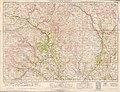 Ordnance Survey One-Inch Sheet 84 Nithsdale & Moffatt, Published 1925.jpg 12,203 × 9,306; 14.87 MB
-
 Ordnance Survey Sheet NX 97 (25 97) Dumfries, Published 1950.jpg 5,725 × 6,608; 14.32 MB
-
 Over the Nith to Sanquhar - geograph.org.uk - 699854.jpg 640 × 480; 87 KB
-
 Pedestrian Bridge - geograph.org.uk - 730341.jpg 640 × 480; 96 KB
-
-

-
 Rail Bridge over River Nith - geograph.org.uk - 1090687.jpg 640 × 430; 75 KB
-
 Reflections on the Nith - geograph.org.uk - 4077805.jpg 640 × 443; 64 KB
-
 River Nith & Maxwell Bank Farm from Glencaple Quay. View west.jpg 3,559 × 1,288; 766 KB
-
 River Nith (31802656525).jpg 7,360 × 4,912; 29.99 MB
-
 River Nith - geograph.org.uk - 1068145.jpg 554 × 640; 57 KB
-
 River Nith - geograph.org.uk - 313720.jpg 2,112 × 2,816; 2.21 MB
-
 River Nith - geograph.org.uk - 313724.jpg 2,816 × 2,112; 2.1 MB
-
 River Nith - geograph.org.uk - 313761.jpg 2,816 × 2,112; 2.27 MB
-
 River Nith - geograph.org.uk - 542614.jpg 640 × 480; 102 KB
-
 River Nith - geograph.org.uk - 686775.jpg 640 × 480; 90 KB
-
 River Nith - geograph.org.uk - 84189.jpg 640 × 427; 96 KB
-
 River Nith - geograph.org.uk - 87304.jpg 426 × 640; 82 KB
-
 River Nith - geograph.org.uk - 873846.jpg 640 × 480; 166 KB
-
 River Nith - upstream - geograph.org.uk - 699857.jpg 640 × 480; 137 KB
-
 River Nith and Cluden Water confluence, Dumfries, Scotland.jpg 4,856 × 2,423; 2.54 MB
-
 River Nith and plantings from Friar's Carse.jpg 2,288 × 1,712; 1.34 MB
-
 River Nith and Suspension Bridge.jpg 4,032 × 3,024; 2.84 MB
-
 River Nith at Auldgirth, Dumfries & Galloway, Scotland.jpg 4,896 × 2,752; 4.06 MB
-
 River Nith At Burnfoot - geograph.org.uk - 1691779.jpg 640 × 480; 92 KB
-
 River Nith at Dumfries - geograph.org.uk - 1010643.jpg 640 × 435; 62 KB
-
 River Nith at Ellisland.JPG 2,288 × 1,712; 1.2 MB
-
 River Nith at Enterkinfoot - geograph.org.uk - 1503845.jpg 640 × 480; 107 KB
-
 River Nith at Friars Carse.jpg 2,288 × 1,712; 2.22 MB
-
 River Nith at Glenairlie Bridge - geograph.org.uk - 1553113.jpg 640 × 480; 102 KB
-
 River Nith at Glencaple - geograph.org.uk - 1204700.jpg 640 × 480; 57 KB
-
 River Nith at Glencaple - geograph.org.uk - 1204714.jpg 640 × 480; 74 KB
-
 River Nith at Glencaple - geograph.org.uk - 1204716.jpg 640 × 480; 67 KB
-
 River Nith at Kingholm Quay - geograph.org.uk - 1204666.jpg 640 × 480; 42 KB
-
 River Nith at Kingholm Quay - geograph.org.uk - 1204670.jpg 640 × 480; 54 KB
-
 River Nith at Kingholm, Dumfries,.jpg 4,896 × 2,752; 7.15 MB
-
 River Nith at the confluence of the Carse Loch Burn.JPG 4,460 × 2,961; 4.47 MB
-
 River Nith at the Frair's Carse sampling station.JPG 2,288 × 1,712; 1.24 MB
-
 River Nith estuary.jpg 3,504 × 2,336; 8.68 MB
-
 River Nith from Friar's Carse.jpg 2,288 × 1,712; 1.43 MB
-
 River Nith from Glencaple Quay - geograph.org.uk - 1204707.jpg 640 × 480; 65 KB
-
 River Nith from Glencaple Quay. View up river towards Dumfries.jpg 4,896 × 2,752; 4.9 MB
-
 River Nith from St Michael's Street.jpg 3,247 × 2,143; 1.62 MB
-
 River Nith from the Devorgilla Bridge, Dumfries, Scotland.jpg 4,459 × 2,505; 2.48 MB
-
 River Nith in Dumfries.jpg 768 × 430; 135 KB
-
 River Nith Meander. - geograph.org.uk - 434175.jpg 640 × 480; 89 KB
-
 River Nith Near A76 - geograph.org.uk - 728159.jpg 480 × 640; 98 KB
-
 River Nith near Nith Lodge - geograph.org.uk - 1249588.jpg 640 × 480; 123 KB
-
 River Nith north of Nith Lodge - geograph.org.uk - 1227767.jpg 640 × 428; 53 KB
-

-

-
 River Nith, Carron Bridge, Dumfries & Galloway, Scotland.jpg 4,604 × 3,450; 7.71 MB
-
 River Nith, downstream from the Blackaddie Bridge, Sanquhar.jpg 4,608 × 3,456; 4.5 MB
-
 River Nith, Dumfries - geograph.org.uk - 1768381.jpg 1,024 × 768; 505 KB
-
 River Nith, Dumfries. View upstream from Robert Burns's Path.jpg 4,896 × 2,752; 1.9 MB
-
 River Nith, near Carron Bridge, Dumfries & Galloway, Scotland..jpg 2,224 × 3,376; 563 KB
-
 River Nith, New Cumnock, East Ayrshire - New Cumnock Bridge.jpg 1,920 × 1,080; 901 KB
-
 River Nith, upstream from the Blackaddie Bridge, Sanquhar, Dumfries & Galloway.jpg 4,608 × 3,456; 5.03 MB
-
 River Nith, Waterside Farm, New Cumnock, East Ayrshire.jpg 1,920 × 1,080; 735 KB
-
 River Nith.jpg 5,402 × 3,592; 12.48 MB
-
 Riverside Walk - geograph.org.uk - 3779517.jpg 640 × 424; 127 KB
-
 Robert burns centre dumfries.JPG 1,954 × 1,619; 1.59 MB
-
 Robert Burns path, River Nith, Dumfries. This was his favourite walk. Town section.jpg 4,896 × 2,752; 3.57 MB
-
 Robert Burns path, River Nith, Dumfries. This was his favourite walk.jpg 4,896 × 2,752; 6.54 MB
-
 Robert Burns path, River Nith, Dumfries.jpg 4,896 × 2,752; 6.29 MB
-
 Rock cut basin, River Nith, Carron Bridge, Dumfries & Galloway.jpg 4,440 × 2,589; 6.49 MB
-
 Rock cut basins, River Nith, Carron Bridge, Dumfries & Galloway.jpg 4,608 × 3,456; 6.98 MB
-
-
 Rusty UK 27 - geograph.org.uk - 609813.jpg 640 × 480; 74 KB
-
 Source of the Nith - geograph.org.uk - 1249562.jpg 480 × 640; 94 KB
-
 The A76 and River Nith near Waistland - geograph.org.uk - 352511.jpg 640 × 480; 113 KB
-
 The Caerlaverock Cairn at Glencaple - geograph.org.uk - 942466.jpg 640 × 427; 63 KB
-
 The Nith valley - geograph.org.uk - 699858.jpg 640 × 480; 96 KB
-
 The path down from Criffel - geograph.org.uk - 531036.jpg 640 × 417; 104 KB
-
 The River Nith - geograph.org.uk - 1363614.jpg 640 × 480; 63 KB
-
 The River Nith - geograph.org.uk - 376825.jpg 640 × 480; 98 KB
-
 The River Nith - geograph.org.uk - 377339.jpg 631 × 416; 98 KB
-
 The River Nith - geograph.org.uk - 414237.jpg 640 × 480; 130 KB
-
 The River Nith - geograph.org.uk - 434135.jpg 640 × 480; 98 KB
-
 The River Nith - geograph.org.uk - 672457.jpg 640 × 480; 46 KB
-
 The River Nith at Dumfries (6612690789).jpg 3,648 × 2,736; 3.7 MB
-
 The River Nith at Friars's Carse, Nithsdale, Dumfries & Galloway.jpg 4,345 × 2,500; 2.37 MB
-
 The River Nith at Kingholm, Dumfries. View upstream.jpg 4,896 × 2,752; 4.68 MB
-
 The River Nith at Meikle Creoch - geograph.org.uk - 331339.jpg 640 × 480; 87 KB
-
 The River Nith from Ellisland Farm, Dumfries & Galloway, Scotland.jpg 4,896 × 2,752; 4.01 MB
-

-
 The River Nith mudflats at sundown - geograph.org.uk - 1469107.jpg 640 × 428; 40 KB
-
 The River Nith, Dumfries (7381585944) (2).jpg 3,872 × 2,592; 6.12 MB
-
 The River Nith, Dumfries (7381591688) (2).jpg 3,872 × 2,592; 4.87 MB
-
 The River Nith. - geograph.org.uk - 434139.jpg 640 × 480; 84 KB
-
 The Robert Burns Centre, Dumfries - geograph.org.uk - 967318.jpg 640 × 480; 79 KB
-
 The WaterOrgan, Auldgirth Bridge, River Nith, Dumfries & Galloway.jpg 4,511 × 2,545; 2.02 MB
-
 Towards Inglestonford from Ardwall - geograph.org.uk - 397618.jpg 640 × 480; 93 KB
-

-
 Water Organ, Auldgirth, River Nith, Dumfries & Galloway, Scotland. Spring Fling 2019.jpg 4,317 × 2,426; 2.52 MB
-
 Water Organ, Auldgirth, River Nith, Dumfries & Galloway.jpg 4,896 × 2,752; 4.11 MB
-
 What is that^ - geograph.org.uk - 434714.jpg 640 × 480; 45 KB
-
 Woodland by the River Nith - geograph.org.uk - 1228491.jpg 640 × 428; 49 KB


.png)


.jpg)


_Burr_or_Burl,_Friars_Carse.JPG)


_and_reservoir._River_Nith._Dumfries_%26_Galloway.jpg)


_from_Eliock_bridge_over_River_Nith_-_geograph.org.uk_-_88998.jpg)


_Dumfries,_Published_1950.jpg)


.jpg)


.jpg)


_(2).jpg)
_(2).jpg)


