Category:River Severn in Gloucestershire
Subcategories
This category has the following 4 subcategories, out of 4 total.
Media in category "River Severn in Gloucestershire"
The following 90 files are in this category, out of 90 total.
-
-
 A flooded Severn Ham, Tewkesbury - geograph.org.uk - 320160.jpg 640 × 426; 99 KB
-

-
 ApproachToFossilBeach DMarshall2017.jpg 3,264 × 1,836; 2.53 MB
-
 Beachley slipway, Old Aust Ferry, River Severn.jpg 4,896 × 3,672; 3.09 MB
-
 Broken boughs - geograph.org.uk - 1105309.jpg 640 × 480; 161 KB
-
 By the River Severn - geograph.org.uk - 992479.jpg 640 × 480; 99 KB
-
 Canada Geese by the Severn.jpg 3,768 × 2,848; 4.67 MB
-
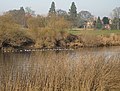 Canada geese settle on the Severn - geograph.org.uk - 1105637.jpg 640 × 484; 128 KB
-
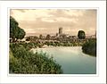 Cathedral from river Gloucester England.jpg 1,073 × 837; 154 KB
-
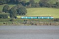 Class150 Arriva WellhouseBay 1.JPG 2,955 × 1,970; 1.98 MB
-
 Class150 Arriva WellhouseBay 2.JPG 3,000 × 2,000; 2.48 MB
-
 Class150 Arriva WellhouseBay 3.JPG 3,000 × 2,000; 2.6 MB
-
 Class150 Arriva WellhouseBay 4.JPG 2,955 × 1,970; 2.14 MB
-
 Cockbury Hall, Chaceley - geograph.org.uk - 643341.jpg 640 × 426; 80 KB
-
 Cold day by the Severn - geograph.org.uk - 1105261.jpg 640 × 480; 99 KB
-
 Cold work - geograph.org.uk - 1107239.jpg 640 × 457; 163 KB
-

-
 Cruising upriver - geograph.org.uk - 1104512.jpg 640 × 427; 121 KB
-

-
 East Channel, River Severn - geograph.org.uk - 5219992.jpg 1,024 × 768; 296 KB
-
 FossilBeach1 DMarshall2017.jpg 3,264 × 1,836; 2.52 MB
-
 FossilBeach2 DMarshall2017.jpg 3,264 × 1,836; 1.59 MB
-
 FossilBeach3 DMarshall2017.jpg 1,698 × 2,346; 857 KB
-
 FossilBeach4 DMarshall2017.jpg 2,716 × 1,492; 1.08 MB
-
 FossilCrinoidFragments DMarshall2014.jpg 1,516 × 1,335; 321 KB
-
 Moorings on the Severn - geograph.org.uk - 1415558.jpg 640 × 420; 104 KB
-
 Mythe Bridge and the River Severn - geograph.org.uk - 1125885.jpg 640 × 426; 80 KB
-
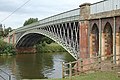 Mythe Bridge in 2004.jpg 3,008 × 2,000; 1.77 MB
-
 Mythe Water Works - geograph.org.uk - 1349619.jpg 640 × 455; 100 KB
-
 Mythe Water Works - geograph.org.uk - 1349622.jpg 640 × 455; 115 KB
-
 Mythe Water Works - geograph.org.uk - 1349654.jpg 640 × 455; 89 KB
-
 Mythewaterworks.jpg 640 × 480; 99 KB
-
 Ordnance Survey One-Inch Tourist Map of the Wye Valley & Lower Severn, published 1961.jpg 13,124 × 16,665; 27.94 MB
-
 Over Bridge in 2004.jpg 2,742 × 1,798; 1.55 MB
-
 Pontoon on the Severn - geograph.org.uk - 1105317.jpg 480 × 640; 169 KB
-

-

-
 Railings of Mythe Bridge in 2004.jpg 3,008 × 2,000; 1.92 MB
-
 Railway by the Severn - geograph.org.uk - 836388.jpg 640 × 481; 93 KB
-
 Reed bed by the Severn - geograph.org.uk - 1105643.jpg 640 × 480; 128 KB
-
 River Severn - geograph.org.uk - 1079551.jpg 640 × 358; 52 KB
-
 River Severn - geograph.org.uk - 1083091.jpg 640 × 358; 46 KB
-
 River Severn - geograph.org.uk - 1083114.jpg 640 × 358; 51 KB
-
 River Severn - geograph.org.uk - 1349615.jpg 640 × 455; 82 KB
-
 River Severn at Deerhurst - geograph.org.uk - 643350.jpg 640 × 426; 65 KB
-
 River Severn at Lower Lode - geograph.org.uk - 1724079.jpg 800 × 600; 163 KB
-
 River Severn at Mythe Hook - geograph.org.uk - 1127332.jpg 426 × 640; 64 KB
-
 River Severn at Weir End - geograph.org.uk - 790852.jpg 640 × 426; 93 KB
-
 River Severn currents near Newnham - geograph.org.uk - 684882.jpg 640 × 426; 68 KB
-
 River Severn flood plain - geograph.org.uk - 1105322.jpg 640 × 480; 115 KB
-
 River Severn from the air - geograph.org.uk - 1221539.jpg 502 × 640; 49 KB
-

-

-

-

-

-
 Saniger Sands from The Tack - geograph.org.uk - 367816.jpg 640 × 480; 51 KB
-
 Severn and Wye bridges, near Bristol, England arp.jpg 2,554 × 1,433; 2.14 MB
-
 Severn Bore pub - geograph.org.uk - 1727244.jpg 640 × 427; 93 KB
-
 Severn towpath at The Haw - geograph.org.uk - 1201401.jpg 640 × 480; 198 KB
-
 Sunset looking towards Westbury - geograph.org.uk - 1124890.jpg 640 × 480; 36 KB
-
 Teamwork on the River Severn - geograph.org.uk - 1107235.jpg 640 × 466; 130 KB
-
 The Pickle bound for Lydney Harbour - geograph.org.uk - 354773.jpg 640 × 480; 64 KB
-

-
 The River Severn - geograph.org.uk - 883541.jpg 640 × 374; 74 KB
-
 The River Severn at Deerhurst - geograph.org.uk - 1729914.jpg 800 × 600; 171 KB
-
 The River Severn at Deerhurst - geograph.org.uk - 1729929.jpg 800 × 601; 167 KB
-
 The River Severn at Lower Lode - geograph.org.uk - 786273.jpg 640 × 426; 50 KB
-
 The River Severn at Quedgeley - geograph.org.uk - 1330688.jpg 640 × 426; 90 KB
-
 The River Severn at Wainlode - geograph.org.uk - 1454664.jpg 640 × 370; 231 KB
-

-
 The River Severn from Mythe Bridge - geograph.org.uk - 1125900.jpg 640 × 426; 42 KB
-
 The River Severn near Ashleworth - geograph.org.uk - 1397357.jpg 640 × 426; 93 KB
-
 The Severn Bridge and river, Beachley, Gloucester.jpg 4,896 × 3,111; 1.45 MB
-
 Tide coming in - geograph.org.uk - 1397643.jpg 640 × 442; 87 KB
-
 Towards Collow Pill - geograph.org.uk - 883812.jpg 640 × 326; 56 KB
-
 Tranquil Severn - geograph.org.uk - 1415586.jpg 640 × 480; 76 KB
-
 Trees on the Severn river bank - geograph.org.uk - 643353.jpg 640 × 426; 52 KB
-
 View across Mythe Bridge - geograph.org.uk - 1125893.jpg 426 × 640; 75 KB
-
 View across the River Severn - geograph.org.uk - 1105279.jpg 640 × 480; 143 KB
-
 View from above Wainlode Cliff - geograph.org.uk - 1397406.jpg 640 × 426; 90 KB
-
 View of the Severn Estuary from the Coaley Peak.jpg 4,896 × 2,752; 8.32 MB
-
 Waiting to cross the River Severn - geograph.org.uk - 1367675.jpg 640 × 480; 187 KB
-
 Washed up after the floods - geograph.org.uk - 683125.jpg 640 × 480; 204 KB
-
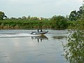
 Water skiing on the River Severn - geograph.org.uk - 1334732.jpg 640 × 426; 90 KB
-
 Waterskiing on the Severn - geograph.org.uk - 783971.jpg 640 × 426; 62 KB
-
 Power lines cross the River Severn - geograph.org.uk - 683415.jpg 640 × 470; 124 KB
-
 River at Broadoak - geograph.org.uk - 682877.jpg 640 × 480; 59 KB
-
 River at Broadoak - geograph.org.uk - 682878.jpg 640 × 480; 41 KB


