Category:River Washburn at Blubberhouses
The stretch of River Washburn between the Thruscross and Fewston reservoirs.
Media in category "River Washburn at Blubberhouses"
The following 20 files are in this category, out of 20 total.
-

-
 Weir on River Washburn-geograph-4450608-by-Martin-Dawes.jpg 800 × 600; 492 KB
-
 Weir on the River Washburn - geograph.org.uk - 29038.jpg 640 × 480; 155 KB
-
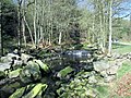
 'Broken Weir' at Washburn-180574690.jpg 1,280 × 960; 321 KB
-
 An ancient beech - geograph.org.uk - 642172.jpg 480 × 640; 126 KB
-
 Footbridge over the river Washburn - geograph.org.uk - 642216.jpg 640 × 480; 94 KB
-
 Ford through the Washburn - geograph.org.uk - 642219.jpg 480 × 640; 110 KB
-
 FP next to the Washburn - geograph.org.uk - 642181.jpg 480 × 640; 126 KB
-
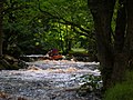
 Kayaking on the Washburn - geograph.org.uk - 370721.jpg 640 × 479; 127 KB
-
 Low Dam near the River Washburn - geograph.org.uk - 28243.jpg 640 × 480; 142 KB
-
 Rafters on Washburn weir - geograph.org.uk - 370691.jpg 640 × 479; 142 KB
-
 Rafting down the Washburn - geograph.org.uk - 370712.jpg 640 × 479; 175 KB
-
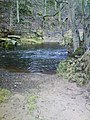
 River Washburn - geograph.org.uk - 642167.jpg 640 × 480; 118 KB
-
 River Washburn - geograph.org.uk - 652576.jpg 480 × 640; 114 KB
-
 Thruscross Dam-13029701204.jpg 6,016 × 4,016; 2.27 MB
-
 Thruscross Reservoir - geograph.org.uk - 370716.jpg 640 × 479; 123 KB
-
 Thruscross Reservoir Spillway and Weir - geograph.org.uk - 489823.jpg 427 × 640; 139 KB
-
 Two kayakers on the Washburn - geograph.org.uk - 225561.jpg 640 × 480; 102 KB
-
 Washburn - geograph.org.uk - 370705.jpg 640 × 479; 184 KB
-
 Washburn during reservoir release - geograph.org.uk - 32312.jpg 640 × 479; 178 KB


