Category:Rivers of Hampshire
Ceremonial counties of England: Bedfordshire · Berkshire · Buckinghamshire · Cambridgeshire · Cheshire · Cornwall · Cumbria · Derbyshire · Devon · Dorset · Durham · East Riding of Yorkshire · East Sussex · Essex · Gloucestershire · Greater London · Greater Manchester · Hampshire · Herefordshire · Hertfordshire · Isle of Wight · Kent · Lancashire · Leicestershire · Lincolnshire · Merseyside · Norfolk · North Yorkshire · Northamptonshire · Northumberland · Nottinghamshire · Oxfordshire · Rutland · Shropshire · Somerset · South Yorkshire · Staffordshire · Suffolk · Surrey · Tyne and Wear · Warwickshire · West Midlands · West Sussex · West Yorkshire · Wiltshire · Worcestershire
City-counties: Bristol ·
Former historic counties: Huntingdonshire ·
Other former counties:
City-counties: Bristol ·
Former historic counties: Huntingdonshire ·
Other former counties:
Wikimedia category | |||||
| Upload media | |||||
| Instance of | |||||
|---|---|---|---|---|---|
| Category combines topics | |||||
| Hampshire | |||||
ceremonial county of England      | |||||
| Instance of |
| ||||
| Location | South East England, England | ||||
| Capital | |||||
| Highest point |
| ||||
| Population |
| ||||
| Area |
| ||||
| Different from | |||||
| Said to be the same as | Hampshire (historic county of England, ceremonial county of England, 1844) | ||||
| official website | |||||
 | |||||
Subcategories
This category has the following 36 subcategories, out of 36 total.
A
- River Alver (4 F)
- River Anton (7 F)
- Avon Water, Hampshire (11 F)
B
- Bourne Rivulet (11 F)
C
- Cadnam River (1 F)
- Candover Brook (15 F)
D
- Dark Water, Hampshire (7 F)
- River Dever (36 F)
- River Dun, Hampshire (15 F)
E
- River Ems, England (5 F)
- Exbury River (2 F)
H
I
L
- River Lyde, Hampshire (3 F)
M
- Monks Brook (9 F)
R
- River Mude (5 F)
S
- River Slea, Hampshire (1 F)
- River Swift, Hampshire (3 F)
T
- Tadburn Lake (7 F)
W
- River Wallington (6 F)
Media in category "Rivers of Hampshire"
The following 25 files are in this category, out of 25 total.
-
 Bow Brook passes under Vyne Road (geograph 3318247).jpg 3,648 × 2,736; 2.93 MB
-
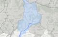 EMS water body.png 706 × 446; 280 KB
-
 Hinton Park, Shears Brook - geograph.org.uk - 1295602.jpg 480 × 640; 134 KB
-
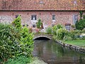 Part of Breamore Mill - geograph.org.uk - 885752.jpg 640 × 480; 136 KB
-
 River and footpath - geograph.org.uk - 739643.jpg 640 × 480; 117 KB
-
 River Blackwater - geograph.org.uk - 1528138.jpg 640 × 480; 124 KB
-

-
-
 Rounding Gull's Island - geograph.org.uk - 1096839.jpg 640 × 427; 174 KB
-
 Shipton Bellinger - High Street - geograph.org.uk - 1110029.jpg 480 × 640; 106 KB
-
 Sopley, first BST sunset - geograph.org.uk - 1226354.jpg 435 × 640; 36 KB
-
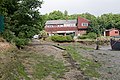
 Stannah industrial estate - geograph.org.uk - 1145528.jpg 640 × 359; 91 KB
-
 Still Waters - geograph.org.uk - 1563830.jpg 640 × 480; 71 KB
-
 Stoke - Pollarded Wilows - geograph.org.uk - 769884.jpg 640 × 480; 90 KB
-
 The River Blackwater - geograph.org.uk - 1219300.jpg 480 × 640; 142 KB
-
 The River Blackwater - geograph.org.uk - 1251197.jpg 640 × 480; 106 KB
-
 The River Blackwater - geograph.org.uk - 755433.jpg 640 × 480; 98 KB
-
 The River Blackwater at Blackwater - geograph.org.uk - 764240.jpg 640 × 480; 112 KB
-
 The River Blackwater in flood - geograph.org.uk - 1156407.jpg 640 × 480; 120 KB
-

-
 View south from Middlebridge - geograph.org.uk - 1736335.jpg 2,699 × 1,800; 1.43 MB
-
-
 Willows by the River Blackwater - geograph.org.uk - 1528144.jpg 480 × 640; 113 KB
-
 Wreck of the 'Norseman' - geograph.org.uk - 1436448.jpg 640 × 480; 106 KB
-
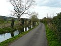
 Eling Creek at low water - geograph.org.uk - 590348.jpg 640 × 480; 115 KB
.jpg)


