Category:Rivers of Texas
States of the United States: Alabama · Alaska · Arizona · Arkansas · California · Colorado · Connecticut · Delaware · Florida · Georgia · Hawaii · Idaho · Illinois · Indiana · Iowa · Kansas · Kentucky · Louisiana · Maine · Maryland · Massachusetts · Michigan · Minnesota · Mississippi · Missouri · Montana · Nebraska · Nevada · New Hampshire · New Jersey · New Mexico · New York · North Carolina · North Dakota · Ohio · Oklahoma · Oregon · Pennsylvania · Rhode Island · South Carolina · South Dakota · Tennessee · Texas · Utah · Vermont · Virginia · Washington · West Virginia · Wisconsin · Wyoming – Washington, D.C.
Guam · Puerto Rico
Guam · Puerto Rico
Wikimedia category | |||||
| Upload media | |||||
| Instance of | |||||
|---|---|---|---|---|---|
| Category combines topics | |||||
| Category contains | |||||
| Texas | |||||
state of the United States of America  someja da satełite in zuño      | |||||
| Pronunciation audio | |||||
| Instance of | |||||
| Part of | |||||
| Named after |
| ||||
| Location |
| ||||
| Located in or next to body of water |
| ||||
| Capital | |||||
| Legislative body |
| ||||
| Executive body | |||||
| Highest judicial authority |
| ||||
| Anthem |
| ||||
| Head of government |
| ||||
| Inception |
| ||||
| Highest point | |||||
| Population |
| ||||
| Area |
| ||||
| Elevation above sea level |
| ||||
| Replaces | |||||
| Different from | |||||
| Maximum temperature record |
| ||||
| Minimum temperature record |
| ||||
| official website | |||||
 | |||||
Subcategories
This category has the following 62 subcategories, out of 62 total.
*
- Dry river beds in Texas (6 F)
- River banks in Texas (4 F)
- River islands in Texas (4 F)
- Sandy river beds in Texas (5 F)
- Streambed boulders in Texas (4 F)
+
- Maps of rivers in Texas (43 F)
.
- River name signs in Texas (5 F)
B
C
D
F
G
L
- Lavaca River (3 F)
M
N
P
R
- Rio Vista Park (3 F)
S
T
W
- Washita River (11 F)
- Woman Hollering Creek (2 F)
Pages in category "Rivers of Texas"
This category contains only the following page.
Media in category "Rivers of Texas"
The following 91 files are in this category, out of 91 total.
-
 1991077 421 020ac (19715033752).jpg 2,720 × 4,117; 633 KB
-
 A River In Texas (80996237).jpeg 2,048 × 1,365; 968 KB
-
 Aerial view of body of water.jpg 599 × 436; 99 KB
-
 Angelina River sign IMG 0979.JPG 2,592 × 1,944; 1.28 MB
-
 Angelina River west of Nacogdoches, Texas.JPG 2,592 × 1,944; 1.5 MB
-
 Barton Creek Vizsla.jpg 4,032 × 3,024; 6.29 MB
-
 Baytown Texas Water Bay.jpg 3,076 × 1,777; 5.23 MB
-
 Baytown-Goose-Creek-10-4-2008.jpg 4,180 × 3,180; 10.33 MB
-
 Baytown-Goose-Creek-8-24-2008.jpg 3,108 × 2,109; 5.56 MB
-
 Baytown-Goose-Creek-stream-8-24-2008.jpg 3,126 × 2,358; 5.25 MB
-
 Big Sandy Creek, Polk Co, TX.jpg 5,067 × 3,178; 11.26 MB
-
 Brays Bayou.jpg 4,032 × 3,024; 4.18 MB
-
 BridgeWest Houston the bird sanctuary.jpg 2,304 × 3,456; 4.05 MB
-
 Bull Creek, Austin. (6756787125).jpg 750 × 585; 123 KB
-
 Clear Creek Harris TX 1.JPG 2,592 × 1,944; 1.3 MB
-
 Coleto Creek Reservoir Pier.jpg 3,072 × 2,304; 3.04 MB
-
 Coleto Creek.jpg 3,072 × 2,304; 2.75 MB
-
 Confluence of Neches and Angelina - panoramio.jpg 1,024 × 768; 104 KB
-
 Cooper-Jim Chapman Lake.jpg 1,500 × 1,000; 268 KB
-
 Cow Creek Bridge between Trout Creek and Old Salem (25141268414).jpg 3,840 × 5,760; 10.69 MB
-
 Devils River - Dolan Falls (174119268).jpg 533 × 800; 97 KB
-
 Devils River - Dolan Falls (174119670).jpg 533 × 800; 108 KB
-
 Devils River - Dolan Falls (174119859).jpg 800 × 533; 114 KB
-
 Devils River Pool (5 image pano) (174119590).jpg 800 × 183; 41 KB
-
 Dolan Creek (3 image pano) (174119508).jpg 800 × 666; 172 KB
-
 Dolan Creek Mouth (5 image pano) (174119427).jpg 800 × 372; 107 KB
-

-
 Dolan Falls (2 image pano) (174119300).jpg 800 × 388; 83 KB
-
 Dolan Falls (4 image pano) (174119342).jpg 800 × 314; 71 KB
-
 Dolan Falls (4939934705).jpg 800 × 533; 43 KB
-
 Dolan Falls (4940519824).jpg 800 × 533; 46 KB
-
 Downtown Austin from Pfluger Pedestrian Bridge, October 2022.jpg 3,000 × 2,000; 4.76 MB
-
 DowntownSanAntonioJune2023-1.jpg 4,928 × 3,288; 9.71 MB
-
 EASTMAN KODAK PLANT IN LONGVIEW - NARA - 547807.jpg 3,000 × 2,038; 813 KB
-
 Elderly man crossing a body of water.jpg 597 × 346; 51 KB
-
 Farmer's Branch Creek (18356883580).jpg 3,648 × 2,736; 5.32 MB
-
 Fishing on the Sulphur River - Wright Patman Dam, Texas (47476599752).jpg 7,952 × 5,304; 49.33 MB
-
 Fishy Cover (2365698482).jpg 800 × 533; 36 KB
-
 GAUI 500x First Flights (6251781335).jpg 1,280 × 720; 506 KB
-
 GH&H Railroad Bridge from Buffalo Bayou, Houston, Texas 1002101432BW (5056815139).jpg 2,855 × 2,285; 2.06 MB
-
 GH&H Railroad Bridge from Buffalo Bayou, Houston, Texas 1002101437BW (5056815151).jpg 3,591 × 2,868; 2.98 MB
-
 GH&H Railroad Bridge, Buffalo Bayou, Houston, Texas 0911101028 (5002480779).jpg 3,032 × 2,314; 2.72 MB
-
 GH&H Railroad Bridge, Buffalo Bayou, Houston, Texas 0911101120 (5002488777).jpg 4,000 × 3,000; 6.85 MB
-
 Goose Creek 10-11-2008 Baytown Texas.jpg 4,015 × 2,475; 7 MB
-
 Goose Creek Baytown Texas Market Street 10-4-2008.jpg 3,941 × 2,927; 8.93 MB
-
 Goose Creek Baytown Texas Water Tower 10-4-2008.jpg 4,018 × 2,654; 6.27 MB
-
 Goose Creek Cross Baytown Texas 10-4-2008.jpg 4,090 × 3,090; 7.58 MB
-
 Goose Creek Exxon Baytown Texas 10-5-2008.jpg 3,126 × 2,358; 5.79 MB
-
 Goose Creek Stream 9-26-2008.jpg 4,072 × 4,920; 14.83 MB
-
 Goose Creek Stream Monument.jpg 2,304 × 2,280; 4.47 MB
-
 Goose Creek Trail 9-26-08.jpg 4,054 × 3,054; 5.19 MB
-
 Goose Creek Trail cyclist.jpg 2,425 × 1,450; 3.16 MB
-
 Great Egret in Clear Creek (5607958370).jpg 576 × 720; 245 KB
-
 Landscape of water and a hill.jpg 597 × 346; 51 KB
-
-
 Little River, Bell County, Texas.jpg 2,966 × 1,915; 4.95 MB
-
 Lone Derrick Baytown Texas-10-11-2008.jpg 4,015 × 1,607; 2.62 MB
-
 Map of the Pine Island Bayou drainage basin in southeast Texas.jpg 479 × 480; 216 KB
-
 Mount Old Baldy Trail View 1.jpg 6,062 × 1,651; 6.93 MB
-
 Navasota River in TX IMG 6231.jpg 4,320 × 3,240; 4.27 MB
-
 North Pease River, Cottle County, Texas.jpg 5,616 × 3,744; 13.26 MB
-
 Oso creek.jpg 500 × 324; 19 KB
-
 Prairie Dog Town Fork Red River 2001.jpg 638 × 801; 352 KB
-
 Prairie Dog Town Fork Red River.jpg 5,419 × 3,612; 8.3 MB
-
-
-

-

-

-
 Railroad Bridge over Old Sims Bayou Channel, Houston, Texas 1311071003 (10745789716).jpg 3,872 × 2,592; 4.83 MB
-
 Railroad Bridge over Old Sims Bayou Channel, Houston, Texas 1311071007BW (10745789786).jpg 3,724 × 2,359; 4.04 MB
-
 Railroad Bridge over Old Sims Bayou Channel, Houston, Texas 1311071008BW (10745789806).jpg 2,937 × 2,577; 3.01 MB
-
 Railroad Bridge over Old Sims Bayou Channel, Houston, Texas 1311071012BW (10745791406).jpg 2,325 × 3,709; 4.89 MB
-
 Redriverbonhamtx.jpg 2,832 × 4,256; 10.01 MB
-
 20111216-NRCS-LSC-0126 - Flickr - USDAgov (1).jpg 3,825 × 2,414; 2.74 MB
-
 20111216-NRCS-LSC-0126 - Flickr - USDAgov.jpg 3,155 × 1,844; 1.46 MB
-
 20111216-NRCS-LSC-0135 - Flickr - USDAgov.jpg 3,560 × 2,075; 2.03 MB
-
 20111216-NRCS-LSC-0149 - Flickr - USDAgov.jpg 2,836 × 1,904; 862 KB
-

-
 Sabine River & Taylor Bayou, Texas.jpg 2,100 × 1,779; 466 KB
-
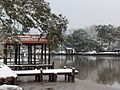 San Bernard river snow 2004.jpg 2,608 × 1,952; 1.26 MB
-
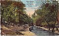
 San Marcos River at Rio Vista Park.jpg 3,264 × 2,448; 3.33 MB
-
-
 Texas tinaja (rock pool).jpg 2,523 × 3,300; 3.02 MB
-

-
 Turkey Creek, Tyler County, TX - August 2022.jpg 5,184 × 2,912; 9.07 MB
-
 USACE Ferrells Bridge Dam spillway.jpg 1,500 × 1,000; 275 KB
-
 WalnutCreekMansfield.jpg 960 × 1,280; 560 KB
-
 White rock creek dallas county texas.JPG 1,600 × 1,200; 436 KB
-
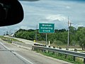 WomanHolleringSign.jpg 2,816 × 2,112; 609 KB
-
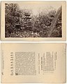
 River Scene, City Park (20102086).jpg 2,300 × 1,429; 5.24 MB
.jpg)
.jpeg)


.jpg)


.jpg)
.jpg)
.jpg)
.jpg)
_(174119508).jpg)
_(174119427).jpg)
_(174119300).jpg)
.jpg)
.jpg)


.jpg)
.jpg)
.jpg)
.jpg)
.jpg)
.jpg)
.jpg)
.jpg)


_2014-12-25.jpg)


.jpg)
.jpg)
.jpg)
.jpg)
.jpg)
.jpg)
.jpg)
.jpg)
.jpg)

.jpg)


.jpg)
.jpg)
.jpg)


.jpg)
_(174119590).jpg)
_(174119437).jpg)
_(174119342).jpg)
.jpg)