Category:Road junctions in North Yorkshire
Media in category "Road junctions in North Yorkshire"
The following 23 files are in this category, out of 23 total.
-
 A6055 and A6136.jpg 2,100 × 1,500; 1.97 MB
-
 Church Hill from Raskelf Road - geograph.org.uk - 3018840.jpg 800 × 600; 107 KB
-
 Easingwold from Alne Road - geograph.org.uk - 2193204.jpg 640 × 480; 211 KB
-
 East Carlton Farm - geograph.org.uk - 489658.jpg 640 × 480; 139 KB
-
 Either Way To Easingwold - geograph.org.uk - 267096.jpg 640 × 480; 96 KB
-
 Junction of Church Hill and Spring Street - geograph.org.uk - 3355112.jpg 1,024 × 768; 336 KB
-

-
 Junction of Cross Lane with Easby Lane - geograph.org.uk - 1703758.jpg 3,072 × 2,304; 1.48 MB
-

-
 Junction of Oulston Road and Thornton Lane - geograph.org.uk - 2790772.jpg 3,137 × 1,533; 738 KB
-

-

-
 Junction with Falsgrave Road - geograph.org.uk - 787375.jpg 640 × 400; 72 KB
-
 Leeds Road - viewed from Station Road - geograph.org.uk - 1299488.jpg 640 × 455; 203 KB
-
 Londesborough Road - geograph.org.uk - 801022.jpg 640 × 399; 69 KB
-
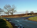
 Major And Minor - geograph.org.uk - 265659.jpg 640 × 480; 98 KB
-
 Marske Bridge approaching road junction - geograph.org.uk - 5616644.jpg 1,024 × 684; 241 KB
-
 Road Junction Crankley Lane - geograph.org.uk - 1206623.jpg 640 × 480; 64 KB
-

-
 Roundabout on the A19 Easingwold Bypass - geograph.org.uk - 4037376.jpg 1,600 × 878; 421 KB
-
 Roundabout on the A19 near Easingwold - geograph.org.uk - 886094.jpg 640 × 375; 51 KB
-
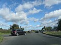 Traffic at A64 Junction.jpg 2,560 × 1,920; 2.09 MB
-


_-_geograph.org.uk_-_794118.jpg)


_-_geograph.org.uk_-_794077.jpg)


