Category:Road junctions in Shropshire
Media in category "Road junctions in Shropshire"
The following 75 files are in this category, out of 75 total.
-
 Another junction on another narrow lane - geograph.org.uk - 1442594.jpg 640 × 426; 299 KB
-
 Chesterton Junction - geograph.org.uk - 1875555.jpg 640 × 480; 89 KB
-
 Church Stretton - geograph.org.uk - 522659.jpg 600 × 488; 68 KB
-
 City Road junction - geograph.org.uk - 1029011.jpg 640 × 480; 82 KB
-
 Crossroads at Farm Hall - geograph.org.uk - 1509516.jpg 640 × 480; 78 KB
-
 Crossroads At Hayton's Bent - geograph.org.uk - 1295442.jpg 640 × 480; 61 KB
-
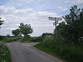
 Crossroads at Mile Oak - geograph.org.uk - 1442117.jpg 640 × 426; 265 KB
-
 Crossroads at The Blue Bell - geograph.org.uk - 1376731.jpg 640 × 480; 54 KB
-
 Crossroads at The Sytch - geograph.org.uk - 821164.jpg 640 × 480; 123 KB
-
 Crossroads on old A5 - geograph.org.uk - 1336305.jpg 640 × 480; 56 KB
-
 Crossroads sign - geograph.org.uk - 1058871.jpg 640 × 484; 200 KB
-
 Crossroads south of Selattyn - geograph.org.uk - 1711637.jpg 640 × 480; 100 KB
-
 Hunkington junction - geograph.org.uk - 809935.jpg 640 × 480; 61 KB
-
 Junction at Bent Lane - geograph.org.uk - 1036247.jpg 640 × 480; 110 KB
-
 Junction at Gilberries Lane - geograph.org.uk - 832836.jpg 640 × 480; 127 KB
-
 Junction at Horsford Bridge - geograph.org.uk - 867871.jpg 640 × 480; 351 KB
-
 Junction at Lower Dinchope - geograph.org.uk - 1073098.jpg 640 × 480; 101 KB
-
 Junction at Shoothill - geograph.org.uk - 1515800.jpg 640 × 480; 116 KB
-
 Junction at Whitcott Evan - geograph.org.uk - 1595488.jpg 640 × 426; 154 KB
-
 Junction for Ticklerton - geograph.org.uk - 1073149.jpg 640 × 425; 88 KB
-
 Junction near Totterton Hall - geograph.org.uk - 1232175.jpg 600 × 450; 335 KB
-

-
 Junction of Grug Hill and School Road - geograph.org.uk - 988703.jpg 640 × 480; 73 KB
-
 Junction of Linney and Dinham - geograph.org.uk - 1192670.jpg 640 × 426; 114 KB
-

-

-

-

-

-
 Junction of road to Woodhill - geograph.org.uk - 1802356.jpg 640 × 480; 70 KB
-

-

-

-

-
 Junction on Nedge Lane - geograph.org.uk - 1623816.jpg 640 × 480; 115 KB
-
 Junction on the B5062 - geograph.org.uk - 821112.jpg 640 × 480; 46 KB
-
-
-

-
 Park Gate junction in Kenley, Shropshire, England.jpg 640 × 480; 95 KB
-

-
 Road Junction at Ponthen - geograph.org.uk - 793164.jpg 640 × 426; 77 KB
-
 Road junction at Priest Weston - geograph.org.uk - 1376704.jpg 640 × 426; 75 KB
-
 Road junction at Upper Wain - geograph.org.uk - 1012953.jpg 640 × 480; 95 KB
-
 Road Junction at Wilcott Marsh - geograph.org.uk - 1507914.jpg 640 × 480; 124 KB
-

-
 Road junction East of Nantmawr - geograph.org.uk - 1722565.jpg 640 × 480; 101 KB
-
 Road junction fingerpost in Child's Ercall, Shropshire, England.jpg 640 × 480; 109 KB
-
 Road junction fingerpost in Greete, Shropshire, England.jpg 640 × 480; 213 KB
-
 Road junction fingerpost in Romsley, Shropshire, England.jpg 640 × 480; 114 KB
-
 Road junction for Weston Rhyn - geograph.org.uk - 1711623.jpg 640 × 480; 87 KB
-
 Road junction in Ashford Carbonel, Shropshire, England.jpg 640 × 480; 89 KB
-
 Road junction in Cleobury North, Shropshire, England.jpg 640 × 480; 105 KB
-
 Road junction near The Cwm Farm - geograph.org.uk - 1013009.jpg 640 × 480; 83 KB
-
 Road junction on Baker's Hill - geograph.org.uk - 904747.jpg 640 × 480; 89 KB
-
 Road Junction on Offa's Dyke path. - geograph.org.uk - 1198091.jpg 640 × 480; 100 KB
-
-

-
 Road junction, Bucknell - geograph.org.uk - 1526861.jpg 640 × 480; 109 KB
-
 Road junction. Pennerley - geograph.org.uk - 1566220.jpg 640 × 480; 81 KB
-
 Road to Candy - geograph.org.uk - 1722604.jpg 640 × 480; 64 KB
-
 Road to Dudston - geograph.org.uk - 1512370.jpg 640 × 480; 64 KB
-
 Road to Montgomery - geograph.org.uk - 1376690.jpg 640 × 426; 72 KB
-
 Sadd's Butchers, Dorrington - geograph.org.uk - 830104.jpg 505 × 640; 81 KB
-
 Staggered junction - geograph.org.uk - 1074416.jpg 640 × 480; 128 KB
-
 Staggered junction - geograph.org.uk - 858974.jpg 640 × 480; 320 KB
-
 Station Rd, Lawley - geograph.org.uk - 1257434.jpg 640 × 480; 89 KB
-
 Steep hill warning - geograph.org.uk - 790382.jpg 640 × 480; 66 KB
-
 Stratford Lane Junction - geograph.org.uk - 1733387.jpg 800 × 600; 117 KB
-
 Tenbury Wells - Clee Hill Road - geograph.org.uk - 1746285.jpg 640 × 480; 152 KB
-
-
 The former Old Hall School - geograph.org.uk - 1285087.jpg 640 × 480; 116 KB
-
 The High Road Or The Low Road - geograph.org.uk - 889336.jpg 640 × 423; 86 KB
-
 The Highlands junction - geograph.org.uk - 867866.jpg 640 × 480; 229 KB
-
 The Old Smithy, Cross Houses - geograph.org.uk - 424467.jpg 600 × 423; 224 KB


