Category:Road maps of Poland
Subcategories
This category has the following 8 subcategories, out of 8 total.
Media in category "Road maps of Poland"
The following 200 files are in this category, out of 306 total.
(previous page) (next page)-
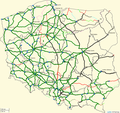
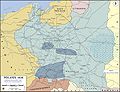 WWII-Poland-1939-communications and industry.jpg 1,280 × 984; 1.15 MB
-
 Autostrada a1 na konturze.png 300 × 282; 35 KB
-
 Autostrada a18 na konturze.png 300 × 282; 35 KB
-
 Autostrada a6 na konturze.png 300 × 282; 35 KB
-
 Autostrada a8 na konturze.png 300 × 282; 35 KB
-
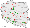
 Autostrady i drogi ekspresowe w Polsce.PNG 789 × 724; 101 KB
-
 Autostrady i drogi ekspresowe.PNG 927 × 796; 107 KB
-
 Autostrady i drogi ekspresowy.PNG 789 × 724; 102 KB
-
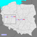
 DK22.svg 610 × 572; 21 KB
-
 DK32 w Polsce.svg 4,461 × 3,146; 33 KB
-
 DK5 w Polsce.svg 4,461 × 3,146; 34 KB
-
 DK6 w Polsce.svg 4,461 × 3,146; 36 KB
-
 DK7 w Polsce.svg 4,461 × 3,146; 37 KB
-
 DK8 w Polsce.svg 4,461 × 3,146; 35 KB
-
 Docelowa siec drog ekspresowych&autostrad w polsce.jpg 2,778 × 3,063; 1.04 MB
-
 Docelowy uklad drog.svg 861 × 837; 2.73 MB
-
 DocelowyUkladDrog.svg 776 × 723; 410 KB
-
 Droga powiatowa 868 - POL PDK.png 1,062 × 1,241; 34 KB
-
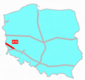
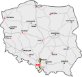
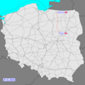
 Droga wojewódzka (Poland) 216.jpg 1,136 × 1,006; 162 KB
-
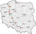
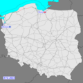
 Droga wojewódzka 501 (Poland) map.jpg 659 × 411; 76 KB
-
 Drogas17.png 1,024 × 954; 171 KB
-
 Drogi EURO2012.svg 750 × 611; 1.82 MB
-
 Drogi krajowe w Polsce.svg 3,937 × 3,462; 8.29 MB
-
 Drogiplanostrow.jpg 272 × 242; 14 KB
-
 DW 629 nowy przebieg.png 898 × 964; 1,016 KB
-
 E75 route.svg 401 × 420; 102 KB
-
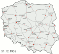
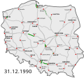 HighwaysMapPoland 31 12 1990.svg 785 × 724; 143 KB
-
 HighwaysMapPoland 31 12 2000.svg 785 × 724; 145 KB
-
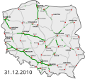 HighwaysMapPoland 31 12 2010.svg 785 × 724; 151 KB
-
 HighwaysMapPoland 31 12 2020.svg 776 × 723; 329 KB
-
 HighwaysMapPoland.svg 776 × 723; 363 KB
-
 Historia budowy autostrad i dróg ekspresowych.gif 500 × 461; 100 KB
-
 Konkurujące drogi równoległe.svg 801 × 622; 8.4 MB
-
 Main roads in powiat augustowski pl.svg 643 × 553; 130 KB
-
 Mapa DK1.png 3,690 × 3,690; 20.27 MB
-
 Mapa DK10.png 2,360 × 1,815; 6.57 MB
-
 Mapa DK11.png 2,360 × 1,815; 6.57 MB
-
 Mapa DK12.png 936 × 920; 797 KB
-
 Mapa DK13 Szczecin.png 1,019 × 962; 833 KB
-
 Mapa DK13.png 936 × 920; 794 KB
-
 Mapa DK14.png 936 × 920; 796 KB
-
 Mapa DK15.png 936 × 920; 797 KB
-
 Mapa DK2.png 3,690 × 3,690; 20.28 MB
-
 Mapa DK3.png 2,360 × 1,815; 6.49 MB
-
 Mapa DK4.png 3,690 × 3,690; 20.26 MB
-
 Mapa DK47.png 3,690 × 3,690; 20.31 MB
-
 Mapa DK5.png 2,360 × 1,815; 6.57 MB
-
 Mapa DK6.png 2,360 × 1,815; 6.48 MB
-
 Mapa DK7.png 2,360 × 1,815; 6.58 MB
-
 Mapa DK71.png 936 × 920; 784 KB
-
 Mapa DK8.png 3,690 × 3,690; 20.27 MB
-
 Mapa DK9.png 2,360 × 1,815; 6.56 MB
-
 Mapa DK90.png 936 × 920; 754 KB
-
 Mapa DK91.png 936 × 920; 839 KB
-
 Mapa DK92.png 3,690 × 3,690; 20.31 MB
-
 Mapa DK94.png 3,690 × 3,690; 20.31 MB
-
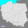
 Mapa DW219.png 986 × 485; 80 KB
-
 Mapa DW772.png 596 × 956; 573 KB
-
 Mapa DW955.png 1,335 × 398; 450 KB
-
 Mapa dw956.png 1,052 × 795; 960 KB
-
 Mapa Leszno.png 3,388 × 3,993; 954 KB
-
 MapaS61.png 1,024 × 954; 171 KB
-
 Mapka zaliczonych linii kolejowych Macpach1234.png 915 × 865; 347 KB
-
 NowaMapaA1.svg 776 × 723; 196 KB
-
 NowaMapaA18.svg 776 × 723; 167 KB
-
 NowaMapaA2.svg 776 × 723; 190 KB
-
 NowaMapaA4.svg 776 × 723; 192 KB
-
 NowaMapaA50.svg 776 × 723; 171 KB
-
 NowaMapaA6.svg 776 × 723; 169 KB
-
 NowaMapaA8.svg 776 × 723; 170 KB
-
 NowaMapaAutostradyStan.svg 981 × 905; 249 KB
-
 NowaMapaS1.svg 776 × 723; 179 KB
-
 NowaMapaS10.svg 776 × 723; 191 KB
-
 NowaMapaS11.svg 776 × 723; 186 KB
-
 NowaMapaS12.svg 776 × 723; 194 KB
-
 NowaMapaS16.svg 776 × 723; 171 KB
-
 NowaMapaS17.svg 776 × 723; 179 KB
-
 NowaMapaS19.svg 776 × 723; 214 KB
-
 NowaMapaS22.svg 776 × 723; 168 KB
-
 NowaMapaS3.svg 776 × 723; 187 KB
-
 NowaMapaS5.svg 776 × 723; 192 KB
-
 NowaMapaS50.svg 776 × 723; 177 KB
-
 NowaMapaS51.svg 776 × 723; 163 KB
-
 NowaMapaS52.svg 776 × 723; 172 KB
-
 NowaMapaS6.svg 776 × 723; 183 KB
-
 NowaMapaS61.svg 776 × 723; 169 KB
-
 NowaMapaS69.svg 776 × 723; 173 KB
-
 NowaMapaS7.svg 776 × 723; 153 KB
-
 NowaMapaS74.svg 776 × 723; 163 KB
-
 NowaMapaS79.svg 776 × 723; 163 KB
-
 NowaMapaS8.svg 776 × 723; 191 KB
-
 NowaMapaS86.svg 776 × 723; 163 KB
-
 NowaMapaStan2015.svg 785 × 724; 170 KB
-
 Obwodnica Legnicy.jpg 890 × 1,200; 380 KB
-
 Piotrków Trybunalski-obwod pd mapka.png 611 × 479; 47 KB
-
 Piotrków Trybunalski-obwod pnzach mapka.png 611 × 479; 49 KB
-
 Piotrków Trybunalski-obwod srodm mapka.png 611 × 479; 48 KB
-
 Piotrków Trybunalski-obwod wsch mapka.png 611 × 479; 48 KB
-
 Piotrków Trybunalski-trasa WZ mapka.png 611 × 479; 48 KB
-
 PL autostrada A1.svg 610 × 572; 74 KB
-
 PL autostrada A18.svg 610 × 572; 74 KB
-
 PL autostrada A2.svg 610 × 572; 74 KB
-
 PL autostrada A4.svg 610 × 572; 74 KB
-
 PL autostrada A6.svg 610 × 572; 74 KB
-
 PL autostrada A8.svg 610 × 572; 74 KB
-
 PL droga ekspresowa S1.svg 610 × 572; 74 KB
-
 PL droga ekspresowa S10.svg 610 × 572; 74 KB
-
 PL droga ekspresowa S11.svg 610 × 572; 74 KB
-
 PL droga ekspresowa S12.svg 610 × 572; 74 KB
-
 PL droga ekspresowa S14.svg 610 × 572; 74 KB
-
 PL droga ekspresowa S16.svg 610 × 572; 74 KB
-
 PL droga ekspresowa S17.svg 610 × 572; 74 KB
-
 PL droga ekspresowa S19.svg 610 × 572; 74 KB
-
 PL droga ekspresowa S22.svg 610 × 572; 74 KB
-
 PL droga ekspresowa S3.svg 610 × 572; 74 KB
-
 PL droga ekspresowa S5.svg 610 × 572; 74 KB
-
 PL droga ekspresowa S51.svg 610 × 572; 74 KB
-
 PL droga ekspresowa S6.svg 610 × 572; 74 KB
-
 PL droga ekspresowa S61.svg 610 × 572; 75 KB
-
 PL droga ekspresowa S69.svg 610 × 572; 74 KB
-
 PL droga ekspresowa S7.svg 610 × 572; 74 KB
-
 PL droga ekspresowa S74.svg 610 × 572; 74 KB
-
 PL droga ekspresowa S8.svg 610 × 572; 74 KB
-
 PL droga ekspresowa S86.svg 610 × 572; 74 KB
-
 PL free- and expressways network.svg 610 × 572; 74 KB
-
 PL map-DK1.png 3,690 × 3,690; 1.08 MB
-
 PL map-DK10.png 3,690 × 3,690; 1.05 MB
-
 PL map-DK11.png 3,690 × 3,690; 1.06 MB
-
 PL map-DK12.png 3,690 × 3,690; 1.06 MB
-
 PL map-DK13.png 3,690 × 3,690; 1,015 KB
-
 PL map-DK14.png 3,690 × 3,690; 1.05 MB
-
 PL map-DK15.png 3,690 × 3,690; 1.05 MB
-
 PL map-DK16.png 3,690 × 3,690; 1.05 MB
-
 PL map-DK17.png 3,690 × 3,690; 1.06 MB
-
 PL map-DK19.png 3,690 × 3,690; 1.07 MB
-
 PL map-DK2.png 3,690 × 3,690; 1.05 MB
-
 PL map-DK20.png 3,690 × 3,690; 1.06 MB
-
 PL map-DK21.png 3,690 × 3,690; 1.05 MB
-
 PL map-DK22.png 3,690 × 3,690; 1.06 MB
-
 PL map-DK23.png 3,690 × 3,690; 1.05 MB
-
 PL map-DK24.png 3,690 × 3,690; 1.05 MB
-
 PL map-DK25.png 3,690 × 3,690; 1.06 MB
-
 PL map-DK26.png 3,690 × 3,690; 1.05 MB
-
 PL map-DK27.png 3,690 × 3,690; 1.05 MB
-
 PL map-DK28.png 3,690 × 3,690; 1.1 MB
-
 PL map-DK29.png 3,690 × 3,690; 1.1 MB
-
 PL map-DK3.png 3,690 × 3,690; 1.07 MB
-
 PL map-DK30.png 3,690 × 3,690; 1.1 MB
-
 PL map-DK31.png 3,690 × 3,690; 1.1 MB
-
 PL map-DK32.png 3,690 × 3,690; 1.05 MB
-
 PL map-DK33.png 3,690 × 3,690; 1.05 MB
-
 PL map-DK34.png 3,690 × 3,690; 1.09 MB
-
 PL map-DK35.png 3,690 × 3,690; 1.09 MB
-
 PL map-DK36.png 3,690 × 3,690; 1.1 MB
-
 PL map-DK37.png 3,690 × 3,690; 1.1 MB
-
 PL map-DK38.png 3,690 × 3,690; 1.09 MB
-
 PL map-DK39.png 3,690 × 3,690; 1.1 MB
-
 PL map-DK4.png 3,690 × 3,690; 1.05 MB
-
 PL map-DK40.png 3,690 × 3,690; 1.1 MB
-
 PL map-DK41.png 3,690 × 3,690; 1.1 MB
-
 PL map-DK42.png 3,690 × 3,690; 1.1 MB
-
 PL map-DK43.png 3,690 × 3,690; 1.1 MB
-
 PL map-DK44.png 3,690 × 3,690; 1.1 MB
-
 PL map-DK45.png 3,690 × 3,690; 1.1 MB
-
 PL map-DK46.png 3,690 × 3,690; 1.1 MB
-
 PL map-DK47.png 3,690 × 3,690; 1.1 MB
-
 PL map-DK48.png 3,690 × 3,690; 1.1 MB
-
 PL map-DK49.png 3,690 × 3,690; 1.1 MB
-
 PL map-DK5.png 3,690 × 3,690; 1.07 MB
-
 PL map-DK50.png 3,690 × 3,690; 1.11 MB
-
 PL map-DK51.png 3,690 × 3,690; 1.11 MB
-
 PL map-DK52.png 3,690 × 3,690; 1.1 MB
-
 PL map-DK53.png 3,690 × 3,690; 1.1 MB
-
 PL map-DK54.png 3,690 × 3,690; 1.1 MB
-
 PL map-DK55.png 3,690 × 3,690; 1.1 MB
-
 PL map-DK56.png 3,690 × 3,690; 1.1 MB
-
 PL map-DK57.png 3,690 × 3,690; 1.1 MB
-
 PL map-DK58.png 3,690 × 3,690; 1.1 MB
-
 PL map-DK59.png 3,690 × 3,690; 1.1 MB
-
 PL map-DK6.png 3,690 × 3,690; 1.06 MB
-
 PL map-DK60.png 3,690 × 3,690; 1.1 MB
-
 PL map-DK61.png 3,690 × 3,690; 1.11 MB
-
 PL map-DK62.png 3,690 × 3,690; 1.1 MB
-
 PL map-DK63.png 3,690 × 3,690; 1.11 MB
-
 PL map-DK64.png 3,690 × 3,690; 1.1 MB
-
 PL map-DK65.png 3,690 × 3,690; 1.11 MB
-
 PL map-DK66.png 3,690 × 3,690; 1.1 MB
-
 PL map-DK67.png 3,690 × 3,690; 1.09 MB
-
 PL map-DK68.png 3,690 × 3,690; 1.1 MB
-
 PL map-DK7.png 3,690 × 3,690; 1.08 MB
-
 PL map-DK70.png 3,690 × 3,690; 1.09 MB
-
 PL map-DK71.png 3,690 × 3,690; 1.05 MB
-
 PL map-DK72.png 3,690 × 3,690; 1.1 MB
-
 PL map-DK73.png 3,690 × 3,690; 1.1 MB
-
 PL map-DK74.png 3,690 × 3,690; 1.1 MB
-
 PL map-DK75.png 3,690 × 3,690; 1.1 MB
-
 PL map-DK76.png 3,690 × 3,690; 1.1 MB
-
 PL map-DK77.png 3,690 × 3,690; 1.1 MB
-
 PL map-DK78.png 3,690 × 3,690; 1.05 MB
-
 PL map-DK79.png 3,690 × 3,690; 1.11 MB


_216.jpg)
_map.jpg)


