Category:Road maps of U.S. Highways in Wisconsin
States of the United States: Alabama · Arizona · Colorado · Connecticut · Florida · Georgia · Idaho · Illinois · Indiana · Iowa · Kansas · Louisiana · Maine · Maryland · Michigan · Nevada · New Jersey · New Mexico · New York · North Carolina · Ohio · Pennsylvania · South Carolina · Texas · Utah · Virginia · Wisconsin · Wyoming
Media in category "Road maps of U.S. Highways in Wisconsin"
The following 12 files are in this category, out of 12 total.
-
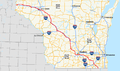
 US-2-(WI)-map.png 960 × 569; 312 KB
-
 US 8 map.svg 1,027 × 609; 1.37 MB
-
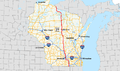
 US-10-(WI)-map.png 960 × 569; 403 KB
-
 US-12-(WI)-map.png 960 × 569; 366 KB
-
 US-14-(WI)-map.png 960 × 569; 291 KB
-
 US-18-(WI)-map.png 960 × 569; 317 KB
-
 US-41-(WI)-map.png 960 × 569; 338 KB
-
 US-45-(WI)-map.png 960 × 569; 420 KB
-
 US-51-(WI)-map.png 960 × 569; 406 KB
-
 US-53-(WI)-map.png 906 × 537; 378 KB
-
 US 141 map.svg 1,028 × 610; 2.48 MB
-
 US-151-(WI)-map.png 800 × 474; 90 KB
-map.png)

-map.png)
-map.png)
-map.png)
-map.png)
-map.png)
-map.png)
-map.png)
-map.png)

-map.png)