Category:Road signs in Arizona
States of the United States: Alabama · Alaska · Arizona · Arkansas · California · Colorado · Connecticut · Delaware · Florida · Georgia · Hawaii · Idaho · Illinois · Indiana · Iowa · Kansas · Kentucky · Louisiana · Maine · Maryland · Massachusetts · Michigan · Minnesota · Mississippi · Missouri · Montana · Nebraska · Nevada · New Hampshire · New Jersey · New Mexico · New York · North Carolina · North Dakota · Ohio · Oklahoma · Oregon · Pennsylvania · Rhode Island · South Carolina · South Dakota · Tennessee · Texas · Utah · Vermont · Virginia · Washington · West Virginia · Wisconsin · Wyoming – District of Columbia: Washington, D.C.
Guam · Puerto Rico
Guam · Puerto Rico
Subcategories
This category has the following 25 subcategories, out of 25 total.
Media in category "Road signs in Arizona"
The following 48 files are in this category, out of 48 total.
-
 1-40 in November 28-2009 - panoramio.jpg 3,264 × 2,448; 1.79 MB
-
 2013, Elephant Curve, Yarnell Grade - panoramio (1).jpg 6,000 × 4,000; 6.78 MB
-
 APPROACHING PHOENIX - NARA - 544032.jpg 3,000 × 2,023; 967 KB
-
 Arizona 1989 02.jpg 1,048 × 692; 495 KB
-
 Arizona 1989 05.jpg 971 × 645; 697 KB
-
 Arizona 1989 06.jpg 1,008 × 701; 439 KB
-
 Arizona Centennial Sign.JPG 4,320 × 3,240; 4.33 MB
-
 Arizona, carteles 1989 04.jpg 1,042 × 658; 336 KB
-
 Arizona, Glen Canyon Dam, No Trespassing sign.jpg 4,681 × 3,110; 4.45 MB
-
 Arizona, varios 1989 08.jpg 681 × 1,028; 505 KB
-
 Arizona, varios 1989 13.jpg 1,017 × 665; 735 KB
-
 AZ-347-North.jpg 2,048 × 1,536; 1.89 MB
-
 Benson Underpass Signage.png 1,603 × 1,019; 1.97 MB
-
 Cienega Creek Natural Preserve Signs Arizona 2014.jpg 4,608 × 3,456; 2.8 MB
-

-
 Entering Hualapai Indian Reservation.jpg 197 × 122; 7 KB
-
 Entering Prescott Sign.jpg 3,496 × 4,656; 5.49 MB
-
 Entering White Mountain Apache Indian Reservation.jpg 214 × 141; 10 KB
-
 Exit 359 Interstate 40 Lupton, AZ 86508 - panoramio (3).jpg 3,205 × 1,997; 1.69 MB
-
 Highway signs in Benson.png 516 × 362; 228 KB
-
 I10-Arizona.jpg 1,935 × 1,575; 257 KB
-
 JollyRoad.JPG 3,888 × 2,592; 2.41 MB
-
 Logo Signs Loop 202 Chandler.jpg 3,200 × 1,800; 1.26 MB
-
 Manhitchhikingnearprison.png 482 × 361; 534 KB
-
 No Camping...No Campfires! (2346142017).jpg 1,557 × 1,038; 611 KB
-
 No Unattended Dogs in Flagstaff.jpg 2,000 × 1,333; 578 KB
-
 Parks(AZ)RAguidesign.jpg 2,592 × 1,944; 1.32 MB
-
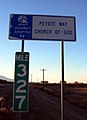 PeyoteWayCleanHwy.jpg 723 × 1,000; 124 KB
-
-
 Route 66 road signal.JPG 2,304 × 1,728; 607 KB
-
 Route 66, don't forget Winona - panoramio.jpg 4,608 × 3,456; 3.55 MB
-
 RunawayTruckRamp.jpg 1,600 × 1,200; 380 KB
-
 Santa Cruz River Bridge 8166 from W 1.JPG 2,149 × 1,380; 948 KB
-
 Seligman (66 Rd).jpg 3,240 × 4,320; 4.63 MB
-
 Seligman, Arizona, GoWest-USA (1).jpg 3,024 × 2,268; 1.72 MB
-
 Seligman, Arizona, GoWest-USA (2).jpg 2,793 × 4,271; 1.97 MB
-
 Seligman1.jpg 4,320 × 3,240; 5.66 MB
-
 Standin on the cornerpark.jpg 2,592 × 1,944; 2.18 MB
-
 The Meteor Crater road signs.jpg 3,888 × 2,592; 2.69 MB
-
 Tombstone Arizona Sign.jpg 5,184 × 3,456; 6.24 MB
-
 Tucson 4th Avenue underpass from S 1.JPG 2,560 × 1,180; 1.17 MB
-
 Tucson solar city sign.JPG 1,296 × 972; 579 KB
-
 US60 West Sign at Superstition Springs (49160721281).jpg 3,600 × 2,400; 4.01 MB
-
 Watch for animals.JPG 3,200 × 2,400; 1.33 MB
-
 Which way 2.jpg 3,644 × 2,574; 2.24 MB
-
 Winona, AZ sign off Interstate 40.jpg 6,000 × 4,000; 13.81 MB
-
 WinonaBridge WinonaAZ.jpg 960 × 648; 332 KB
-
 Yarnell Arizona.JPG 3,648 × 2,736; 3.96 MB

.jpg)


.jpg)


.jpg)

RAguidesign.jpg)


.jpg)
.jpg)
.jpg)


.jpg)


