Category:Road signs in Coffee County, Georgia
Counties of Georgia: Appling · Atkinson · Bacon · Baker · Banks · Barrow · Bartow · Ben Hill · Berrien · Brantley · Brooks · Bryan · Butts · Calhoun · Camden · Carroll · Catoosa · Charlton · Chatham · Chattooga · Cherokee · Clay · Clayton · Clinch · Cobb · Coffee · Colquitt · Columbia · Cook · Coweta · Crawford · Crisp · Dade · Dawson · Decatur · DeKalb · Dodge · Dooly · Dougherty · Douglas · Early · Effingham · Evans · Floyd · Forsyth · Franklin · Fulton · Gilmer · Glynn · Gordon · Grady · Greene · Gwinnett · Habersham · Hall · Haralson · Harris · Hart · Henry · Houston · Irwin · Jasper · Jeff Davis · Jefferson · Lamar · Lanier · Laurens · Lee · Liberty · Long · Lowndes · Lumpkin · Macon · Madison · Marion · McIntosh · Miller · Mitchell · Monroe · Montgomery · Murray · Peach · Pierce · Pike · Polk · Pulaski · Putnam · Randolph · Rockdale · Schley · Seminole · Spalding · Stephens · Stewart · Sumter · Talbot · Tattnall · Taylor · Telfair · Terrell · Thomas · Tift · Toombs · Towns · Treutlen · Troup · Turner · Upson · Walker · Ware · Wayne · Wheeler · White · Whitfield · Wilcox · Worth
City-counties: Athens–Clarke · Augusta–Richmond · Columbus–Muscogee · Georgetown–Quitman · Macon–Bibb · Preston–Webster · Statenville–Echols
City-counties: Athens–Clarke · Augusta–Richmond · Columbus–Muscogee · Georgetown–Quitman · Macon–Bibb · Preston–Webster · Statenville–Echols
Subcategories
This category has only the following subcategory.
Media in category "Road signs in Coffee County, Georgia"
The following 54 files are in this category, out of 54 total.
-
 Ambrose City limit GA268EB.jpg 5,184 × 3,456; 9.51 MB
-
 Atkinson County border, GA64WB.JPG 5,152 × 3,864; 7.93 MB
-
 Bacon County border, GA32EB.JPG 5,152 × 3,864; 7.94 MB
-
 Bacon County Sign (32785395261).jpg 1,600 × 2,400; 1.46 MB
-
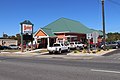 Bobby's Treat Shop, Douglas.jpg 5,184 × 3,456; 7.48 MB
-
 Bridgetown community sign, Bridgetown Rd, Coffee County.jpg 5,184 × 3,456; 7.05 MB
-
 Broxton city limit, US441SB.JPG 4,608 × 3,456; 4.98 MB
-
 Broxton limit GA268 EB.jpg 5,184 × 3,456; 8.53 MB
-
 Citizens Christian Academy, Douglas.jpg 5,184 × 3,456; 5.81 MB
-
 Coffee County border, GA32WB.jpg 5,152 × 3,864; 8 MB
-
 Coffee County border, GA64EB.JPG 5,152 × 3,864; 7.95 MB
-
 Coffee County border, Ocmulgee River bridge, US319SB.JPG 4,608 × 3,456; 4.74 MB
-
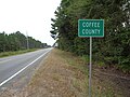
 Coffee County Sign (32868735336).jpg 1,600 × 2,400; 3.81 MB
-
 Douglas City limit, US441SB.JPG 4,608 × 3,456; 5.57 MB
-
 Douglas limit US32 EB.jpg 5,184 × 3,456; 6.52 MB
-
 GA 268 EB MM0.jpg 5,184 × 3,456; 6.49 MB
-
 GA107 turn left, US441N.jpg 5,184 × 3,456; 5.55 MB
-
 GA158 NB at Ameris Dr.jpg 5,184 × 3,456; 5.58 MB
-
 GA206 Conn WB end.jpg 5,184 × 3,456; 10.01 MB
-
 GA206 end, Douglas.jpg 5,184 × 3,456; 7.73 MB
-
 GA206 GA268 EB Intersection.jpg 5,184 × 3,456; 6.11 MB
-
 GA268 railroad crossing, Ambrose.jpg 5,184 × 3,456; 7.68 MB
-
 GA32 GA268 EB Intersection.jpg 5,184 × 3,456; 6.95 MB
-
 GA90 NB Irwin County.jpg 5,184 × 3,456; 6.29 MB
-
 GA90 SB at GA158 Coffee County border.jpg 5,184 × 3,456; 4.42 MB
-
 GA90 SB Atkinson County 2024.jpg 5,184 × 3,456; 5.44 MB
-
 GA90 SB Atkinson County.jpg 5,184 × 3,456; 5.45 MB
-
 GA90 SB Willacoochee 9 miles Coffee County.jpg 5,184 × 3,456; 5.3 MB
-
 Georgia State Route 206 268 intersection.jpg 5,184 × 3,456; 9.14 MB
-
 Georgia State Route 268 begin at GA32.jpg 5,184 × 3,456; 9.71 MB
-
 Georgia State Route 268 end at GA32.jpg 5,184 × 3,456; 8.51 MB
-
 Georgia State Route 64, eastern terminus.JPG 5,152 × 3,864; 7.85 MB
-
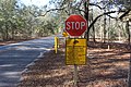
 Gopher Tortoise crossing sign, General Coffee State Park.jpg 5,184 × 3,456; 9.2 MB
-
 Halls Creek, GA268 EB, Coffee County.jpg 5,184 × 3,456; 5.33 MB
-
 J.H. Milhollin Memorial Bridge, US441N.jpg 5,184 × 3,456; 5.67 MB
-
 JC 206 on GA268 EB.jpg 5,184 × 3,456; 5.05 MB
-
 NB Broxton City limit, GA268 EB.jpg 5,184 × 3,456; 5.49 MB
-
 NB Telfair County, Ocmulgee River.jpg 5,184 × 3,456; 5.46 MB
-
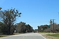
 Nicholls city limit, S Liberty St NB.JPG 5,152 × 3,864; 7.9 MB
-
 Ocmulgee River Water Trail, Mobley Bluff Landing Ben Hill County, US441N.jpg 5,184 × 3,456; 5.05 MB
-
 Pridgen community US441 NB.jpg 5,184 × 3,456; 9.98 MB
-
 Pridgen limit, US441SB.JPG 4,608 × 3,456; 3.7 MB
-
 Roses Creek, GA268 EB, Coffee County.jpg 5,184 × 3,456; 5.01 MB
-
 Sandhill Management Area sign, General Coffee State Park.jpg 5,184 × 3,456; 10.63 MB
-
 Telfair County US319NB.jpg 5,184 × 3,456; 6.98 MB
-
 US319 SB GA 107 WB Ben Hill County.jpg 5,184 × 3,456; 6.53 MB
-
 US319 SB Jct GA107 WB.jpg 5,184 × 3,456; 5.69 MB
-
 US319 SB Mobley Bluff Landing.jpg 5,184 × 3,456; 5.56 MB
-
 US441 GA31 SB GA107 EB, US319 SB GA107 WB turn right.jpg 5,184 × 3,456; 5.14 MB
-
 US441 SB, US319 SB turn right.jpg 5,184 × 3,456; 5.3 MB
-
 US441N GA31N GA107W MM27.jpg 5,184 × 3,456; 5.33 MB
-
 US441N GA31N GA107W.jpg 5,184 × 3,456; 5.28 MB
-
 US441N GA31N, Broxton.jpg 5,184 × 3,456; 6.88 MB
-
 US441N US319N GA31N, US319S GA107W turn left.jpg 5,184 × 3,456; 4.97 MB


.jpg)


.jpg)


