Category:Road signs in the Metropolitan Borough of Kirklees
Media in category "Road signs in the Metropolitan Borough of Kirklees"
The following 12 files are in this category, out of 12 total.
-

-

-
 Ainley Top Rbt Sign 2016.jpg 2,069 × 1,441; 1.5 MB
-
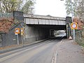 Bridge MVN2 207 02 - Forge Lane - geograph.org.uk - 4241621.jpg 640 × 480; 82 KB
-
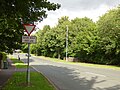 Church Lane, Birstall - geograph.org.uk - 5484309.jpg 1,024 × 768; 867 KB
-

-
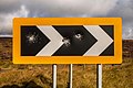
 Dangerous bend near Nether End - geograph.org.uk - 99644.jpg 640 × 426; 111 KB
-
 Milestone (from the east), Longwood Common - geograph.org.uk - 4450817.jpg 1,024 × 768; 174 KB
-
 Old sign - geograph.org.uk - 2194698.jpg 427 × 640; 59 KB
-
 Sat Nav Wrong Use Brain sign, Tyas Lane, Slaithwaite.jpg 1,381 × 2,071; 2.92 MB
-

-
 Take That^ - geograph.org.uk - 4111027.jpg 3,888 × 2,592; 1.72 MB


,_Longwood_Common_-_geograph.org.uk_-_4450817.jpg)


