Category:Road signs in the United States photographed in 2024
Media in category "Road signs in the United States photographed in 2024"
The following 181 files are in this category, out of 181 total.
-
 Advent Christian Village distance road sign, CR53nb, Lafayette County.jpg 5,184 × 3,456; 4.98 MB
-
 Camp Grade Rd bridge over Steinhatchee River looking east.jpg 5,184 × 3,456; 7.36 MB
-
 Camp Grade Rd bridge over Steinhatchee River looking west.jpg 5,184 × 3,456; 8.42 MB
-
 Cooks Hammock sign, FL51nb.jpg 5,184 × 3,456; 6.95 MB
-
 Directional road sign, Mayo.jpg 5,184 × 3,201; 4.57 MB
-
 Directional road sign, Northbound S Court St Quitman facing courthouse.jpg 5,184 × 3,456; 5.69 MB
-
 Distance road sign east of Quitman, US 84, Valdosta 18 Homerville 51.jpg 5,184 × 3,456; 5.16 MB
-
 Dixie County, FL51nb.jpg 5,184 × 3,456; 4.84 MB
-
 Drifton, US19SB Jefferson County.jpg 5,184 × 3,456; 5.8 MB
-
 Eastbound Screven and Washington St intersection, Quitman.jpg 5,184 × 3,456; 5.28 MB
-
 EB I-10 Enters Columbia County from Suwannee County.jpg 4,608 × 3,456; 3.51 MB
-
 EB I-10 Madison Co Rest Area-02.jpg 2,774 × 2,195; 916 KB
-
 EB I-10 Madison Co Rest Area-03.jpg 4,608 × 3,456; 3.65 MB
-
 EB I-10 Madison Co Rest Area-04.jpg 3,622 × 1,733; 953 KB
-
 EB I-10 Madison Co Truck Weigh Station-01.jpg 4,608 × 3,456; 3.79 MB
-
 EB I-10 Madison Co Truck Weigh Station-02.jpg 4,608 × 3,456; 3.72 MB
-
 EB I-10 Madison Co Truck Weigh Station-04.jpg 4,608 × 3,456; 3.99 MB
-
 EB I-10 Suwanee Co Rest Area; 2 Miles.jpg 4,608 × 3,456; 3.79 MB
-
 EB I-10 Suwanee Co Rest Area; Cars vs Truck Parking.jpg 4,608 × 3,456; 3.67 MB
-
 EB I-10 Suwanee Co Rest Area; Gore Sign.jpg 4,608 × 3,456; 3.63 MB
-
 EB I-10 Suwanee Co Rest Area; Next Right.jpg 4,608 × 3,456; 3.8 MB
-
 EB I-10 Suwanee Co Rest Area; Tandem Truck Parking Sign-1.jpg 4,608 × 3,456; 3.97 MB
-
 EB I-10 Suwanee Co Rest Area; Tandem Truck Parking Sign-2.jpg 4,608 × 3,456; 4.43 MB
-
 EB I-10 Suwanee Co Rest Area; Truck Parking Gore-1.jpg 4,608 × 3,456; 3.58 MB
-
 EB I-10 Suwanee Co Rest Area; Truck Parking Gore-2.jpg 4,608 × 3,456; 3.76 MB
-
 EB I-10 Suwanee Co Rest Area; Truck Parking.jpg 4,608 × 3,456; 3.68 MB
-
 EB I-10; Jct I-75; 4 Miles.jpg 4,608 × 3,456; 3.82 MB
-
 Exiting WB I-10 Columbia Co Rest Area-1.jpg 4,608 × 3,456; 3.68 MB
-
 Exiting WB I-10 Columbia Co Rest Area-2.jpg 4,608 × 3,456; 3.67 MB
-
 FL222eb at I75NB.jpg 5,184 × 3,456; 4.24 MB
-
 FL222wb at I75NB.jpg 5,184 × 3,456; 4.65 MB
-
 FL222wb at I75SB.jpg 5,184 × 3,456; 4.67 MB
-
 FL263nb I10eb onramp.jpg 5,184 × 3,456; 4.69 MB
-
 FL267nb before I10 direction sign.jpg 5,184 × 3,456; 5.01 MB
-
 FL267sb I10eb direction sign.jpg 5,184 × 3,456; 5.22 MB
-
 Florida I10eb distance Tallahassee 20.jpg 5,184 × 3,456; 4.22 MB
-
 Florida I10eb Exit 192 2024.jpg 5,184 × 3,456; 4.86 MB
-
 Florida I10eb Exit 192 next right.jpg 5,184 × 3,456; 4.22 MB
-
 Florida I10eb Exit 196 2 miles 2024.jpg 5,184 × 3,456; 4.34 MB
-
 Florida I10eb Exit 199 2024.jpg 5,184 × 3,456; 4.57 MB
-
 Florida I10eb Exit 199 exit only.jpg 5,184 × 3,456; 4.46 MB
-
 Florida I10eb Exit 203 1 mile 2024.jpg 5,184 × 3,456; 4.98 MB
-
 Florida I10eb Exit 203 2 miles 2024.jpg 5,184 × 3,456; 5.11 MB
-
 Florida I10eb Exit 203 2024.jpg 5,184 × 3,456; 4.84 MB
-
 Florida I10eb Exit 203 exit only.jpg 5,184 × 3,456; 4.85 MB
-
 Florida I10eb Exit 203 Maclay Gardens.jpg 5,184 × 3,456; 4.98 MB
-
 Florida I10eb Exit 203 off ramp Thomasville Rd gantry.jpg 5,184 × 3,456; 4.2 MB
-
 Florida I10eb Exit 203 Thomasville Tallahassee.jpg 5,184 × 3,456; 4.83 MB
-
 Florida I10wb Distance Pensacola 178.jpg 5,184 × 3,251; 4.1 MB
-
 Florida I10wb Distance Pensacola 191.jpg 5,184 × 3,456; 5.38 MB
-
 Florida I10wb distance road sign Tallahassee 14.jpg 5,184 × 3,456; 5.05 MB
-
 Florida I10wb distance road sign Tallahassee 22.jpg 5,184 × 3,456; 5.44 MB
-
 Florida I10wb Exit 181 1 mile 2024.jpg 5,184 × 3,456; 4.75 MB
-
 Florida I10wb Exit 181 Lake Talquin State Forest.jpg 5,184 × 3,456; 5.25 MB
-
 Florida I10wb Exit 181 offramp.jpg 5,184 × 3,456; 4.91 MB
-
 Florida I10wb Exit 192 1 mile 2024.jpg 5,184 × 3,456; 5.04 MB
-
 Florida I10wb Exit 192 ahead.jpg 5,184 × 3,456; 5 MB
-
 Florida I10wb Exit 196 1 mile.jpg 5,184 × 3,456; 4.99 MB
-
 Florida I10wb Exit 196 2024.jpg 5,184 × 3,456; 5.04 MB
-
 Florida I10wb Exit 196 ahead.jpg 5,184 × 3,456; 4.85 MB
-
 Florida I10wb Exit 196 offramp Capital Circle direction signs.jpg 5,184 × 3,456; 4.9 MB
-
 Florida I10wb Exit 196 offramp Havana direction sign.jpg 5,184 × 3,456; 5.11 MB
-
 Florida I10wb Exit 196 TCC.jpg 5,184 × 3,456; 5.32 MB
-
 Florida I10wb Exit 199 2024.jpg 5,184 × 3,456; 4.9 MB
-
 Florida I10wb Exit 199 ahead.jpg 5,184 × 3,456; 4.99 MB
-
 Florida I10wb Exit 203 1 mile.jpg 5,184 × 3,456; 5.05 MB
-
 Florida I10wb Exit 203 ahead.jpg 5,184 × 3,456; 5.66 MB
-
 Florida I10wb Exit 203 Tallahassee Thomasville.jpg 5,184 × 3,456; 4.86 MB
-
 Florida I10wb Exit 209 1 mile.jpg 5,184 × 3,456; 5.36 MB
-
 Florida I10wb Exit 209B 2024.jpg 5,184 × 3,456; 5.18 MB
-
 Florida I10wb Exit 217 1 mile.jpg 5,184 × 3,456; 4.85 MB
-
 Florida I10wb Exit 217 right.jpg 5,184 × 3,456; 5.98 MB
-
 Florida I10wb Exit Ochlockonee River.jpg 5,184 × 3,456; 4.58 MB
-
 Florida I10wb Florida Universities second right.jpg 5,184 × 3,456; 4.63 MB
-
 Florida I10wb Leon County 2024.jpg 5,184 × 3,456; 4.67 MB
-
 Florida I10wb Tallahassee City limit 2024.jpg 5,184 × 3,456; 5.27 MB
-
 Florida I75nb Alapaha River.JPG 5,184 × 3,456; 5.07 MB
-
 Florida I75nb County Rd 132 Overpass.JPG 5,184 × 3,456; 4.36 MB
-
 Florida I75nb County Rd 249 Overpass.JPG 5,184 × 3,456; 4.46 MB
-
 Florida I75nb CR18 Overpass.JPG 5,184 × 3,456; 5.12 MB
-
 Florida I75nb CR235A Overpass.JPG 5,184 × 3,456; 5.05 MB
-
 Florida I75nb CR349 Overpass.JPG 5,184 × 3,456; 4.56 MB
-
 Florida I75nb Exit 427 .5 mile.jpg 5,184 × 3,456; 4.49 MB
-
 Florida I75nb Exit 427 1 mile.JPG 5,184 × 3,456; 4.23 MB
-
 Florida I75nb Exit 435 .5 mile.jpg 5,184 × 3,456; 4.22 MB
-
 Florida I75nb Exit 435 2 miles.JPG 5,184 × 3,456; 4.05 MB
-
 Florida I75nb Exit 439 2024.jpg 5,184 × 3,456; 4.36 MB
-
 Florida I75nb Exit 460 2 miles 2024.jpg 5,184 × 3,456; 4.84 MB
-
 Florida I75nb Exit Nash Rd Overpass.JPG 5,184 × 3,456; 4.42 MB
-
 Florida I75nb Hamilton County line.JPG 5,184 × 3,456; 4.27 MB
-
 Florida I75nb Lake City 14 miles.jpg 5,184 × 3,456; 4.33 MB
-
 Florida I75nb Lake City 22 miles.jpg 5,184 × 3,456; 4.69 MB
-
 Florida I75nb Lake City city limit.JPG 5,184 × 3,456; 4.43 MB
-
 Florida I75nb rest area 20161 1 mile.jpg 5,184 × 3,456; 4.68 MB
-
 Florida I75nb rest area 20161 2 miles.jpg 5,184 × 3,456; 4.76 MB
-
 Florida I75nb rest area 20161 exit 2024.jpg 5,184 × 3,456; 4.64 MB
-
 Florida I75nb Suwannee County line.JPG 5,184 × 3,456; 4.58 MB
-
 Florida I75nb Suwannee River.JPG 5,184 × 3,456; 4.35 MB
-
 Florida I75sb Alachua city limit.jpg 5,184 × 3,456; 4.15 MB
-
 Florida I75SB CR232 Overpass closer.jpg 5,184 × 3,456; 4.1 MB
-
 Florida I75sb CR235A Overpass.jpg 5,184 × 3,456; 4.17 MB
-
 Florida I75sb CR241 Overpass.jpg 5,184 × 3,456; 4.11 MB
-
 Florida I75sb Exit 390 1 mile.jpg 5,184 × 3,456; 3.99 MB
-
 Florida I75sb Exit 390 Santa Fe College.jpg 5,184 × 3,456; 4.37 MB
-
 Florida I75sb Exit 399.jpg 5,184 × 3,456; 4.2 MB
-
 Florida US441nb Micanopy city limit.jpg 5,184 × 3,456; 6.23 MB
-
 GA135 SB Direction road sign before GA168.jpg 5,184 × 3,245; 4.08 MB
-
 GA135 SB John Wayne Spivey Bridge.jpg 5,184 × 3,456; 4.04 MB
-
 GA90 SB at GA158 Coffee County border.jpg 5,184 × 3,456; 4.42 MB
-
 GA90 SB directional sign US129, Irwin County.jpg 5,184 × 3,456; 4.65 MB
-
 GA90 SB distance sign LAX, Ocilla.jpg 5,184 × 3,456; 4.62 MB
-
 GA90 SB Willacoochee 9 miles Coffee County.jpg 5,184 × 3,456; 5.3 MB
-
 GA90 SB Willacoochee city limit 2024.jpg 5,184 × 3,456; 4.54 MB
-
 GA94 EB, Clinch County just before Fargo city limits.jpg 5,184 × 3,456; 4.59 MB
-
 GA94 EB, Clinch County, Fargo city limits.jpg 5,184 × 3,456; 4.81 MB
-
 GA94 EB, Clinch County, Suwannoochee Creek.jpg 5,184 × 3,456; 4.11 MB
-
 GA94 EB, Echols County, direction road sign Statenville Howell Jennings.jpg 5,184 × 3,456; 4.86 MB
-
 GA94 EB, Echols County, distance road sign Statenville 1 Fargo 30.jpg 5,184 × 3,456; 5.32 MB
-
 GA94 EB, Echols County, Statenville Unincorporated Alapaha River.jpg 5,184 × 3,456; 4.24 MB
-
 GA94 EB, Echols County, Stephen C. Foster State Park direction sign.jpg 5,184 × 3,456; 4.63 MB
-

-
 GA94 US129 intersection, Statenville.jpg 5,184 × 3,456; 4.54 MB
-
 GA94 WB, Echols County, direction road sign Valdosta Naylor Lakeland.jpg 5,184 × 3,456; 5.39 MB
-
 GA94 WB, Echols County, distance road sign Valdosta 15 Morven30.jpg 5,184 × 3,456; 4.92 MB
-
 GA94 WB, Echols County, distance road sign Valdosta 18 Morven 32.jpg 5,184 × 3,456; 5.26 MB
-
 Georgia I75nb Exit 13 .5 mile 2024.jpg 5,184 × 3,456; 4.41 MB
-
 Georgia I75nb Exit 13 1 mile 2024.jpg 5,184 × 3,456; 4.18 MB
-
 Georgia I75nb Exit 13 2024.jpg 5,184 × 3,456; 4.56 MB
-
 Georgia I75nb Exit 16 1 mile 2024.jpg 5,184 × 3,456; 4.42 MB
-
 Georgia I75nb Exit 2 1 mile 2024.jpg 5,184 × 3,456; 4.09 MB
-
 Georgia I75nb Exit 2 2024.jpg 5,184 × 3,456; 4.05 MB
-
 Georgia I75nb Exit 22 .5 mile.JPG 4,320 × 3,240; 4.45 MB
-
 Georgia I75nb Lowndes County border 2024.jpg 5,184 × 3,456; 4.02 MB
-
 Georgia I75nb Old Clyattville Rd Overpass 2024.jpg 5,184 × 3,456; 4.34 MB
-
 Georgia I75sb Exit 11 .5 mile.JPG 5,184 × 3,456; 4.76 MB
-
 Georgia I75sb Exit 16 .5 mile.jpg 5,184 × 3,456; 4.64 MB
-
 Georgia I75sb Exit 16 1 mile.jpg 5,184 × 3,456; 4.62 MB
-
 Georgia I75sb Exit 16.jpg 5,184 × 3,456; 4.39 MB
-
 Georgia I75sb Exit 18 .5 mile.jpg 5,184 × 3,456; 4.31 MB
-
 Georgia I75sb Exit 18 1 mile.jpg 5,184 × 3,456; 4.76 MB
-
 Georgia I75sb Exit 18.jpg 5,184 × 3,456; 4.35 MB
-
 Georgia I75sb Exit 2 .5 mile closer.jpg 5,184 × 3,456; 4.22 MB
-
 Georgia I75sb Exit 2 closer.jpg 5,184 × 3,456; 4.22 MB
-
 Georgia I75sb Exit 32 .5 mile.JPG 5,184 × 3,456; 4.35 MB
-
 Georgia I75sb Exit 32 1 mile.JPG 4,320 × 3,240; 4.5 MB
-
 Georgia I75sb GA133 Overpass.jpg 5,184 × 3,456; 4.23 MB
-
 Georgia I75sb Withlacoochee River.jpg 5,184 × 3,456; 4.29 MB
-
 Hamilton County Inspection Station 1 mile.jpg 5,184 × 3,456; 4.58 MB
-
 Hamilton County Inspection Station Bypass when flashing sign.jpg 5,184 × 3,456; 4.23 MB
-
 Jct Lafayette CR251, 350 road signs.jpg 5,184 × 3,456; 4.34 MB
-
 Jena road sign.jpg 5,184 × 3,456; 6.4 MB
-
 Lafayette CR251, 350 road signs.jpg 5,184 × 3,456; 4.86 MB
-
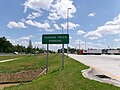
 Lakeland city limit GA135 SB.jpg 5,184 × 3,372; 4.25 MB
-
 Lee city limit, CR255NB 2024.jpg 5,184 × 3,456; 5.05 MB
-
 Little River Water Trail, GA37 Cook County.jpg 5,184 × 3,456; 4.1 MB
-
 Mayo 22 distance sign, FL51nb.jpg 5,184 × 3,456; 5.03 MB
-
 NB FL 121 in MacClenny; St George 17-Folkston 42.jpg 3,648 × 2,736; 2.1 MB
-
 NB FL 121; FL 222 Directional Signs in Gainesville.jpg 3,648 × 2,736; 2.06 MB
-
 NB GA 121-23 in St George, Georgia-09.jpg 3,648 × 2,736; 2.09 MB
-
 NB US 27; First Sign West of US 19.jpg 4,608 × 3,456; 3.76 MB
-
 School Zone, FL57A US19SB T Intersection, Jefferson County.jpg 5,184 × 3,456; 4.95 MB
-
 South Canal Rd wooden bridge over Steinhatchee River straight.jpg 5,184 × 3,456; 9.17 MB
-
 South Canal Rd wooden bridge over Steinhatchee River weight limit.jpg 5,184 × 3,456; 9.28 MB
-
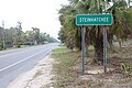
 Steinhatchee distance sign, FL51sb.jpg 5,184 × 3,456; 4.5 MB
-
 Steinhatchee road sign, FL51sb.jpg 5,184 × 3,456; 7.44 MB
-
 Taylor County, FL51sb.jpg 5,184 × 3,456; 5.41 MB
-
 Tennille, FL51nb.jpg 5,184 × 3,456; 9.74 MB
-
 US129 NB Distance road sign after GA158.jpg 5,184 × 3,456; 4 MB
-
 US19SB at Interstate 10, Jefferson County.jpg 5,184 × 3,456; 5.08 MB
-
 Valdosta City Limit, Madison Highway NB.jpg 5,184 × 3,456; 5.67 MB
-
 WB I-10 Columbia Co Rest Area-02.jpg 4,608 × 3,456; 3.75 MB
-
 WB I-10 Columbia Co Rest Area-03.jpg 4,608 × 3,456; 3.78 MB
-
 WB I-10 Columbia Co Rest Area-04.jpg 4,608 × 3,456; 3.84 MB
-
 WB I-10 Columbia Co Rest Area-05.jpg 4,608 × 3,456; 3.48 MB
-
 WB I-10 Columbia Co Rest Area-06.jpg 4,608 × 3,456; 3.51 MB
-
 WB I-10 Columbia Co Rest Area-07.jpg 1,845 × 878; 382 KB
-
 WB I-10 Columbia Co Rest Area; Half-Mile.jpg 4,608 × 3,456; 3.66 MB
-
 WB I-10 Columbia Co Rest Area; Tandem Truck Parking Sign-1.jpg 4,608 × 3,456; 3.63 MB
-
 WB I-10 Columbia Co Rest Area; Tandem Truck Parking Sign-2.jpg 4,608 × 3,456; 3.75 MB
-
 WB I-10 Enters Suwannee County from Columbia County.jpg 4,608 × 3,456; 3.94 MB
-
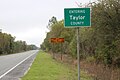
 Welcome to Lowndes County, NW16th Ave, Hamilton County, Florida.jpg 5,184 × 3,456; 9.31 MB


