Category:Roads in Plymouth Township, Montgomery County, Pennsylvania
Media in category "Roads in Plymouth Township, Montgomery County, Pennsylvania"
The following 79 files are in this category, out of 79 total.
-

-

-

-

-

-

-

-

-

-

-

-

-

-

-
-

-

-

-

-
-

-
-

-

-

-

-

-

-

-

-

-

-

-
 Butler Pike NB at Cold Point Hill.jpg 1,764 × 1,305; 664 KB
-
 Butler Pike NB at PA Turnpike.jpg 1,851 × 1,389; 655 KB
-
 Butler Pike NB at Plymouth-Flourtown Rd.JPG 2,592 × 1,944; 800 KB
-
 Butler Pike NB at Trenton Cutoff.jpg 1,782 × 1,371; 773 KB
-
 Butler Pike SB at Township Line Rd.jpg 1,788 × 1,287; 577 KB
-
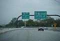
 Exit 20.JPG 1,024 × 769; 70 KB
-
 Germantown Pike WB past Plymouth Road.jpeg 4,032 × 3,024; 3.4 MB
-
 I-276 West - Exit 333 - Norristown (43704826762).jpg 2,400 × 1,600; 1.59 MB
-
 I-476 Bridge.jpg 3,024 × 4,032; 3.32 MB
-
 I-476 NB 0.25 mile to Ridge Pike.JPG 3,072 × 2,304; 505 KB
-
 I-476 NB 1 mile to Ridge Pike.JPG 3,072 × 2,304; 474 KB
-
 I-476 NB 2 miles to PA TPK.JPG 848 × 579; 37 KB
-
 I-476 NB at Ridge Pike EB exit.JPG 845 × 577; 47 KB
-
 I-476 NB at Ridge Pike WB exit.JPG 3,072 × 2,304; 464 KB
-
 I-476 NB on Pearl Harbor Memorial Bridge.JPG 851 × 581; 30 KB
-
 I-476 SB 1 mi to Ridge Pike.JPG 3,072 × 2,304; 435 KB
-
 I-476 SB 1000 feet to toll plaza.JPG 3,072 × 2,304; 464 KB
-
 I-476 SB 2 mi to I-76.JPG 851 × 581; 36 KB
-
 I-476 SB approaching Pearl Harbor Memorial Bridge.JPG 841 × 574; 36 KB
-
 I-476 SB at Ridge Pike exit.JPG 841 × 574; 34 KB
-
 I-476 SB on Pearl Harbor Memorial Bridge.JPG 844 × 576; 26 KB
-
 I-476 SB PA 23 sign.JPG 3,072 × 2,304; 395 KB
-
 I-476 signs on Ridge Pike.JPG 3,072 × 2,304; 2.72 MB
-
 Int276wRoad-Int476nsExitRampSigns (32776221254).jpg 2,400 × 1,600; 2.01 MB
-
 MCPC photos DSC 0012 (32833402573).jpg 6,016 × 4,000; 6.28 MB
-
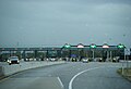
 Mid-County toll plaza SB.JPG 3,072 × 2,304; 461 KB
-
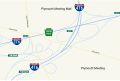 MidCounty interchange map.svg 806 × 538; 196 KB
-
 Norristown ramps to PA TPK.JPG 848 × 579; 39 KB
-
 NorristownExit.jpg 3,264 × 2,448; 1.86 MB
-
 PA TPK EB approaching Mid-County.JPG 3,072 × 2,304; 408 KB
-
 PA TPK EB at Mid-County 2.JPG 3,072 × 2,304; 422 KB
-
 PA TPK EB at Mid-County.JPG 3,072 × 2,304; 479 KB
-
 PA TPK EB past Mid-County.JPG 3,072 × 2,304; 464 KB
-
 PA TPK Norristown tollbooth.JPG 846 × 578; 34 KB
-
 PA TPK WB 0.5 mi to Norristown.JPG 843 × 576; 42 KB
-
 PA TPK WB across Schuylkill River.JPG 842 × 575; 35 KB
-
 PA TPK WB approaching Norristown.JPG 3,072 × 2,304; 454 KB
-
 PA TPK WB approaching Schuylkill River.JPG 847 × 578; 43 KB
-
 PA TPK WB at Mid-County.JPG 841 × 574; 43 KB
-
 PA TPK WB at Norristown.JPG 3,072 × 2,304; 443 KB
-
 PA TPK WB past Norristown.JPG 3,072 × 2,304; 457 KB
-
 Pearl Harbor Memorial Bridge.jpg 3,024 × 4,032; 3.14 MB
-
 Ridge Pike WB past Butler Pike.jpeg 4,032 × 3,024; 3.79 MB
-
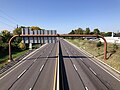
 Schuylkill River Bridge.jpg 3,264 × 2,448; 1.56 MB
-
 WB Mid-County ramp 0.5 mi to toll plaza.JPG 847 × 579; 36 KB
-
 WB Mid-County ramp split.JPG 841 × 574; 37 KB
_at_the_exit_for_Interstate_476_(Allentown,_Chester)_in_Plymouth_Township,_Montgomery_County,_Pennsylvania.jpg)
_at_Exit_333_(Norristown)_in_Plymouth_Township,_Montgomery_County,_Pennsylvania.jpg)
_just_west_of_Exit_333_in_Plymouth_Township,_Montgomery_County,_Pennsylvania.jpg)
_at_Exit_18A_(Conshohocken)_in_Plymouth_Township,_Montgomery_County,_Pennsylvania.jpg)
_at_Exit_18B_(Norristown)_in_Plymouth_Township,_Montgomery_County,_Pennsylvania.jpg)
_just_north_of_Exit_18B_in_Plymouth_Township,_Montgomery_County,_Pennsylvania.jpg)
_at_Exit_19_(Plymouth_Meeting)_in_Plymouth_Township,_Montgomery_County,_Pennsylvania.jpg)
_at_Exit_20_(Interstate_276_WEST,_Harrisburg,_Plymouth_Road)_in_Plymouth_Township,_Montgomery_County,_Pennsylvania.jpg)
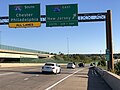
_at_the_exit_for_Interstate_276_EAST_(New_Jersey)_in_Plymouth_Township,_Montgomery_County,_Pennsylvania.jpg)
_just_north_of_Interstate_276_(Pennsylvania_Turnpike_Delaware_River_Extension)_in_Plymouth_Township,_Montgomery_County,_Pennsylvania.jpg)
_at_Exit_333_(Interstate_476_SOUTH,_Chester)_in_Plymouth_Township,_Montgomery_County,_Pennsylvania.jpg)
_at_the_exit_for_Interstate_476_NORTH_(Northeast_Extension,_Allentown)_in_Plymouth_Township,_Montgomery_County,_Pennsylvania.jpg)
_just_north_of_Interstate_276_(Pennsylvania_Turnpike_Delaware_River_Extension)_in_Plymouth_Township,_Montgomery_County,_Pennsylvania.jpg)
_at_the_exit_for_Interstate_276_WEST_(Harrisburg)_in_Plymouth_Township,_Montgomery_County,_Pennsylvania.jpg)
_at_the_exit_for_Interstate_276_EAST_(New_Jersey)_in_Plymouth_Township,_Montgomery_County,_Pennsylvania.jpg)
_between_Interstate_276_(Pennsylvania_Turnpike_Delaware_River_Extension)_and_Exit_18_in_Plymouth_Township,_Montgomery_County,_Pennsylvania.jpg)
_at_Exit_18_(Norristown)_in_Plymouth_Township,_Montgomery_County,_Pennsylvania.jpg)
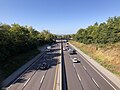
_from_the_overpass_for_Ridge_Pike_in_Plymouth_Township,_Montgomery_County,_Pennsylvania.jpg)
_from_the_overpass_for_Ridge_Pike_in_Plymouth_Township,_Montgomery_County,_Pennsylvania.jpg)
_from_the_overpass_for_Ridge_Pike_in_Plymouth_Township,_Montgomery_County,_Pennsylvania.jpg)
_from_the_overpass_for_Ridge_Pike_in_Plymouth_Township,_Montgomery_County,_Pennsylvania.jpg)
_from_the_overpass_for_Belvoir_Road_in_Plymouth_Township,_Montgomery_County,_Pennsylvania.jpg)
_from_the_overpass_for_Belvoir_Road_in_Plymouth_Township,_Montgomery_County,_Pennsylvania.jpg)
_from_the_overpass_for_the_ramps_to_Germantown_Pike_in_Plymouth_Township,_Montgomery_County,_Pennsylvania.jpg)
_from_the_overpass_for_the_ramps_to_Germantown_Pike_in_Plymouth_Township,_Montgomery_County,_Pennsylvania.jpg)
_from_the_overpass_for_Germantown_Pike_in_Plymouth_Township,_Montgomery_County,_Pennsylvania.jpg)
_from_the_overpass_for_Germantown_Pike_in_Plymouth_Township,_Montgomery_County,_Pennsylvania.jpg)
_from_the_overpass_for_Plymouth_Road_in_Plymouth_Township,_Montgomery_County,_Pennsylvania.jpg)
_from_the_overpass_for_Plymouth_Road_in_Plymouth_Township,_Montgomery_County,_Pennsylvania.jpg)
_from_the_overpass_for_Interstate_476_(Pennsylvania_Turnpike_Northeast_Extension)_in_Plymouth_Township,_Montgomery_County,_Pennsylvania.jpg)
_from_the_overpass_for_Interstate_476_(Pennsylvania_Turnpike_Northeast_Extension)_in_Plymouth_Township,_Montgomery_County,_Pennsylvania.jpg)
_from_the_overpass_for_Walton_Road_in_Plymouth_Township,_Montgomery_County,_Pennsylvania.jpg)
_from_the_overpass_for_Walton_Road_in_Plymouth_Township,_Montgomery_County,_Pennsylvania.jpg)


.jpg)


.jpg)
.jpg)


