Category:Rock formations in Montana
States of the United States: Alabama · Alaska · Arizona · Arkansas · California · Colorado · Connecticut · Delaware · Florida · Georgia · Hawaii · Idaho · Illinois · Indiana · Iowa · Kansas · Kentucky · Louisiana · Maine · Maryland · Massachusetts · Michigan · Minnesota · Mississippi · Missouri · Montana · Nebraska · Nevada · New Hampshire · New Jersey · New Mexico · New York · North Carolina · North Dakota · Ohio · Oklahoma · Oregon · Pennsylvania · Rhode Island · South Carolina · South Dakota · Tennessee · Texas · Utah · Vermont · Virginia · Washington · West Virginia · Wisconsin · Wyoming – Washington, D.C.
American Samoa · Northern Mariana Islands
American Samoa · Northern Mariana Islands
Subcategories
This category has the following 19 subcategories, out of 19 total.
.
B
- Bedrock benches in Montana (5 F)
C
D
K
M
O
R
- Ringing Rocks (Montana) (5 F)
- Rock glaciers in Montana (2 F)
- Rockfall scars in Montana (1 F)
T
- The Chinese Wall (Montana) (6 F)
- Tower Rock (Montana) (15 F)
V
Media in category "Rock formations in Montana"
The following 28 files are in this category, out of 28 total.
-

-
 Gates of the Mountains 10.JPG 4,457 × 3,272; 5.75 MB
-
 Gates of the Mountains opening 02.jpg 4,608 × 3,456; 4.7 MB
-
 Gates of the Mountains5.JPG 4,479 × 3,350; 4.43 MB
-
 Gates of the Mountains Pictographs.JPG 4,608 × 3,456; 7.05 MB
-
 Gates of the Mountains1.JPG 4,608 × 3,456; 7.14 MB
-
 Gates of the Mountains11.JPG 4,608 × 3,456; 6.62 MB
-
 Gates of the Mountains2.JPG 4,608 × 3,456; 7.57 MB
-
 Gates of the Mountains3.JPG 4,608 × 3,456; 7.06 MB
-
 Gates of the Mountains8.JPG 4,608 × 3,456; 7.35 MB
-
 Glacier east tunnel eTour gttsrhistory.jpg 852 × 576; 231 KB
-
 BlodgettCanyonMT2.jpg 600 × 594; 149 KB
-
 Great Falls 1 (8037116487).jpg 5,160 × 2,862; 11.73 MB
-
 Great Falls 2 (8037125058).jpg 5,184 × 3,456; 13.58 MB
-
 Great Falls 4 (8037133525).jpg 3,456 × 4,314; 13.18 MB
-
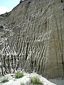 Makoshika park - dirt formation.jpg 2,346 × 3,128; 2.02 MB
-
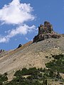
 Needle, in Bridger Canyon. Near Fort Ellis. Gallatin County, Montana. - NARA - 517469.jpg 3,000 × 1,968; 1.48 MB
-
 New World Mine (3763647210).jpg 1,536 × 2,048; 908 KB
-

-
 Pulpit Rock. Gallatin County, Montana - NARA - 516838.jpg 2,363 × 3,000; 2.34 MB
-
 Pulpit Rock. Gallatin County, Montana - NARA - 516838.tif 2,363 × 3,000; 6.76 MB
-
 Rock formation Custer National Forest.jpg 2,446 × 2,583; 670 KB
-
 Rock-formation-near-lolo-hot-springs-montana-roger-peterson (5688605858).jpg 1,622 × 2,449; 1.49 MB
-
 Sand Arroyo (8589613243).jpg 2,048 × 1,536; 1.35 MB
-
 Sand Arroyo (8589613881).jpg 2,048 × 1,536; 939 KB
-
 Sand Arroyo (8589614225).jpg 2,048 × 1,536; 799 KB
-
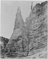 The Needle, in Bridger Canyon, Gallatin County, Montana - NARA - 516819.jpg 2,450 × 3,000; 2.08 MB
-
 The Needle, in Bridger Canyon, Gallatin County, Montana - NARA - 516820.jpg 2,400 × 3,000; 2.08 MB


.jpg)
.jpg)
.jpg)


.jpg)


.jpg)
.jpg)
.jpg)
.jpg)

