Category:Rockingham, Northamptonshire
English: Rockingham is a village and civil parish in the Corby district of Northamptonshire, England. It is just to the north of Corby town itself, on the A6003 road to Uppingham, and close by the border with Leicestershire and Rutland, near to Great Easton and Caldecott.
village and civil parish in Northamptonshire, England  | |||||
| Upload media | |||||
| Instance of | |||||
|---|---|---|---|---|---|
| Location | North Northamptonshire, Northamptonshire, East Midlands, England | ||||
 | |||||
Subcategories
This category has the following 2 subcategories, out of 2 total.
R
S
Media in category "Rockingham, Northamptonshire"
The following 91 files are in this category, out of 91 total.
-
 A6003, Uppingham Road, Corby - geograph.org.uk - 1419853.jpg 640 × 480; 200 KB
-
 Bridge over the River Welland - geograph.org.uk - 362447.jpg 640 × 480; 93 KB
-
 Bridleway towards Great Easton - geograph.org.uk - 1941115.jpg 4,000 × 3,000; 2.89 MB
-
 The Welland Valley - geograph.org.uk - 564093.jpg 640 × 499; 108 KB
-
 Church near Rockingham Castle - geograph.org.uk - 4469595.jpg 4,608 × 3,456; 5.4 MB
-
 Corby's Indoor Tennis Courts - geograph.org.uk - 362455.jpg 640 × 480; 56 KB
-
 Cottingham Road towards Rockingham - geograph.org.uk - 5199772.jpg 480 × 640; 42 KB
-
 Entrance to Rockingham Castle - geograph.org.uk - 6154313.jpg 2,592 × 1,936; 2.07 MB
-
 Entrance to Rockingham Castle - geograph.org.uk - 6154314.jpg 2,592 × 1,936; 1.92 MB
-
 Gates and grassland - Rockingham Castle - geograph.org.uk - 4481864.jpg 4,608 × 3,456; 5.38 MB
-
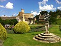
 Herbaceous borders in Rockingham Castle grounds - geograph.org.uk - 2028097.jpg 2,816 × 2,112; 2.54 MB
-
 Jurassic Way north from the B670 - geograph.org.uk - 377922.jpg 640 × 480; 57 KB
-
 Jurassic Land-rovers - geograph.org.uk - 1834832.jpg 3,648 × 2,736; 2.15 MB
-
 Looking down on the Elephant Hedge - Rockingham Castle - geograph.org.uk - 4470426.jpg 4,608 × 3,456; 5.68 MB
-
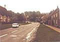 Main Street (A6003), Rockingham in 1984 - geograph.org.uk - 2543492.jpg 1,117 × 784; 141 KB
-
 Main Street Rockingham - geograph.org.uk - 1301622.jpg 640 × 385; 50 KB
-
 Main Street Rockingham - geograph.org.uk - 3067382.jpg 4,000 × 3,000; 3.74 MB
-
 Memorial Cross Rockingham - geograph.org.uk - 4531960.jpg 480 × 640; 62 KB
-

-
 Poplar trees on the boundary - geograph.org.uk - 4469115.jpg 4,608 × 3,456; 6.21 MB
-
 River Welland flowing from the West - geograph.org.uk - 310904.jpg 640 × 396; 43 KB
-
 Approaching Rockingham - geograph.org.uk - 564160.jpg 640 × 431; 85 KB
-
 Bins, Rockingham - geograph.org.uk - 1433290.jpg 640 × 480; 76 KB
-
 Cottingham Road towards Rockingham - geograph.org.uk - 564179.jpg 640 × 433; 92 KB
-
 Looking down Main Street in Rockingham - geograph.org.uk - 563378.jpg 640 × 475; 127 KB
-
 Main Street towards Rockingham - geograph.org.uk - 564110.jpg 565 × 640; 166 KB
-
 Main Street, Rockingham - geograph.org.uk - 561748.jpg 640 × 473; 110 KB
-
 Main Street, Rockingham - geograph.org.uk - 563366.jpg 640 × 381; 103 KB
-
 Main Street, Rockingham - geograph.org.uk - 563370.jpg 640 × 423; 116 KB
-
 Pipebridge across the River Welland - geograph.org.uk - 561745.jpg 640 × 415; 106 KB
-
 Road to Caldecott - geograph.org.uk - 362453.jpg 640 × 480; 61 KB
-
 The River Welland - geograph.org.uk - 561743.jpg 640 × 466; 131 KB
-
 Water Tower - geograph.org.uk - 323498.jpg 640 × 480; 105 KB
-
 Rockingham - panoramio.jpg 2,816 × 2,112; 2.25 MB
-
 Rockingham Castle Horse Trials, dressage - geograph.org.uk - 4152945.jpg 1,005 × 1,024; 284 KB
-

-

-

-
 Rockingham Castle, aerial 2017 - geograph.org.uk - 5436388.jpg 1,024 × 683; 147 KB
-
 Rockingham Road, Caldecott - geograph.org.uk - 6225028.jpg 1,920 × 1,280; 1.19 MB
-
 Rockingham Telephone Exchange - geograph.org.uk - 1396640.jpg 640 × 480; 117 KB
-
 Rockingham village (10) (geograph 7171288).jpg 3,855 × 2,891; 6.81 MB
-
 Rockingham village (14) (geograph 7171298).jpg 4,320 × 3,240; 6.1 MB
-
 Rockingham village (15) (geograph 7171299).jpg 4,320 × 3,240; 4.58 MB
-
 Rockingham village (16) (geograph 7171300).jpg 4,320 × 3,240; 4.82 MB
-
 Rockingham village (24) (geograph 7172013).jpg 4,320 × 3,240; 5.04 MB
-
 Rockingham village (25) (geograph 7172014).jpg 4,320 × 3,240; 5.05 MB
-
 Rockingham village (26) (geograph 7172016).jpg 4,320 × 3,240; 5.26 MB
-
 Rockingham village (27) (geograph 7172017).jpg 4,320 × 3,240; 4.95 MB
-
 Rockingham village (28) (geograph 7172018).jpg 3,929 × 2,947; 6.19 MB
-
 Rockingham village (29) (geograph 7172019).jpg 4,320 × 3,240; 4.65 MB
-
 Rockingham village (6) (geograph 7171271).jpg 4,320 × 3,240; 4.83 MB
-
 Rockingham village (7) (geograph 7171272).jpg 4,320 × 3,240; 4.89 MB
-
 Rockingham village (geograph 7161915).jpg 4,320 × 3,240; 4.64 MB
-
 Rockingham Village - panoramio (1).jpg 2,577 × 1,604; 1.6 MB
-
 Rockingham Village - panoramio (2).jpg 2,816 × 2,112; 2.2 MB
-
 Rockingham Village - panoramio.jpg 2,643 × 1,936; 2.02 MB
-
 Rockingham village centre - geograph.org.uk - 6224189.jpg 1,906 × 1,260; 1.55 MB
-
 Rockingham, Northamptonshire - geograph.org.uk - 138512.jpg 480 × 640; 61 KB
-
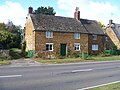
 Sondes Arms Public house - geograph.org.uk - 2785551.jpg 6,270 × 3,799; 1.08 MB
-
 Sondes Arms Rockingham - geograph.org.uk - 3067438.jpg 4,000 × 3,000; 3.6 MB
-

-
 Sundial at Rockingham - geograph.org.uk - 6154320.jpg 2,592 × 1,936; 2.57 MB
-
 The Jurassic Way approaches Rockingham - geograph.org.uk - 4917431.jpg 800 × 600; 108 KB
-
 The Jurassic Way enters Rutland - geograph.org.uk - 1941142.jpg 4,000 × 3,000; 2.98 MB
-
 The Sondes Arms, Rockingham - geograph.org.uk - 2995919.jpg 800 × 600; 97 KB
-
 The Sondes Arms, Rockingham - geograph.org.uk - 2995922.jpg 600 × 800; 110 KB
-

-
 View from the perimeter wall - Rockingham Castle - geograph.org.uk - 4469528.jpg 4,608 × 3,456; 5.17 MB
-
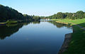
 View over the Welland Valley from Rockingham - geograph.org.uk - 2028092.jpg 2,816 × 2,112; 2.58 MB
-
 Village shop and tea room, Rockingham - geograph.org.uk - 1834842.jpg 2,736 × 3,648; 2.16 MB
-
 What's growing here^ - geograph.org.uk - 1433285.jpg 640 × 480; 81 KB
-
 Wild rhubarb bordering the pond - Rockingham Castle - geograph.org.uk - 4481899.jpg 4,608 × 3,456; 5.54 MB
-
 A view down Main Street in Rockingham - geograph.org.uk - 563396.jpg 640 × 451; 128 KB
-
 A6003 Corby - geograph.org.uk - 369211.jpg 640 × 480; 81 KB
-
 A6003 Uppingham Road, Corby - geograph.org.uk - 564157.jpg 640 × 502; 151 KB
-
 A6003-A427 roundabout - geograph.org.uk - 310942.jpg 640 × 480; 74 KB
-
 Access road for Rockingham Park - geograph.org.uk - 1419859.jpg 640 × 480; 222 KB
-
 Boating lake being dredged - geograph.org.uk - 348780.jpg 640 × 426; 168 KB
-
 Boating Lake, Corby - geograph.org.uk - 1428024.jpg 640 × 480; 75 KB
-
 Coleridge Way, Corby - geograph.org.uk - 1419840.jpg 640 × 480; 225 KB
-
 Corby Boating Lake - geograph.org.uk - 72866.jpg 640 × 403; 48 KB
-
 Corby Pool - geograph.org.uk - 1428048.jpg 640 × 480; 98 KB
-
 Corby Pool - geograph.org.uk - 1428080.jpg 640 × 480; 52 KB
-
 Corby Road - geograph.org.uk - 310933.jpg 640 × 480; 75 KB
-
 Corby town centre - geograph.org.uk - 1428117.jpg 640 × 480; 67 KB
-
 Cottingham Road, Northamptonshire - geograph.org.uk - 564187.jpg 640 × 481; 105 KB
-
 Fields by Forest Lodge - geograph.org.uk - 310946.jpg 640 × 515; 59 KB
-
 Hazel Leys Primary School - geograph.org.uk - 349073.jpg 640 × 427; 183 KB
-
 Lodge Green Cottages - geograph.org.uk - 352050.jpg 640 × 409; 104 KB
-
 Ploughing - geograph.org.uk - 564196.jpg 640 × 529; 119 KB


,_Rockingham_in_1984_-_geograph.org.uk_-_2543492.jpg)


_(geograph_7171288).jpg)
_(geograph_7171298).jpg)
_(geograph_7171299).jpg)
_(geograph_7171300).jpg)
_(geograph_7172013).jpg)
_(geograph_7172014).jpg)
_(geograph_7172016).jpg)
_(geograph_7172017).jpg)
_(geograph_7172018).jpg)
_(geograph_7172019).jpg)
_(geograph_7171271).jpg)
_(geograph_7171272).jpg)
.jpg)
.jpg)
.jpg)


