Category:Rohrau, Lower Austria
municipality in Bruck/Leitha District, Lower Austria, Austria .JPG)  | |||||
| Upload media | |||||
| Instance of |
| ||||
|---|---|---|---|---|---|
| Location | |||||
| Population |
| ||||
| Area |
| ||||
| Elevation above sea level |
| ||||
| Different from | |||||
| official website | |||||
 | |||||
Subcategories
This category has the following 12 subcategories, out of 12 total.
Media in category "Rohrau, Lower Austria"
The following 15 files are in this category, out of 15 total.
-
 AUT Rohrau COA.jpg 238 × 226; 12 KB
-
 Bildstock 11658 in A-2471 Rohrau.jpg 1,350 × 1,800; 307 KB
-
 Dreifaltigkeitssäule 11660 in A-2471 Rohrau.jpg 1,350 × 1,800; 623 KB
-
 Ehemaliges Gasthaus 11662 in A-2471 Rohrau.jpg 4,415 × 1,500; 595 KB
-
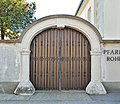 Eingang Pfarrhof 11665 in A-2471 Rohrau.jpg 1,700 × 1,475; 353 KB
-
 Gerhaus Einsatzfahrzeug der FF.jpg 4,315 × 2,800; 6.67 MB
-
 Joseph Haydn-Denkmal 11657 in A-2471 Rohrau.jpg 1,350 × 1,800; 310 KB
-
 Kapelle 11656 in A-2471 Rohrau.jpg 1,700 × 1,475; 310 KB
-
 Lst Rohrau 2020 N 2.jpg 6,000 × 4,000; 17.26 MB
-
 Lst Rohrau 2020 N.jpg 6,000 × 4,000; 16.84 MB
-
 Lst Rohrau 2020 S.jpg 4,262 × 2,841; 9.91 MB
-
 Map at rohrau.png 400 × 240; 3 KB
-
 Pranger 11652 in A-2471 Rohrau.jpg 1,350 × 1,800; 555 KB
-
 Rohrau im Bezirk Bruck an der Leitha.svg 951 × 616; 96 KB
-
 Wikipedia Rudolf Winkelmayer.jpg 2,448 × 3,264; 747 KB


