Category:Roker Pier lighthouse
| Object location | | View all coordinates using: OpenStreetMap |
|---|
English: Roker Pier lighthouse
lighthouse in Sunderland, England  | |||||
| Upload media | |||||
| Instance of | |||||
|---|---|---|---|---|---|
| Part of |
| ||||
| Made from material | |||||
| Location | Roker, Sunderland, Tyne and Wear, North East England, England | ||||
| Operator |
| ||||
| Heritage designation | |||||
| Inception |
| ||||
| Height |
| ||||
 | |||||
Media in category "Roker Pier lighthouse"
The following 25 files are in this category, out of 25 total.
-
 Beach and the lighthouse - panoramio.jpg 685 × 1,024; 161 KB
-
 Beach and the lonely lighthouse - panoramio.jpg 1,024 × 685; 155 KB
-
 Beach, wood, lighthouse - panoramio.jpg 1,024 × 685; 196 KB
-
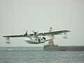 Consolidated PBY Catalina & Sunderland Rooker Lighthouse.JPG 1,280 × 960; 213 KB
-
 Rocker Lighthouse from the park - panoramio.jpg 1,024 × 685; 104 KB
-
 Rocks and Roker Lighthouse - panoramio.jpg 1,024 × 685; 193 KB
-
 Roker beach. - geograph.org.uk - 295241.jpg 640 × 480; 56 KB
-
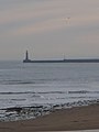
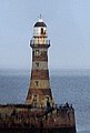
 Roker Lighthouse - geograph.org.uk - 1095762.jpg 640 × 427; 51 KB
-
 Roker lighthouse and beach - geograph.org.uk - 1119969.jpg 480 × 640; 43 KB
-
 Roker Lighthouse, Sunderland, UK - panoramio.jpg 3,456 × 5,184; 15.98 MB
-
 Roker North lighthouse with yacht. - geograph.org.uk - 510815.jpg 640 × 516; 76 KB
-
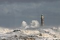
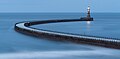
 Roker North Pier and lighthouse. - geograph.org.uk - 496512.jpg 640 × 356; 74 KB
-
 Roker North Pier lighthouse - geograph.org.uk - 447078.jpg 640 × 480; 64 KB
-
 Roker North pier lighthouse. - geograph.org.uk - 496521.jpg 640 × 480; 102 KB
-
 Roker pier 10 5 15 (16898465414).jpg 1,000 × 490; 99 KB
-
 Roker Pier and Lighthouse - geograph.org.uk - 1164921.jpg 640 × 483; 80 KB
-
 Roker Pier Lighthouse (14127026543).jpg 3,456 × 4,608; 2.57 MB
-
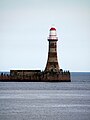
 Roker Pier Lighthouse - geograph.org.uk - 2368008.jpg 903 × 1,339; 223 KB
-

-

-

-
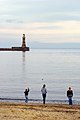
 Spectators on Roker Lighthouse (43409594561).jpg 4,000 × 6,000; 12.93 MB
-
 The lighthouse on Roker Pier - geograph.org.uk - 2854510.jpg 1,500 × 983; 197 KB
-
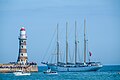 The Tall Ships Race 2018, Sunderland (43409593231).jpg 6,000 × 4,000; 17.07 MB
-
 The view from Seaburn beach, Sunderland, on Boxing Day (79084671).jpg 3,264 × 2,448; 3.16 MB


.jpg)

.jpg)


.jpg)

.jpg)
.jpg)