Category:Roos
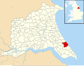
English: Roos is a village and civil parish in the East Riding of Yorkshire, England. It is situated 12 miles (19 km) east of Kingston upon Hull city centre and 3.5 miles (5.6 km) north west of Withernsea on the B1242 road.
village and civil parish in East Riding of Yorkshire, England  | |||||
| Upload media | |||||
| Instance of | |||||
|---|---|---|---|---|---|
| Location | East Riding of Yorkshire, Yorkshire and the Humber, England | ||||
 | |||||
Subcategories
This category has the following 7 subcategories, out of 7 total.
A
- Admiral Storr's Tower (13 F)
- All Saints Church, Roos (14 F)
H
M
O
- Owstwick (37 F)
T
- The Bog, Roos (3 F)
Media in category "Roos"
The following 139 files are in this category, out of 139 total.
-
 A Guarded Field - geograph.org.uk - 2700041.jpg 3,264 × 2,448; 2.37 MB
-
 A public footpath to Tunstall - geograph.org.uk - 2096301.jpg 800 × 600; 224 KB
-
 A view over the Furze - geograph.org.uk - 2704614.jpg 3,264 × 2,448; 1.93 MB
-
 A WW2 Pill Box - geograph.org.uk - 2096271.jpg 800 × 600; 243 KB
-
 Across Roos Drain, near Halsham - geograph.org.uk - 1768041.jpg 640 × 466; 174 KB
-
 Advertising on the box, near Hilston - geograph.org.uk - 5511929.jpg 640 × 480; 192 KB
-
 Approaching Roos - geograph.org.uk - 1894526.jpg 640 × 480; 65 KB
-
 Barleyfield near Owstwick - geograph.org.uk - 5453860.jpg 1,024 × 768; 97 KB
-
 Burton Road, Roos - geograph.org.uk - 327398.jpg 640 × 477; 88 KB
-
 Cliff edge near Tunstall - geograph.org.uk - 5454265.jpg 1,024 × 768; 170 KB
-
 Cliff top path - geograph.org.uk - 5452787.jpg 1,024 × 768; 167 KB
-
 Conversion suspended - geograph.org.uk - 5454256.jpg 1,024 × 768; 150 KB
-
 Corner House, Roos - geograph.org.uk - 327396.jpg 640 × 476; 94 KB
-
 Cottages, South End, Roos - geograph.org.uk - 5453872.jpg 1,024 × 768; 249 KB
-
 Country Lane Junction - geograph.org.uk - 2707871.jpg 3,264 × 2,448; 2.07 MB
-
 Definitely Dead - geograph.org.uk - 2707891.jpg 2,448 × 3,264; 1.55 MB
-
 East of Danthorpe - geograph.org.uk - 448120.jpg 480 × 640; 112 KB
-
 Eastfield House Roos.jpg 640 × 451; 68 KB
-
 Elm Farm, Roos - geograph.org.uk - 327394.jpg 640 × 428; 81 KB
-
 Entering Roos, East Yorkshire - geograph.org.uk - 2213406.jpg 800 × 600; 201 KB
-
 Farm at North End - geograph.org.uk - 45874.jpg 640 × 480; 84 KB
-
 Farm at Roos Furze - geograph.org.uk - 2704608.jpg 3,264 × 2,448; 1.67 MB
-
 Farm Track West of Roos. - geograph.org.uk - 53926.jpg 640 × 480; 62 KB
-
 Farmland north of Roos - geograph.org.uk - 1507505.jpg 640 × 426; 214 KB
-
 Farmland off South End Road, Roos - geograph.org.uk - 1894566.jpg 640 × 480; 65 KB
-
 Field of oilseed rape off Southfield Lane - geograph.org.uk - 5454779.jpg 1,024 × 768; 168 KB
-
 Field of Rapeseed - geograph.org.uk - 402810.jpg 640 × 480; 161 KB
-
 Fishing below the cliff - geograph.org.uk - 5449599.jpg 1,024 × 768; 207 KB
-
 Fly tipping on Hogsea Lane - geograph.org.uk - 2746165.jpg 800 × 600; 100 KB
-
 Footpath junction near Halsham - geograph.org.uk - 1767424.jpg 484 × 640; 185 KB
-
 Footpath to Hilston - geograph.org.uk - 5454735.jpg 1,024 × 768; 215 KB
-
 Footpath to Mount Farm Hilston - geograph.org.uk - 2707569.jpg 3,264 × 2,448; 1.71 MB
-
 Furze Farm, Roos - geograph.org.uk - 498765.jpg 640 × 461; 144 KB
-
 Furze Road and Glebe Farm - geograph.org.uk - 5454755.jpg 1,024 × 768; 85 KB
-
 Furze Road from Tower Road near Roose - geograph.org.uk - 2065144.jpg 800 × 600; 180 KB
-
 Furze Road towards Roos - geograph.org.uk - 2207849.jpg 800 × 600; 259 KB
-
 Furze Road, North End, Roos - geograph.org.uk - 2207852.jpg 800 × 600; 305 KB
-
 Geyhorn Bridge and the new Roos Wind Farm - geograph.org.uk - 3383605.jpg 3,175 × 2,231; 1.65 MB
-
 Geyhorn Bridge, Burton Pidsea - geograph.org.uk - 269571.jpg 640 × 462; 179 KB
-
 Glebe Farm - geograph.org.uk - 45852.jpg 640 × 480; 112 KB
-
 Glebe Farm on Furze Road near Roose - geograph.org.uk - 2065099.jpg 800 × 600; 182 KB
-
 Hilston from Hogsea Lane - geograph.org.uk - 5511920.jpg 640 × 482; 192 KB
-
 Holderness Country Park - geograph.org.uk - 1507054.jpg 640 × 386; 220 KB
-
 Holderness Country Park - geograph.org.uk - 1743084.jpg 800 × 600; 95 KB
-
 House on Main Street Roos.jpg 640 × 443; 234 KB
-
 Imminent Harvest - geograph.org.uk - 1968678.jpg 3,222 × 2,550; 3.31 MB
-
 Inglepool Corner - geograph.org.uk - 498720.jpg 640 × 464; 97 KB
-
 It wasnt real love!! (4469140323).jpg 5,070 × 2,766; 3.39 MB
-
 Ivy Cottage, Owstwick - geograph.org.uk - 5384068.jpg 1,024 × 752; 96 KB
-
 Junction of Tower Road with Aldbrough Road - geograph.org.uk - 2707583.jpg 3,264 × 2,448; 1.6 MB
-
 Kiln Farm Kilnhouse Lane - geograph.org.uk - 2703283.jpg 3,264 × 2,448; 1.74 MB
-
 Lamb Lane, Roos - geograph.org.uk - 327395.jpg 476 × 640; 95 KB
-
 Lamb Lane, Roos, East Yorkshire - geograph.org.uk - 2213423.jpg 800 × 600; 288 KB
-
 Lane near Primrose Hill - geograph.org.uk - 5384051.jpg 1,024 × 768; 191 KB
-
 Lane to Hilston - geograph.org.uk - 2704587.jpg 3,264 × 2,448; 1.41 MB
-
 Lane towards Westfield - geograph.org.uk - 2707846.jpg 3,264 × 2,448; 1.67 MB
-
 Lightning Tree - geograph.org.uk - 494543.jpg 480 × 640; 82 KB
-
 Lightning Tree in the Evening Sun - geograph.org.uk - 2459119.jpg 2,736 × 3,648; 1.55 MB
-
 Llamados - geograph.org.uk - 498754.jpg 640 × 480; 68 KB
-
 Llamados - geograph.org.uk - 498758.jpg 640 × 442; 52 KB
-
 Longbrough Lane (Track) - geograph.org.uk - 2707728.jpg 3,264 × 2,448; 1.98 MB
-
 Longbrough Lane (Track) meets Aldbrough Road - geograph.org.uk - 2707599.jpg 3,264 × 2,448; 1.64 MB
-
 Longbrough Lane - geograph.org.uk - 5384052.jpg 1,024 × 768; 198 KB
-
 Longbrough Lane - geograph.org.uk - 5384056.jpg 1,024 × 768; 314 KB
-
 Looking east along Longbrough Lane - geograph.org.uk - 2407429.jpg 800 × 600; 188 KB
-
 Looking west along Longbrough Lane - geograph.org.uk - 2407437.jpg 800 × 600; 207 KB
-
 Main Street - geograph.org.uk - 2308606.jpg 640 × 427; 66 KB
-
 Main Street Roos.jpg 640 × 468; 96 KB
-
 Main Street, Roos - geograph.org.uk - 1507530.jpg 467 × 640; 199 KB
-
 Main Street, Roos - geograph.org.uk - 2213431.jpg 800 × 600; 193 KB
-
 Main Street, Roos in 1987 - geograph.org.uk - 2731853.jpg 1,051 × 721; 148 KB
-

-
 Muck truck near Rimswell - geograph.org.uk - 5822505.jpg 1,600 × 1,600; 2.51 MB
-
 New Road towards Owstwick - geograph.org.uk - 1893986.jpg 640 × 480; 57 KB
-
 North of Longbrough Lane, Fitling - geograph.org.uk - 5512737.jpg 640 × 480; 188 KB
-
 One Man and his Dog on Tunstall Beach - geograph.org.uk - 5398926.jpg 4,365 × 3,382; 3.07 MB
-
 Pinfold Lane, North End, Roos - geograph.org.uk - 2207854.jpg 800 × 600; 257 KB
-
 Pinfold Lane, Roos - geograph.org.uk - 327397.jpg 640 × 487; 86 KB
-
 Postbox at North End, Roos - geograph.org.uk - 1507519.jpg 500 × 640; 188 KB
-
 Primrose Hill Farm and lane to Westfield - geograph.org.uk - 2707856.jpg 3,264 × 2,448; 1.6 MB
-
 Quaker Road, near Hilston - geograph.org.uk - 5511639.jpg 640 × 509; 148 KB
-
 Rectory Lane, Roos - geograph.org.uk - 71905.jpg 640 × 480; 83 KB
-
 Rectory Road looking north, Roos - geograph.org.uk - 1894549.jpg 640 × 480; 95 KB
-
 Rectory Road, Roos - geograph.org.uk - 1766492.jpg 640 × 449; 178 KB
-
 Remains of groyne - geograph.org.uk - 5511078.jpg 1,024 × 768; 120 KB
-
 Road junction with the B1242 - geograph.org.uk - 1894014.jpg 640 × 480; 36 KB
-
 Roos - geograph.org.uk - 71897.jpg 640 × 480; 74 KB
-
 Roos Arms in Roos - geograph.org.uk - 2403617.jpg 2,701 × 3,516; 1.7 MB
-
 Roos Bridge - geograph.org.uk - 1766539.jpg 640 × 443; 226 KB
-
 Roos Carrs - geograph.org.uk - 269504.jpg 444 × 640; 109 KB
-
 Roos Carrs - geograph.org.uk - 5453815.jpg 1,024 × 768; 201 KB
-
 Roos Drain - geograph.org.uk - 1894523.jpg 640 × 480; 85 KB
-
 Roos Drain and Footpath - geograph.org.uk - 2682642.jpg 3,264 × 2,448; 2.63 MB
-
 Roos Drain footbridge - geograph.org.uk - 1766540.jpg 640 × 488; 175 KB
-
 Roos Drain looking east - geograph.org.uk - 1894536.jpg 640 × 480; 103 KB
-
 Roos Drain looking west - geograph.org.uk - 1894542.jpg 640 × 480; 108 KB
-
 Roos Hall (or Old Rectory), near Withernsea, Yorkshire.JPG 640 × 496; 82 KB
-
 Roos pond - geograph.org.uk - 1766477.jpg 640 × 446; 216 KB
-
 Roos sewage works - geograph.org.uk - 1766454.jpg 575 × 640; 193 KB
-
 Roos UK parish locator map.svg 1,425 × 1,107; 1.68 MB
-
 Roos Wind Turbines at Dusk - geograph.org.uk - 3738513.jpg 1,600 × 1,157; 205 KB
-
 Rostun Road towards Tunstall ^1 - geograph.org.uk - 2064735.jpg 800 × 600; 207 KB
-
 Rostun Road towards Tunstall ^2 - geograph.org.uk - 2064745.jpg 800 × 600; 187 KB
-
 Rostun Road towards Tunstall ^3 - geograph.org.uk - 2064749.jpg 800 × 600; 187 KB
-
 Sand-le-Mere and Tunstall Drain, aerial 2015 - geograph.org.uk - 4583277.jpg 1,024 × 683; 138 KB
-
 Sand-le-Mere and Tunstall Drain, aerial 2015 - geograph.org.uk - 4583281.jpg 2,496 × 1,664; 1.54 MB
-

-
 Smallholding ,West of Roos - geograph.org.uk - 53588.jpg 640 × 480; 109 KB
-
 Some refurbishment required - geograph.org.uk - 268535.jpg 478 × 640; 86 KB
-
 South End Road heading south, Roos - geograph.org.uk - 1894558.jpg 640 × 480; 113 KB
-
 Storm Clouds over the new Roos Wind Farm - geograph.org.uk - 3411467.jpg 3,097 × 3,448; 2.43 MB
-
 Sunderland, Roos - geograph.org.uk - 269505.jpg 640 × 482; 105 KB
-
 The B1242 Aldbrough Road towards Roos - geograph.org.uk - 2207834.jpg 800 × 600; 203 KB
-
 The Black Horse, Roos - geograph.org.uk - 5453877.jpg 1,024 × 689; 97 KB
-
 The bridleway follows the cliff top - geograph.org.uk - 2097717.jpg 800 × 600; 195 KB
-
 The Elms Farm, Roos - geograph.org.uk - 5453868.jpg 1,024 × 768; 124 KB
-

-
-
 The new Roos Wind Farm - geograph.org.uk - 3411452.jpg 3,853 × 3,369; 4.38 MB
-
 The new Roos Wind Farm - geograph.org.uk - 3411459.jpg 4,330 × 2,154; 1.46 MB
-
 The Old Rectory, Roos - geograph.org.uk - 268547.jpg 640 × 463; 122 KB
-
 The Pinfold, Roos - geograph.org.uk - 5453866.jpg 1,024 × 768; 175 KB
-
 The Post Office in Roos - geograph.org.uk - 2403412.jpg 3,648 × 2,736; 1.74 MB
-
 The road into Roos - geograph.org.uk - 28889.jpg 640 × 480; 83 KB
-
 The road to Roos - geograph.org.uk - 28888.jpg 640 × 480; 103 KB
-
 The Rostun Road, Roos - geograph.org.uk - 5784207.jpg 2,592 × 1,944; 1.16 MB
-
 There's Power and then there's POWER - geograph.org.uk - 3738472.jpg 2,736 × 3,001; 990 KB
-
 Thirtle Bridge and Roos Drain - geograph.org.uk - 2699935.jpg 3,264 × 2,448; 1.74 MB
-
 Tilled field on West Furze - geograph.org.uk - 2704622.jpg 3,264 × 2,448; 1.78 MB
-
-
 View towards Hilston - geograph.org.uk - 5384060.jpg 1,024 × 768; 119 KB
-
 View towards Tunstall - geograph.org.uk - 5454262.jpg 1,024 × 768; 176 KB
-
 Westhill Farm, Tunstall - geograph.org.uk - 5454259.jpg 1,024 × 768; 143 KB
-
 Wheatfield near Hilston - geograph.org.uk - 5449602.jpg 1,024 × 768; 247 KB
-
 Wheatfield off Rostun Road - geograph.org.uk - 5454765.jpg 1,024 × 768; 135 KB
-
 White Bridge over Roos Drain and Footpath to Roos - geograph.org.uk - 2682598.jpg 3,264 × 2,448; 2.3 MB
-
 Willow Toft Farm from footpath to Burton Pidsea - geograph.org.uk - 2707909.jpg 3,264 × 2,448; 1.83 MB
-
 Wind turbines and West Carr Plantation - geograph.org.uk - 5453804.jpg 1,024 × 768; 129 KB
-
 Woods Plantation over Roos Drain - geograph.org.uk - 2682606.jpg 3,264 × 2,448; 2.15 MB


.jpg)


_-_geograph.org.uk_-_2707728.jpg)
_meets_Aldbrough_Road_-_geograph.org.uk_-_2707599.jpg)


,_near_Withernsea,_Yorkshire.JPG)


_-_geograph.org.uk_-_4583730.jpg)


