Category:Rossington
English: Rossington is a civil parish and former mining village in the Metropolitan Borough of Doncaster in South Yorkshire, England and is surrounded by countryside and the market towns of Bawtry and Tickhill. It has a population of 13,255.
Nederlands: Rossington is een dorp (village) en civil parish in het bestuurlijke gebied Doncaster, in het Engelse graafschap South Yorkshire. De civil parish telt
village and civil parish in South Yorkshire, United Kingdom  | |||||
| Upload media | |||||
| Instance of | |||||
|---|---|---|---|---|---|
| Location | Doncaster, South Yorkshire, Yorkshire and the Humber, England | ||||
 | |||||
Subcategories
This category has the following 4 subcategories, out of 4 total.
Media in category "Rossington"
The following 200 files are in this category, out of 238 total.
(previous page) (next page)-
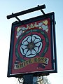
 "The White Rose", New Rossington - geograph.org.uk - 4112040.jpg 2,377 × 1,902; 1.41 MB
-
 A path leading to Bessacarr, Doncaster - geograph.org.uk - 2824507.jpg 800 × 600; 161 KB
-
 A path leading to New Rossington - geograph.org.uk - 2824508.jpg 800 × 600; 149 KB
-

-
 A638 towards Bawtry - geograph.org.uk - 2556369.jpg 640 × 480; 77 KB
-
 A638 towards Doncaster - geograph.org.uk - 2556381.jpg 1,600 × 1,200; 399 KB
-
 Aisby Drive, Rossington - geograph.org.uk - 2425460.jpg 1,600 × 1,200; 383 KB
-
 Alongside the cemetery - geograph.org.uk - 3996964.jpg 1,024 × 768; 249 KB
-
 Approaching Seven Arches Bridge - geograph.org.uk - 4112628.jpg 1,944 × 2,592; 2.18 MB
-
 Ash tree by the path near Rossington Hall - geograph.org.uk - 5977751.jpg 1,024 × 768; 179 KB
-
 At The Circle - New Rossington - geograph.org.uk - 4112043.jpg 2,488 × 1,778; 1.48 MB
-
 Atterby Drive, Rossington - geograph.org.uk - 2425463.jpg 640 × 480; 60 KB
-
 Bahram Grove - New Rossington - geograph.org.uk - 4112613.jpg 2,504 × 1,878; 1.82 MB
-
 Bawtry Road Junction - geograph.org.uk - 1368214.jpg 640 × 480; 77 KB
-
 Bench beneath the beeches - geograph.org.uk - 5977875.jpg 1,024 × 768; 329 KB
-

-
 Billy Wrights Lane - geograph.org.uk - 170851.jpg 640 × 427; 113 KB
-
 Bond Street, New Rossington heading east - geograph.org.uk - 2556200.jpg 1,600 × 1,200; 311 KB
-
 Bridleway Skirting the Hurst Plantation - geograph.org.uk - 4988351.jpg 4,608 × 3,456; 3.54 MB
-
 Bridleway to Branton - geograph.org.uk - 210449.jpg 640 × 480; 114 KB
-
 Bridleway towards New Rossington - geograph.org.uk - 2556164.jpg 1,600 × 1,200; 484 KB
-
 Burial ground west of Rossington - geograph.org.uk - 4112036.jpg 1,942 × 2,428; 1.94 MB
-
 Children's slide at Rossington, South Yorkshire, England.jpg 480 × 640; 107 KB
-
 Christ the King Catholic Church, New Rossington - geograph.org.uk - 4402146.jpg 1,600 × 1,200; 402 KB
-
 Coal train - geograph.org.uk - 1196387.jpg 468 × 640; 82 KB
-
 Commercial area on King Avenue - geograph.org.uk - 4402143.jpg 1,600 × 1,200; 398 KB
-
 Corn Field by the Gipsy Plantation - geograph.org.uk - 5157110.jpg 4,608 × 3,456; 3.84 MB
-
 Cottage on the A638 - geograph.org.uk - 2556373.jpg 1,600 × 1,200; 258 KB
-
 Countryside south of Rossington - geograph.org.uk - 2350727.jpg 640 × 323; 23 KB
-
 Crop field south of New Rossington - geograph.org.uk - 2556190.jpg 1,600 × 1,200; 395 KB
-
 Cycle Path Alongside A638 - geograph.org.uk - 2951203.jpg 2,560 × 1,920; 1.74 MB
-
 Derelict building - geograph.org.uk - 5977973.jpg 1,024 × 768; 173 KB
-
 Diverging routes - geograph.org.uk - 5977913.jpg 1,024 × 768; 177 KB
-
 Diverted bridleway - geograph.org.uk - 3996970.jpg 1,024 × 768; 219 KB
-
 Diverted bridleway and new spoil heap - geograph.org.uk - 3996985.jpg 1,024 × 768; 172 KB
-
 Diverted bridleway and new spoil heaps - geograph.org.uk - 3996999.jpg 1,024 × 768; 215 KB
-
 Diverted bridleway to Wadworth - geograph.org.uk - 3996975.jpg 1,024 × 768; 176 KB
-
 Doncaster Greenway (Cycle Track) - geograph.org.uk - 2425450.jpg 1,600 × 1,200; 591 KB
-
 Egg Lane - geograph.org.uk - 170854.jpg 640 × 427; 83 KB
-

-
 Entrance to RSPCA Centre - geograph.org.uk - 5157047.jpg 4,608 × 3,456; 3.92 MB
-
 Entrance to the burial ground west of Rossington - geograph.org.uk - 4402139.jpg 1,600 × 1,200; 515 KB
-

-
 Farmland and Footpath Post near Rossington - geograph.org.uk - 5144452.jpg 4,608 × 3,456; 4.48 MB
-
 Farmland near New Rossington - geograph.org.uk - 2657930.jpg 1,600 × 1,000; 181 KB
-
 Farmland near Northern Racing College - geograph.org.uk - 2556367.jpg 1,600 × 1,200; 332 KB
-

-
 Farmland off the A638 - geograph.org.uk - 2556503.jpg 1,600 × 1,200; 476 KB
-
 Farmland, Hunster Grange Farm - geograph.org.uk - 2556213.jpg 1,600 × 1,200; 426 KB
-
 FARRS Link Road Rail Bridge.JPG 4,608 × 3,456; 7 MB
-
 Field between Hayfield Lane and the River Torne - geograph.org.uk - 5978246.jpg 1,024 × 768; 294 KB
-
 Field near Rossington Bridge - geograph.org.uk - 5157130.jpg 4,608 × 3,456; 3.52 MB
-
 Fire station, New Rossington - geograph.org.uk - 4402142.jpg 1,600 × 1,200; 372 KB
-
 Footbridge over the railway at Church Field, Rossington - geograph.org.uk - 4512669.jpg 1,600 × 1,200; 748 KB
-

-
 Footbridge over the River Torne - geograph.org.uk - 4403826.jpg 1,600 × 1,200; 1,000 KB
-
 Footpath alongside Whinny Lane Plantation - geograph.org.uk - 5977939.jpg 1,024 × 768; 231 KB
-
 Footpath and Stubble Field - geograph.org.uk - 5144445.jpg 4,608 × 3,456; 4.26 MB
-
 Footpath barred^ - geograph.org.uk - 502976.jpg 640 × 480; 132 KB
-

-

-
 Footpath near Rossington Hall - geograph.org.uk - 5157085.jpg 4,608 × 3,456; 3.42 MB
-
 Footpath near the Whinny Lane Plantation - geograph.org.uk - 5157098.jpg 4,608 × 3,456; 4.16 MB
-
 Footpath on the edge of Rossington - geograph.org.uk - 5977752.jpg 1,024 × 768; 117 KB
-
 Footpath through a plantation - geograph.org.uk - 5977982.jpg 1,024 × 768; 371 KB
-
 Footpath to Littleworth Lane - geograph.org.uk - 5978085.jpg 1,024 × 768; 267 KB
-
 Footpath to Rossington - geograph.org.uk - 5977871.jpg 1,024 × 768; 197 KB
-
 Footpath to Rossington - geograph.org.uk - 5977963.jpg 1,024 × 768; 182 KB
-
 Footpath to Rossington Hall - geograph.org.uk - 3191054.jpg 640 × 427; 57 KB
-
 Footpath to Rossington Hall - geograph.org.uk - 5978089.jpg 1,024 × 768; 216 KB
-
 Footpath towards Home Farm and the Great North Road - geograph.org.uk - 2556243.jpg 1,600 × 1,200; 405 KB
-
 Footpath towards Rossington Hall - geograph.org.uk - 4512203.jpg 1,600 × 1,200; 767 KB
-
 Former Stables, Rossington Hall.jpg 640 × 427; 80 KB
-

-
 Gate on the path - geograph.org.uk - 5977921.jpg 1,024 × 768; 313 KB
-
 Get Rich Quick Scheme - geograph.org.uk - 4112044.jpg 2,487 × 1,865; 1.73 MB
-
 Going for Goal - geograph.org.uk - 4112046.jpg 1,766 × 2,354; 1.37 MB
-
 Grange Lane and Grange Road in New Rossington - geograph.org.uk - 5144489.jpg 4,526 × 3,338; 3.75 MB
-
 Grange Lane near Rossington - geograph.org.uk - 5144495.jpg 4,608 × 3,456; 3.52 MB
-
 Grange Lane now closed - geograph.org.uk - 3993001.jpg 1,024 × 768; 201 KB
-
 Grange Lane, New Rossington - geograph.org.uk - 2708153.jpg 800 × 600; 201 KB
-
 Hatfield Lane at Bawtry Road, A638 - geograph.org.uk - 2821023.jpg 800 × 600; 124 KB
-
 Hayfield Lane - geograph.org.uk - 5977715.jpg 1,024 × 768; 386 KB
-
 Hayfield Lane towards the A638 - geograph.org.uk - 2820948.jpg 800 × 600; 111 KB
-
 Holmes carr great wood. - geograph.org.uk - 2363820.jpg 640 × 376; 119 KB
-
 Hunster Flat Lane (footpath) heading south - geograph.org.uk - 2556182.jpg 1,600 × 1,200; 427 KB
-
 Hunster Flat Lane - geograph.org.uk - 5144483.jpg 4,608 × 3,456; 3.76 MB
-
 In need of repair - geograph.org.uk - 1203564.jpg 640 × 480; 85 KB
-
 Inter City 125 - geograph.org.uk - 2289901.jpg 640 × 480; 94 KB
-
 King Avenue shops, New Rossington - geograph.org.uk - 1203608.jpg 640 × 480; 65 KB
-
 Lake east of Church Field, Rossington - geograph.org.uk - 4512208.jpg 1,600 × 1,200; 965 KB
-
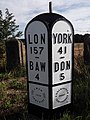
 London 150 Miles - geograph.org.uk - 2011724.jpg 800 × 531; 67 KB
-
 M18, southbound - geograph.org.uk - 5442556.jpg 640 × 426; 39 KB
-
-
 Maize field and houses - geograph.org.uk - 5978080.jpg 1,024 × 768; 192 KB
-
 Milepost near Rossington.jpg 480 × 640; 355 KB
-
 Mother Drain - geograph.org.uk - 3997138.jpg 1,024 × 768; 201 KB
-
 Mother Drain - geograph.org.uk - 4112618.jpg 1,944 × 2,592; 2.65 MB
-
 Mother Drain and the M18 overbridge - geograph.org.uk - 3997149.jpg 1,024 × 768; 253 KB
-
 Mount Pleasant Cottages - geograph.org.uk - 502960.jpg 640 × 480; 96 KB
-
 Near Sixteen Acre Plantation - geograph.org.uk - 5311572.jpg 640 × 470; 31 KB
-
 New bridge being built over the East Coast Main Line - geograph.org.uk - 4403890.jpg 1,600 × 1,200; 581 KB
-
 New Housing seen from Grange Lane - geograph.org.uk - 5145342.jpg 4,608 × 3,456; 3.8 MB
-
 New Life Christian Church, New Rossington - geograph.org.uk - 4402148.jpg 1,600 × 1,200; 563 KB
-
 New Lodge - geograph.org.uk - 5156462.jpg 4,123 × 2,846; 2.9 MB
-

-
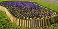 New Rossington pansies - geograph.org.uk - 1203652.jpg 640 × 319; 96 KB
-
 New spoil heaps - geograph.org.uk - 3996979.jpg 1,024 × 768; 163 KB
-
-

-
-
-
 On King George's Road, Rossington - geograph.org.uk - 4112039.jpg 2,592 × 1,944; 2.29 MB
-
 Ordnance Survey Cut Mark - geograph.org.uk - 4963207.jpg 640 × 548; 131 KB
-
 Outbuildings to a secluded dwelling - geograph.org.uk - 5977928.jpg 1,024 × 768; 220 KB
-
 Outdoor Car Park - geograph.org.uk - 210934.jpg 640 × 480; 73 KB
-
 Path and beech hedge - geograph.org.uk - 5977935.jpg 1,024 × 768; 295 KB
-
 Path north of Whinny Lane Plantation - geograph.org.uk - 5977748.jpg 1,024 × 768; 209 KB
-

-

-

-
 Pentecostal Church, New Rossington - geograph.org.uk - 2556180.jpg 1,600 × 1,200; 327 KB
-
 Pine Trees Bordering Rossington Cemetery - geograph.org.uk - 5145348.jpg 4,608 × 3,456; 4.41 MB
-
 Pit Hill Farm - geograph.org.uk - 920497.jpg 640 × 412; 60 KB
-

-
 Pylon by Park Wood - geograph.org.uk - 2346262.jpg 640 × 430; 55 KB
-
 Relocated spoil heap and Reedy Holmes Plantation - geograph.org.uk - 4695615.jpg 1,024 × 768; 163 KB
-
 River Torne - geograph.org.uk - 2556154.jpg 1,600 × 1,200; 677 KB
-
 River Torne Footbridge seen from Spoil Heap - geograph.org.uk - 5148613.jpg 4,517 × 3,317; 3.58 MB
-
 River Torne from Rossington bridge - geograph.org.uk - 1852093.jpg 480 × 640; 73 KB
-
 Rossington Bridge - geograph.org.uk - 210447.jpg 640 × 480; 82 KB
-
 Rossington cemetery - geograph.org.uk - 1203578.jpg 640 × 468; 79 KB
-
 Rossington Ex-Services Social Club - geograph.org.uk - 2708138.jpg 800 × 600; 247 KB
-
 Rossington fire station - geograph.org.uk - 1631884.jpg 640 × 427; 200 KB
-
 Rossington Grange Farm - geograph.org.uk - 2556157.jpg 1,600 × 1,200; 459 KB
-
 Rossington Hall - geograph.org.uk - 4254540.jpg 3,547 × 2,534; 1.92 MB
-

-
 Rossington Hall and walled garden - geograph.org.uk - 3190934.jpg 640 × 427; 61 KB
-
 Rossington Hall buildings, detail - geograph.org.uk - 3190926.jpg 640 × 427; 60 KB
-
 Rossington Hall by Chris.jpg 640 × 427; 61 KB
-
 Rossington Hall coat of arms - geograph.org.uk - 3190846.jpg 640 × 427; 71 KB
-
 Rossington Hall lodge cottage - geograph.org.uk - 3190953.jpg 640 × 427; 90 KB
-
 Rossington Hall lodge cottage - geograph.org.uk - 3190964.jpg 640 × 427; 89 KB
-
 Rossington Hall swimming pool - geograph.org.uk - 3190918.jpg 640 × 427; 87 KB
-
 Rossington Hall, aerial 2014 - geograph.org.uk - 3879815.jpg 640 × 427; 58 KB
-
 Rossington level crossings - geograph.org.uk - 2708130.jpg 800 × 600; 281 KB
-
 Rossington Main FC 20180819.jpg 4,032 × 3,024; 4.41 MB
-
 Rossington well^ - geograph.org.uk - 920508.jpg 640 × 424; 97 KB
-

-
 Sceptre Grove, New Rossington - geograph.org.uk - 2821249.jpg 800 × 600; 76 KB
-
 School, New Rossington - geograph.org.uk - 2556194.jpg 1,600 × 1,200; 309 KB
-
 Scrum down in Rossington - geograph.org.uk - 4112051.jpg 2,350 × 1,880; 2.06 MB
-
 Sheep Bridge Lane near Rossington - geograph.org.uk - 5157118.jpg 4,450 × 3,270; 3.44 MB
-
 Spoil Heap - geograph.org.uk - 160064.jpg 640 × 427; 96 KB
-
 Spoil heap and diverted bridleway - geograph.org.uk - 3997007.jpg 1,024 × 768; 140 KB
-
 St Luke's Church, New Rossington - geograph.org.uk - 4402144.jpg 1,600 × 1,200; 346 KB
-
 St Michael's Church, Rossington - geograph.org.uk - 4403823.jpg 1,600 × 1,200; 609 KB
-
 St. Catherine's well stream - geograph.org.uk - 1203244.jpg 640 × 480; 79 KB
-
 St. Michael's Church in Rossington - geograph.org.uk - 4988345.jpg 4,484 × 3,216; 3.24 MB
-
 Stand of beech trees - geograph.org.uk - 5977898.jpg 1,024 × 768; 164 KB
-
 Stand of conifers - geograph.org.uk - 5977907.jpg 1,024 × 768; 234 KB
-
 Stripe road (B6463) towards Harworth - geograph.org.uk - 2556219.jpg 1,600 × 1,200; 344 KB
-
 Stripe Road in Rossington - geograph.org.uk - 5156500.jpg 4,515 × 3,326; 3.8 MB
-
 Stripe Road near Hunster Grange Farm - geograph.org.uk - 5156472.jpg 4,608 × 3,456; 3.97 MB
-
 Stripe road water tower - geograph.org.uk - 1203646.jpg 480 × 640; 55 KB
-
 Stripe Road water Tower - geograph.org.uk - 160045.jpg 427 × 640; 121 KB
-
 The "Hare and Tortoise".jpg 4,288 × 2,416; 5.52 MB
-

-

-
 The Circle - New Rossington - geograph.org.uk - 4112042.jpg 2,545 × 1,818; 1.83 MB
-
 The Doncaster Greenway - geograph.org.uk - 3997110.jpg 1,024 × 768; 304 KB
-

-
 The fishing lake at Rossington - geograph.org.uk - 2824489.jpg 800 × 600; 117 KB
-
 The fishing lake at Rossington - geograph.org.uk - 2824496.jpg 800 × 600; 125 KB
-
 The Hare ^ Tortoise public house - geograph.org.uk - 2708116.jpg 800 × 600; 299 KB
-
 The Heron way. - geograph.org.uk - 2363829.jpg 480 × 640; 86 KB
-

-
 The Mount Pleasant Hotel - geograph.org.uk - 1061618.jpg 640 × 433; 54 KB
-
 The railway north of Stripe Road - geograph.org.uk - 4403812.jpg 1,600 × 1,200; 558 KB
-
 The River Torne - geograph.org.uk - 3997115.jpg 1,024 × 768; 330 KB
-

-

-
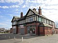
 The Station public house, New Rossington - geograph.org.uk - 2708136.jpg 800 × 600; 215 KB
-

-
 The Station public house, New Rossington - geograph.org.uk - 2821029.jpg 800 × 600; 117 KB
-
 The Station public house, New Rossington - geograph.org.uk - 2821031.jpg 800 × 600; 116 KB
-

-
 The Styrrup at Rossington - geograph.org.uk - 4403817.jpg 1,600 × 1,200; 408 KB
-
 The Warren Golf Course - geograph.org.uk - 3998450.jpg 1,024 × 768; 230 KB
-
 The Wasteland - geograph.org.uk - 4112035.jpg 2,592 × 1,944; 2.48 MB
-
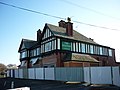
 The White Rose, New Rossington - geograph.org.uk - 2556172.jpg 1,600 × 1,039; 226 KB
-
 The White Rose, New Rossington - geograph.org.uk - 2708145.jpg 800 × 600; 242 KB
-
 The White Rose, New Rossington - geograph.org.uk - 2708149.jpg 600 × 800; 202 KB
-
 The White Rose, New Rossington - geograph.org.uk - 2821233.jpg 800 × 600; 100 KB
-
 Track junction near Rossington - geograph.org.uk - 502596.jpg 640 × 480; 132 KB
-
 Track to Hunster Grange Farm - geograph.org.uk - 1203663.jpg 640 × 480; 78 KB
-
 Track to Rossington Hall - geograph.org.uk - 5157067.jpg 4,608 × 3,456; 4.12 MB
-
 Track towards the Northern Racing College - geograph.org.uk - 2556364.jpg 1,600 × 1,200; 433 KB
-
 Turn left at the pole for Rossington - geograph.org.uk - 5977744.jpg 1,024 × 768; 208 KB
-
 Turn right at the pole - geograph.org.uk - 5978077.jpg 1,024 × 768; 174 KB


_-_geograph.org.uk_-_2425450.jpg)


_heading_south_-_geograph.org.uk_-_2556182.jpg)


_towards_Harworth_-_geograph.org.uk_-_2556219.jpg)


